Rentonomy, who describe themselves as, for now, “an easy-to-use site that looks at London in a totally new way and gives you all the tools
More...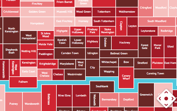
Highlighting the best London maps
Rentonomy, who describe themselves as, for now, “an easy-to-use site that looks at London in a totally new way and gives you all the tools
More...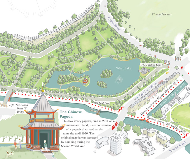
A book, by author and illustrator David Fathers, has recently been published, on the Regent’s Canal. It’s an engaging little book, part route finder, part
More...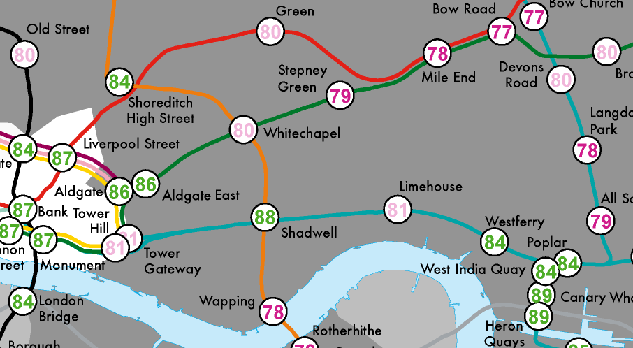
Most government statistics are mapped according to official geographical units such as wards or lower super output areas. Whilst such units are essential for data
More...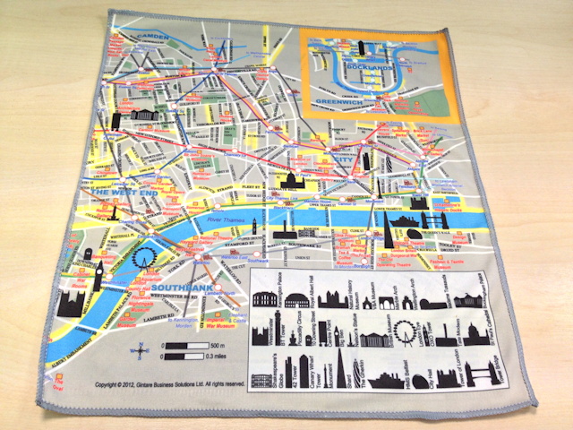
Silky Map is a bespoke map of central London, printed on a soft cleaning cloth, the kind you would use for cleaning your iPhone screen
More...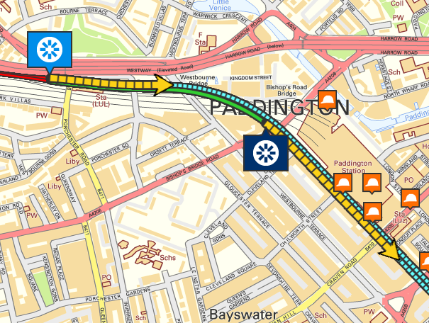
Crossrail are currently building a new deep-level railway line right across the heart of London. The mega-project recently launched the first two of their tunnel
More...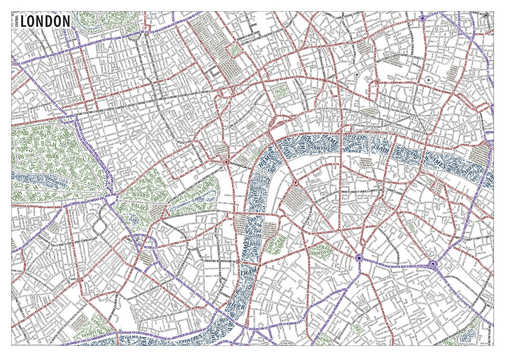
It seems there is no escaping typographic maps of London, the idea has really taken off over the past couple of years. Axis Maps have
More...
This map is produced by The Green Traveller in collaboration with Visit England and the Green Tourism Business Scheme, and presents an idyllic view of
More...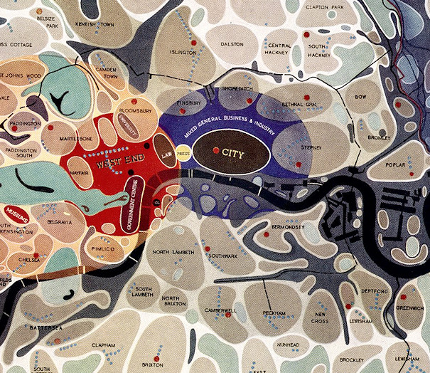
[Updated] This map of London districts, was intended to be used as a grand “masterplan” of how a post-WW2 London could look. Each district appears
More...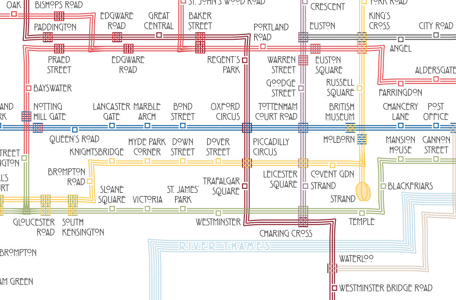
Above is an extract from a map of the London Underground, drawn by Max Roberts in the style of Charles Rennie Mackintosh – with sets
More...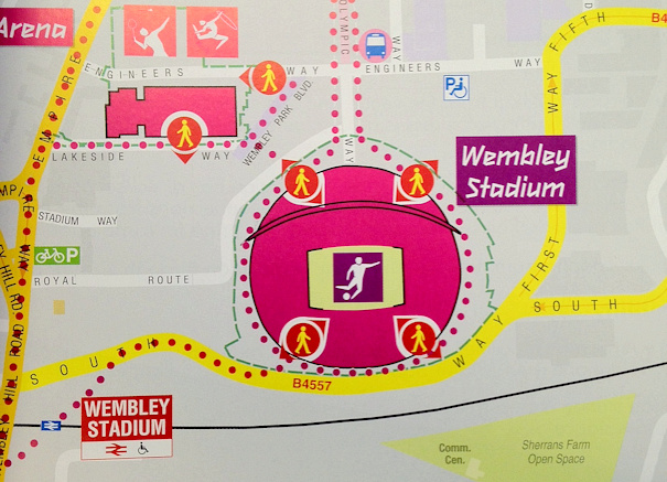
The A-Z is probably the most famous London Atlas – it’s been around for over 75 years, and has been updated ever since. The company
More...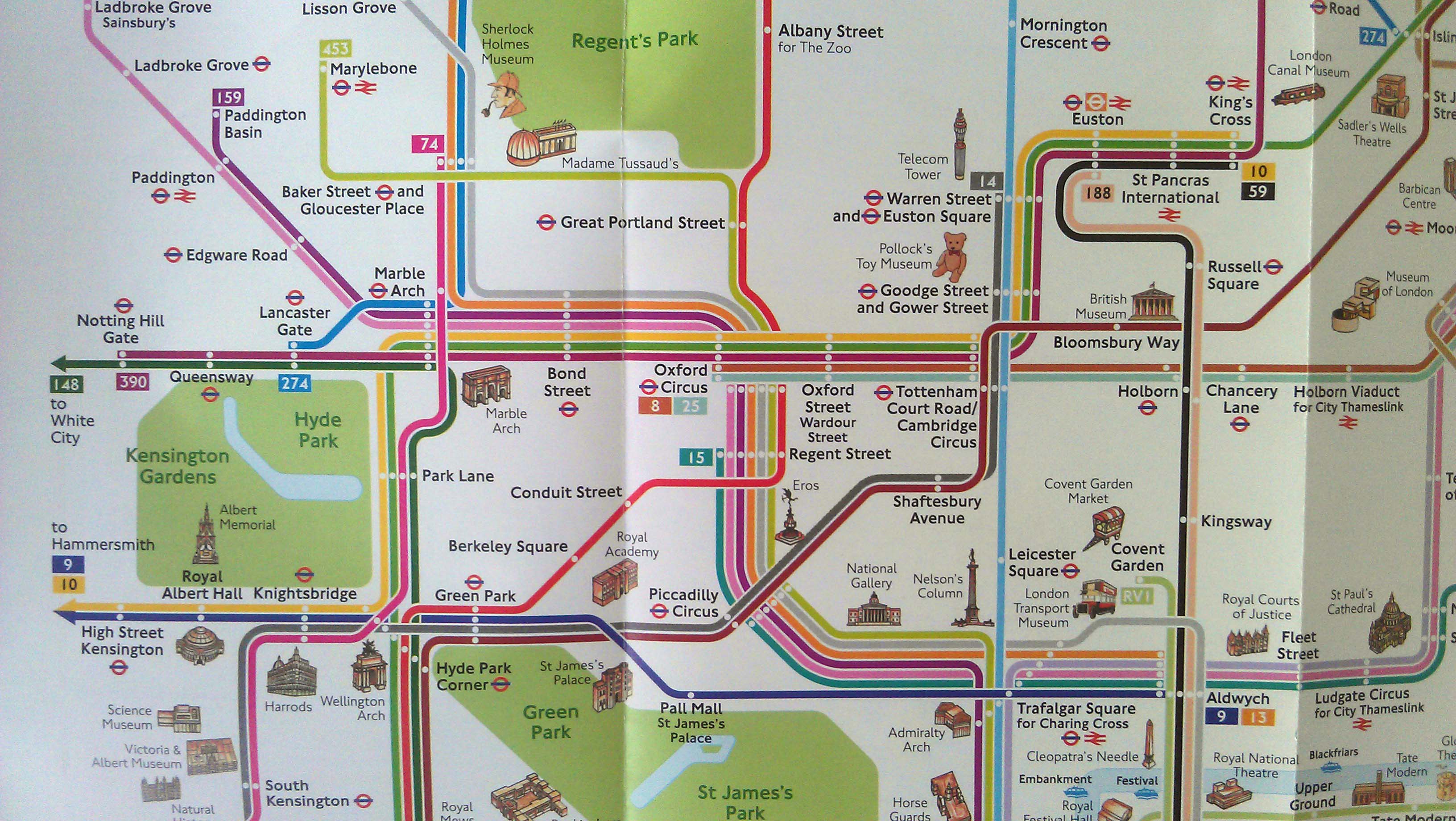
Next time you are passing through a station keep an eye out for a “London Summer 2012” map. It is a similar style to the
More...
Thanks to the Chairman of CASA, Prof Michael Batty, for tipping me off about this map of Olympic Venues in London, created by Katherine Baxter
More...