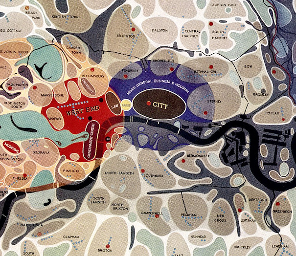

[Updated] This map of London districts, was intended to be used as a grand “masterplan” of how a post-WW2 London could look. Each district appears as a simplified “blob” with rounded edges – many districts are simple ovals. Specific single “University”, “Government”, “Press” and “Law” districts are all defined. Blue dots mark out the main shopping streets, with town halls marked with larger red dots.
The accompanying text reads:
A simplification of the communities & open space survey showing the existing main elements of London. Around the centre consisting of the Fort City and West End are grouped the residential communities which are divided into A. the central communities around the West End, B. the East End & South Bank communities which have a high proportion of obsolescent property & in the main are adjacent to or mixed with industry, C. the suburban communities, the major open spaces & industrial concentrations are also shown.
Thankfully London has not ended up as ordered and prescribed – and obsolescent – as this map suggests.
[Update – Thanks to Andrea Marchesetti for mentioning the below related map, from around the same time and with the same general idea, except with more precise boundaries drawn around the communities.]
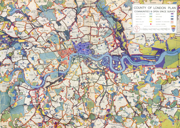
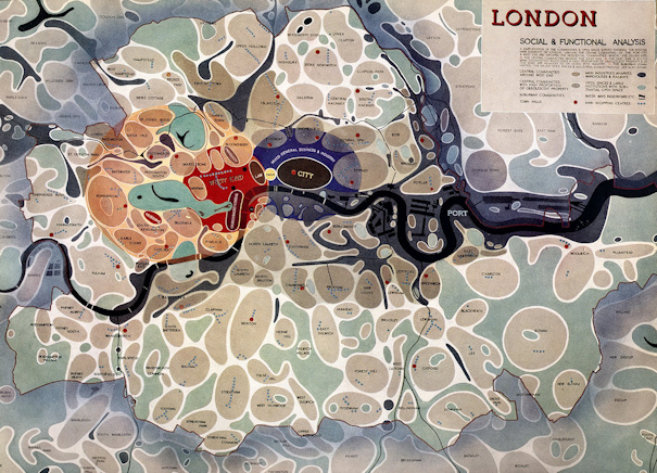
Scan of the main out-of-copyright map (top and middle) from Urban Realm. Another source. The second map can be found here.
Surely a survey, and not a “masterplan”? The map does show the city-as-a-machine single-function view of Abercrombie and his team, and they went on to do lots of masterplanning for better or worse. The map still remains a classic work of cartography on London’s districts.
“This map of London districts, was intended to be used as a grand ‘masterplan’ of how a post-WW2 London could look.… https://t.co/tboDAeTSnV
Hello, I am an academic postdoctoral researcher in the field of urban data mapping and visualization. I am writing a chapter for a university textbook and I am wondering if the London social and functional analysis (bubble diagram) (1943) is free of copyright so that I can use it.
Hi Efrossyni, I am not sure, the map itself is likely not out of copyright as it’s not been 70 years since the death of the creator, so you would likely need to contact the creator’s estate. You may find that excerpting part of it or showing it at low resolution (like I have done) would not be a full reproduction of the map and so could come under fair use.