
The A-Z is probably the most famous London Atlas – it’s been around for over 75 years, and has been updated ever since. The company recently launched a trio of London 2012 maps – a pocket-sized fold-out map of the Olympic Park, a slightly larger one with detailed maps of each London venue, and an A4 book – the venues atlas
– with maps and information on every one of the 30+ venues hosting an event.
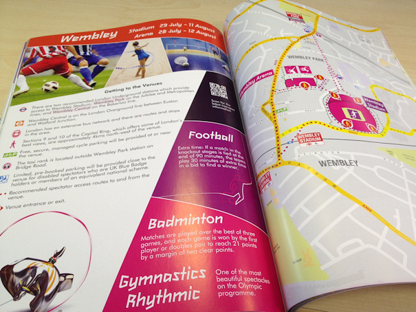
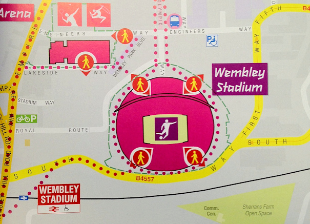
The cartography of the maps is nice and clear. The traditional A-Z maps are very busy with detail – with every road shown – but by having a dedicated map for a single venue, it allows more space to present the information in an uncluttered way. The designated station for each venue is prominently shown, along with the route to/from it. Local non-Olympic tourist attractions are also mentioned in the larger map and the book.
I particularly like the book – partly because it goes into each venue in great detail – many are given four pages in the book, with detailed travel notes – but mainly because it is presented very nicely and is as much a souvenir as the official games programme is, for those with a more cartographical persuasion. In fact it wouldn’t look too bad on a coffee table, as long as you don’t mind the predominant pink colouring and jagged writing that has become synonymous with London 2012.
All three maps state that they are an “Official Product of London 2012” and have an “XXX Olympiad” hologram on the back.
Definitely recommended for the Olympic tourist – particularly if you visiting more than one venue during these games.
Thank you to The Geographer’s A-Z Map Company for sending me a copy of the London 2012 National Venues Atlas and Guide, along with a London 2012 map and an Olympic Park map. The imagery is © Copyright 2012 Geographers’ A-Z Map Company Ltd. © Crown copyright.