The London Blitz, from 1940-1941, was a traumatic event that changed London’s landscape for ever. Until now, maps of the impact sights from the bombs
More...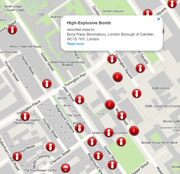
Highlighting the best London maps
The London Blitz, from 1940-1941, was a traumatic event that changed London’s landscape for ever. Until now, maps of the impact sights from the bombs
More...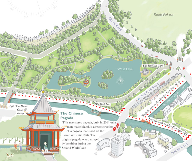
A book, by author and illustrator David Fathers, has recently been published, on the Regent’s Canal. It’s an engaging little book, part route finder, part
More...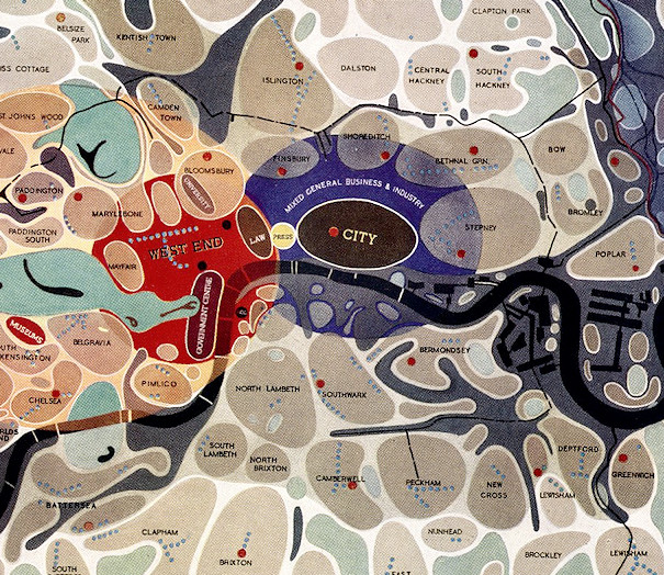
[Updated] This map of London districts, was intended to be used as a grand “masterplan” of how a post-WW2 London could look. Each district appears
More...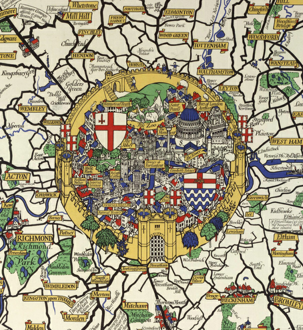
This is an extract of a map produced in 1928 for London Transport by Macdonald Gill. He produced many maps in this “flowery” style, including
More...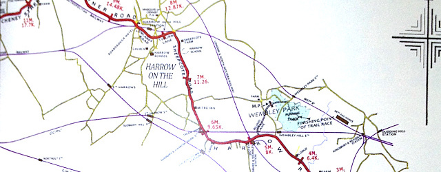
The same day that James received a historic picture map of London that we eventually dated to around 1908, mainly based on the appearance of
More...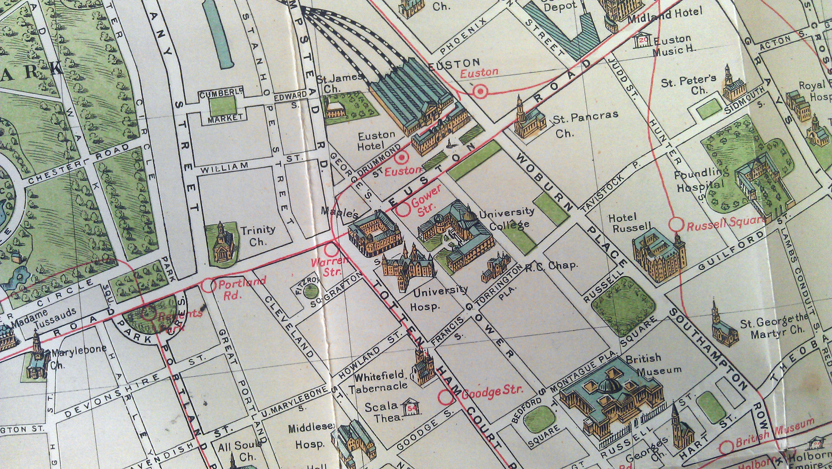
I recently managed to get my hands on one of my favourite maps of London. It is produced by G.W. Bacon and Co. Ltd and
More...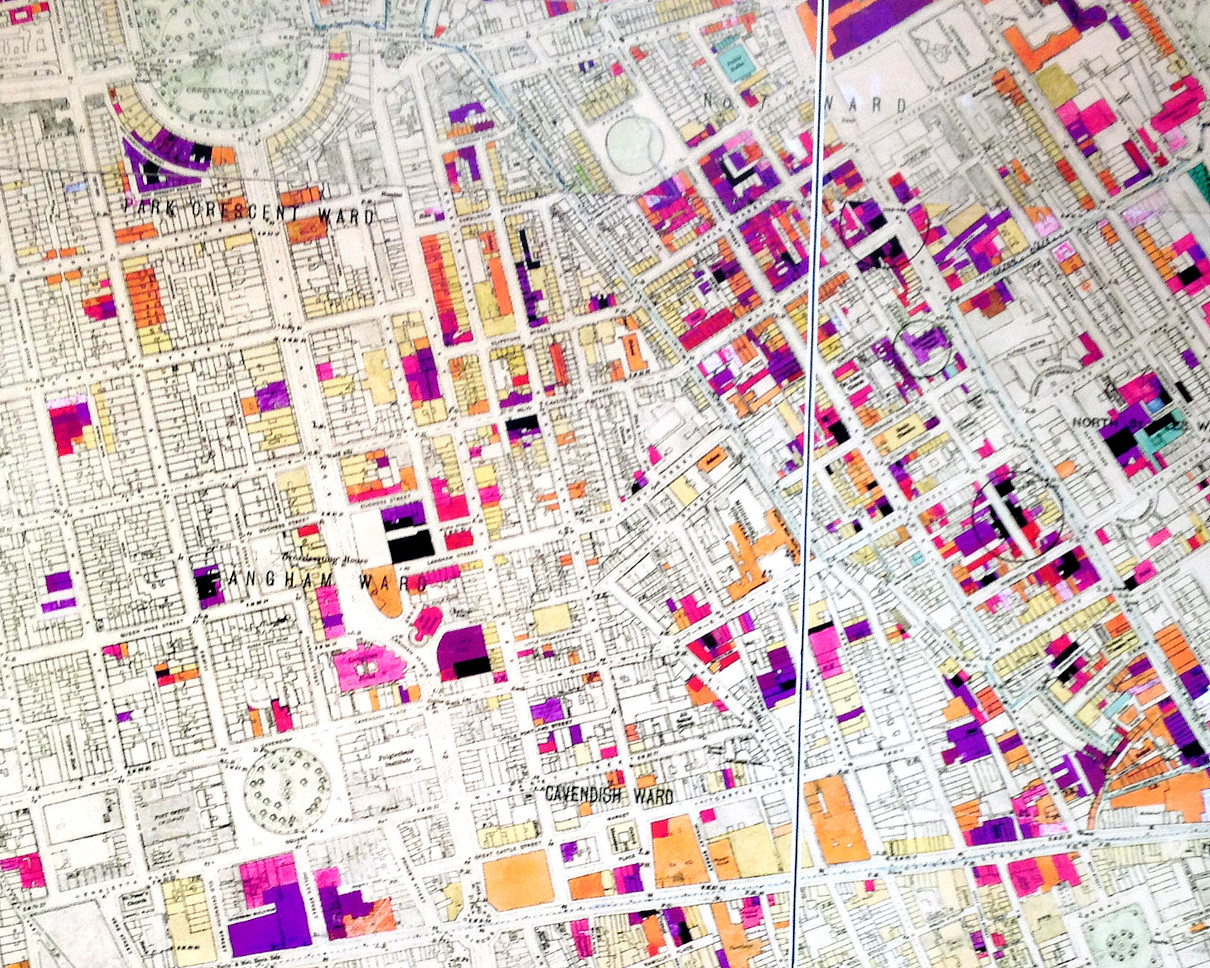
The image above is a photo of part of a large map of London, created just after the Second World War and showing buildings that
More...
We probably don’t feature enough old maps of London on here – we tend to go for the latest glitzy maps, but to make up,
More...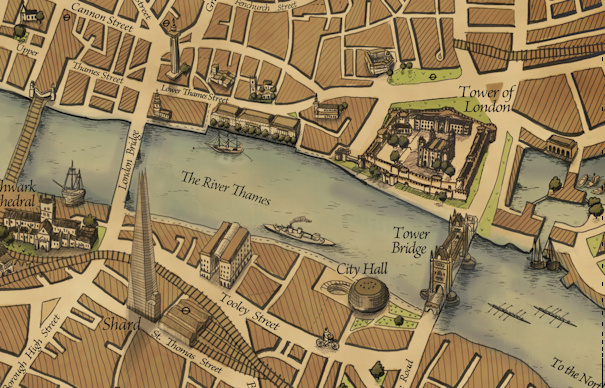
After featuring many very modern maps on Mapping London thus far, it was a pleasure to hear about the Grand Map of London, produced by
More...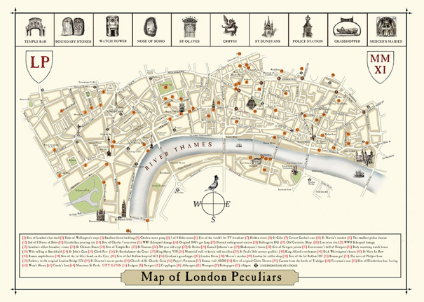
We were delighted to receive a copy of this rather brilliant new map from artist Julia Forte. It highlights the sort of things in the
More...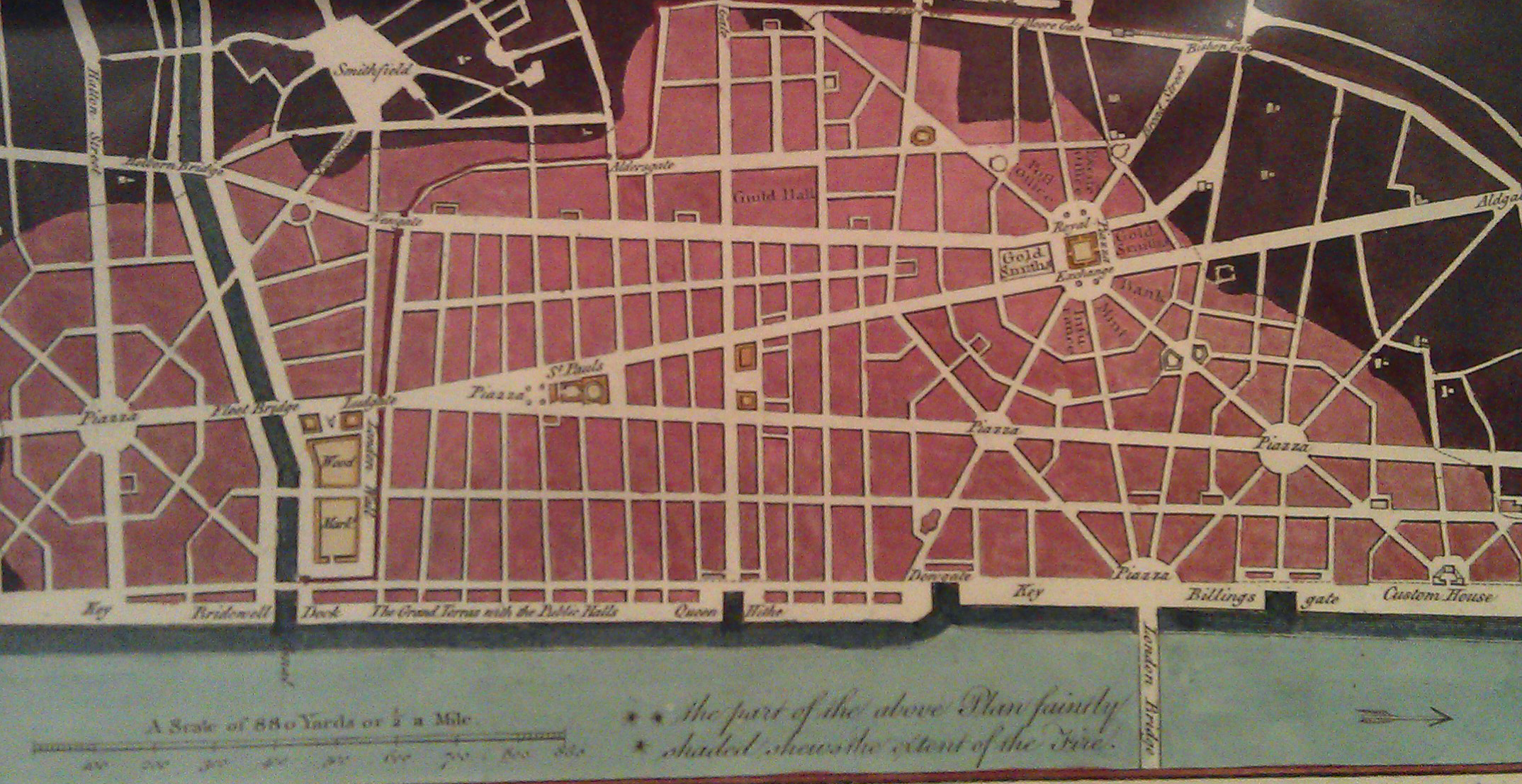
There is a shop in London that I always peer into when I walk past but have always resisted going in as it presented a
More...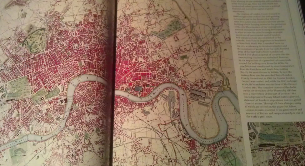
A few months back I had the honour of being asked to approve the use of a couple of excerpts from my London Surname Map
More...