As a followup to yesterday’s article on the Soviet Cold War maps of London, above is an extract sent from the Landmark Information Group, which
More...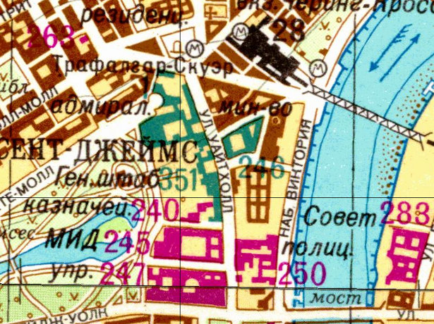
Highlighting the best London maps
As a followup to yesterday’s article on the Soviet Cold War maps of London, above is an extract sent from the Landmark Information Group, which
More...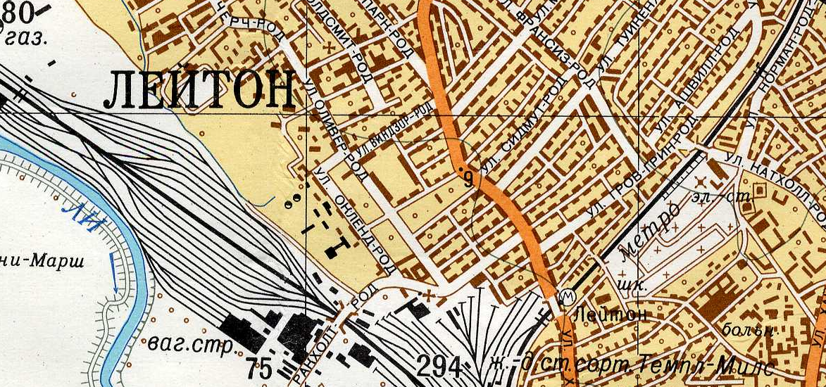
Yes the U.S.S.R. had its own maps of London, and other British cities, produced during Cold War era, i.e. the 1950s-1980s, to be perhaps used
More...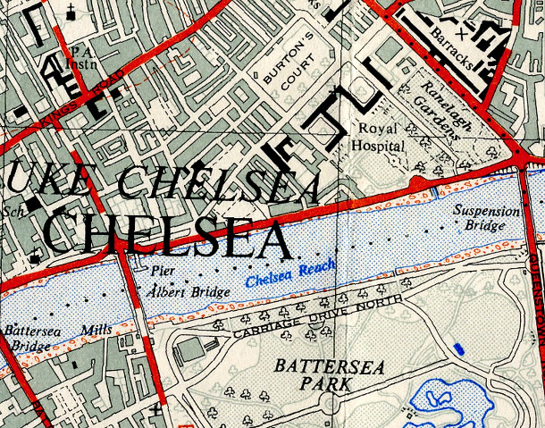
The OpenStreetMap Out-of-Copyright (OOC) project aims to scan in old Ordnance Survey maps of the country, so that they may be of some use when
More...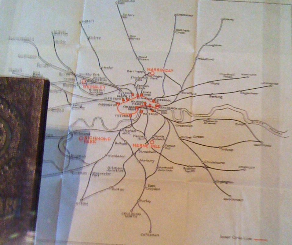
I came across this map of London train lines and underground routes in 1948, part of a guide and travel-card given to competitors at last
More...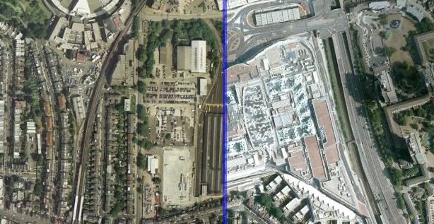
Using the visualisation technique used by ABC Australia and the New York Times to show before/after photographs of the impact of the Japan Tsunami, below
More...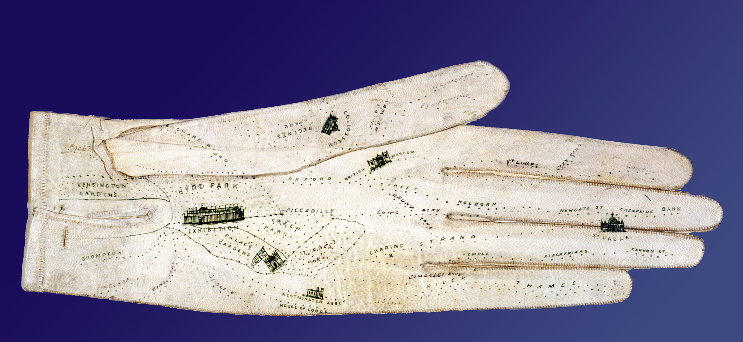
If you lack a sense of direction and resort to writing directions on scraps of paper or the palm of your hand, this glove is
More...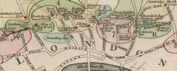
Paying to use London’s roads is not a new idea. I have just come across a map showing turnpike gates (tolls) which were like the
More...