The British Library has launched a portal to let people georeference thousands of historic maps in their collection which have been recently digitised, allowing the
More...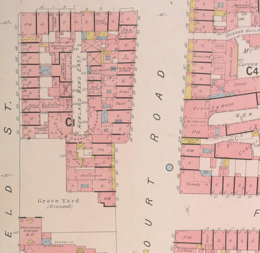
Highlighting the best London maps
The British Library has launched a portal to let people georeference thousands of historic maps in their collection which have been recently digitised, allowing the
More...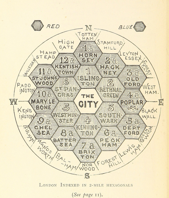
This map is taken from an book “The Unification of London: The Need and the Remedy” written by John Leighton and published in 1895. London
More...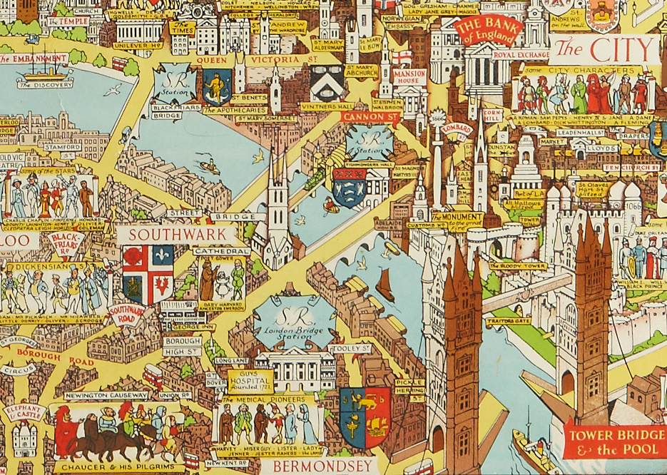
This decorative map was published in or around 1946, as a commemorative keepsake for a weary city and a population that had just been through
More...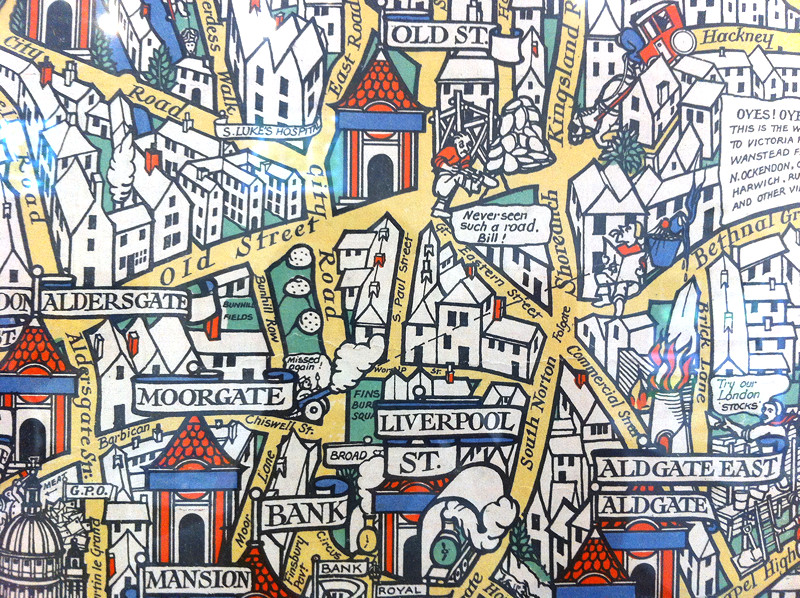
Above is a small part of the “Wonderground Map of London Town” – MacDonald Gill created this fantastic decorative map, which was commissioned to provide
More...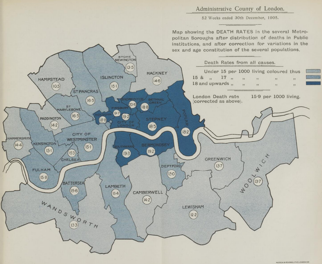
A great new resource has just been released by the Wellcome Library. They have meticulously scanned “Medical Officer of Health” reports for London between 1848 and
More...
Here’s a real treat. The National Library of Scotland’s Map Department, supported by David Rumsey, have taken some very high-resolution scans of the Ordnance Survey
More...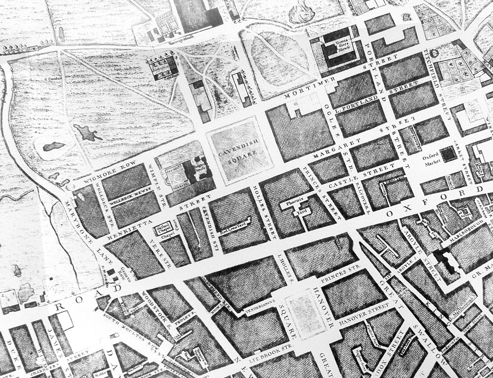
Mapping London has always been most interested in modern maps of London, however we are happy to make the occasional exception, and so when this
More...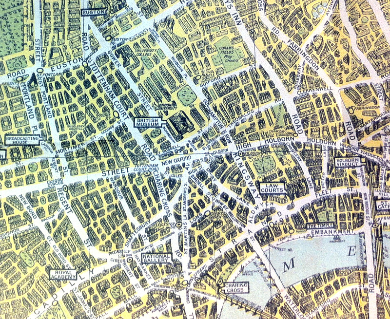
The above map is an extract from a reproduction of the “Pictorial Map of London” published in 1938 by what was then known as the
More...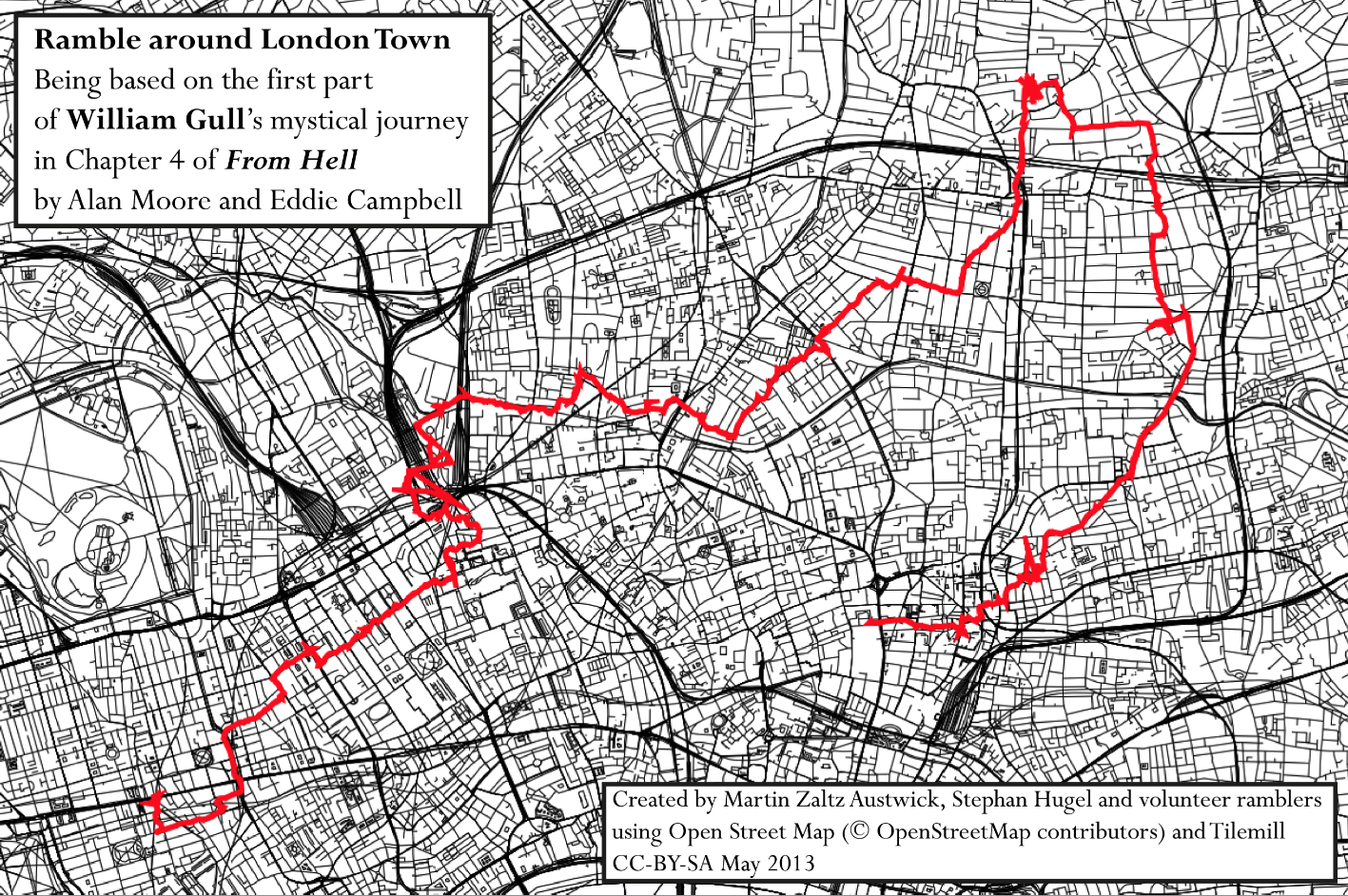
The epic graphic novel entitled “From Hell” is summarised in the following way: “An unflinching recreation of Jack the Ripper’s mutilation of five Whitechapel prostitutes
More...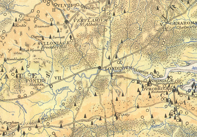
Here is part of a map, The Map of Roman Britain, Second Edition, published by the Ordnance Survey in 1931 and scanned by Bibliographics. The
More...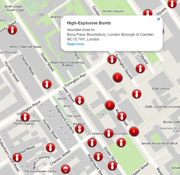
The London Blitz, from 1940-1941, was a traumatic event that changed London’s landscape for ever. Until now, maps of the impact sights from the bombs
More...
A book, by author and illustrator David Fathers, has recently been published, on the Regent’s Canal. It’s an engaging little book, part route finder, part
More...