
As a followup to last week’s post about university campus maps in London, my attention was drawn to the Middlesex University campus map which I had overlooked.
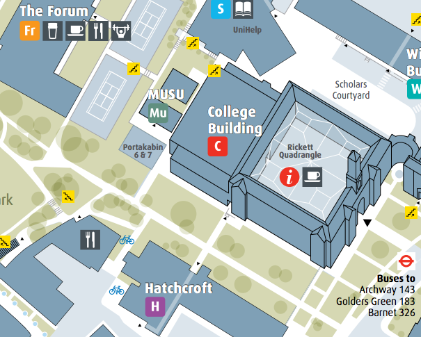
This was unfortunate, as it is far and away the best London university campus map I’ve seen. It’s in 2D, and uses a little bit of 3D to emphasise the key building, without overusing the effect. It ticks all the boxes for good design – particularly, it’s a good use of a select set of colours, which don’t overwhelm the map, Arrows discretely show access points, the main one shown with a slightly larger arrow. Trees are shown as an attractive blend of translucent circles. The symbols are well thought out, and include the “official” tube, train and cycle logos.
Extract of the map which is “Redrawn from Ordnance Survey with permission of HMSO © Crown Copyright 2010. All rights reserved. London Borough of Barnet 100017674. Cartography by Steer Davies Gleave 2011.”
Hi Ollie,
Pleased that Steve pointed this out to you.
We’ve been working with Hendon campus for a while now implementing a new wayfinding system too, alongside our transport consultancy work. The mapping was a key component to revive the look and feel of the signage too and to help ensure a consistent identity across the nearby sites and make it clear how to get from one to to the other.
There’s been positive feedback from staff and students, but always nice to see how it compares to others out there.
Clare Seldon
http://www.linkedin.com/in/clareseldon