Stamen Design are a bespoke design and technology company based in San Francisco. They have a reputation for creating wonderful looking maps, often with OpenStreetMap
More...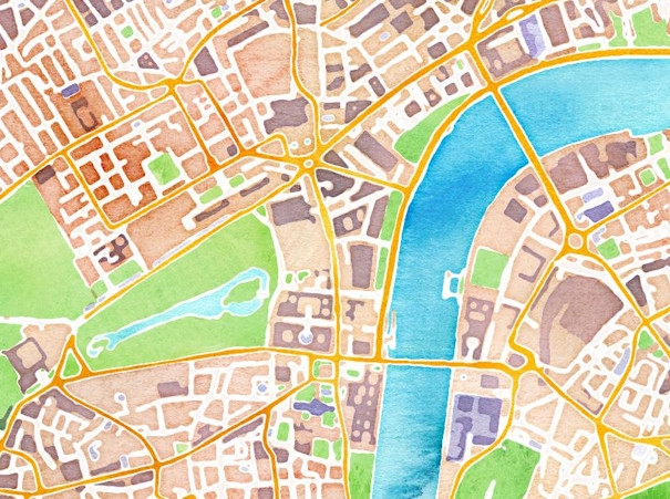
Highlighting the best London maps
Stamen Design are a bespoke design and technology company based in San Francisco. They have a reputation for creating wonderful looking maps, often with OpenStreetMap
More...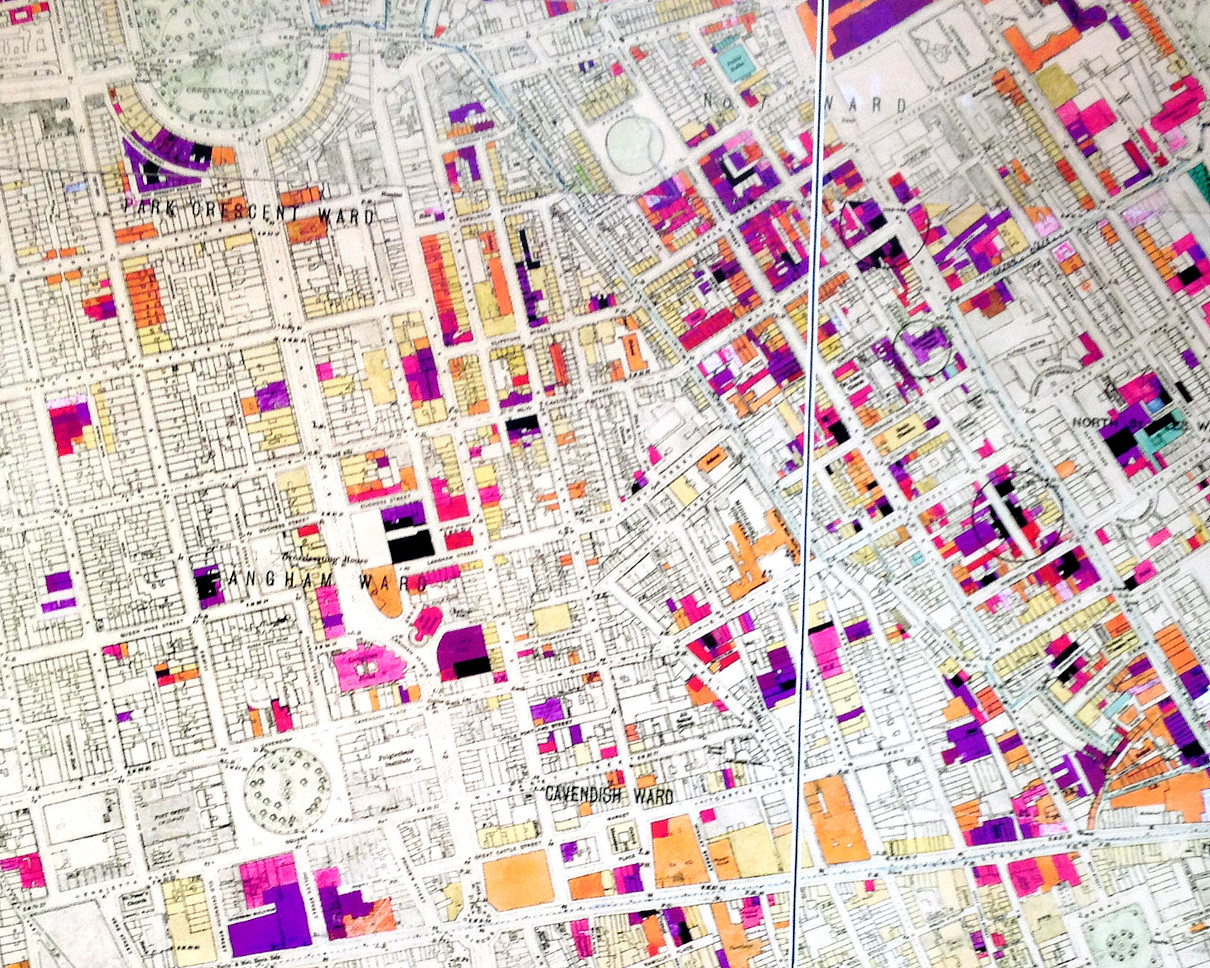
The image above is a photo of part of a large map of London, created just after the Second World War and showing buildings that
More...
This post was going to appear on Friday but I’ve brought it forward as tickets are rapidly disappearing – 2/3rds of them have already been
More...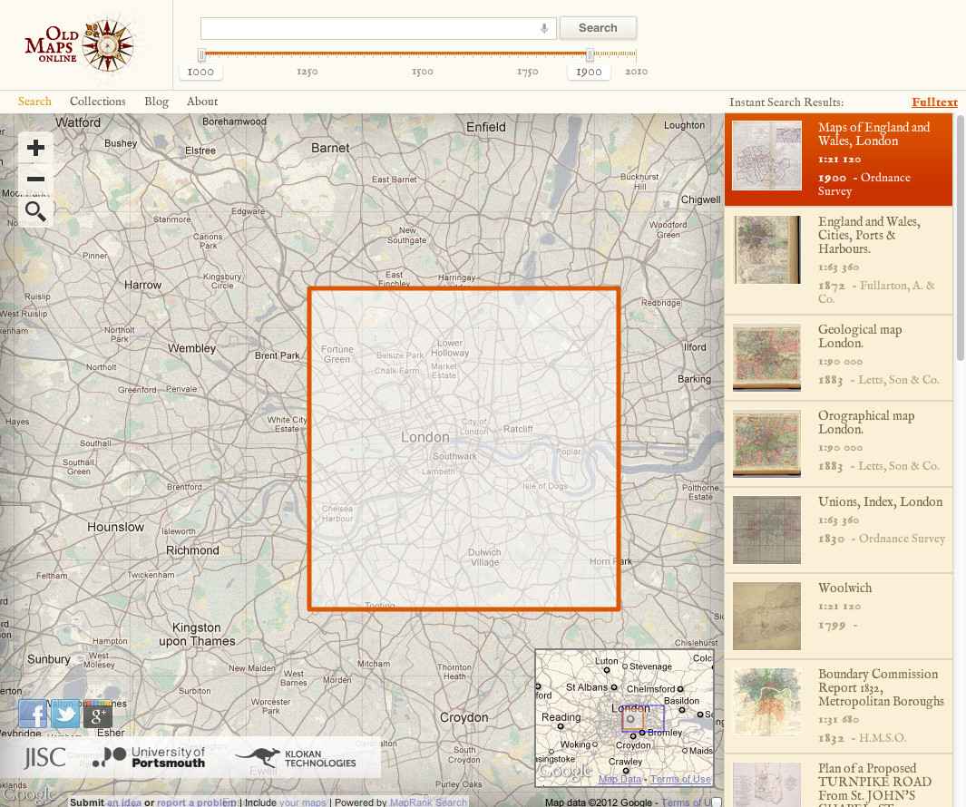
We probably don’t feature enough old maps of London on here – we tend to go for the latest glitzy maps, but to make up,
More...
Eric Fischer produced this interesting data map of London a while back. The map is entirely made of of location coordinates included on Twitter tweets,
More...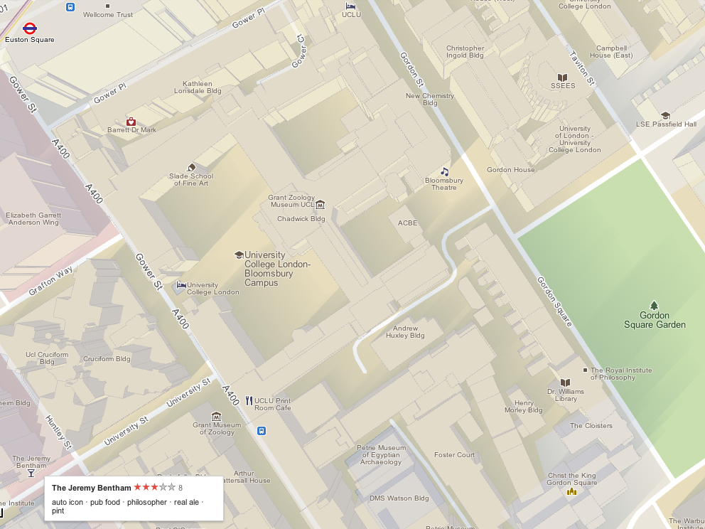
The Mapping London blog is 1 year today! We launched on February 24, 2011. To celebrate, today we are featuring Google Maps, and how it
More...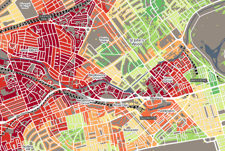
“Geodemographics of Housing in Great Britain – a new visualisation in the style of Charles Booth’s map” is a map that I have produced that
More...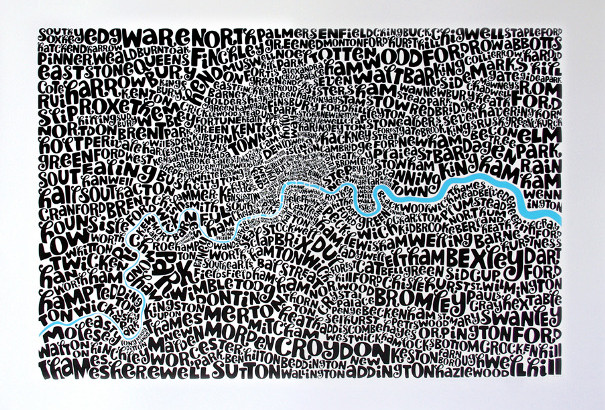
James previously featured a tube map made up of just names of the stations. He’s also featured other London typographic maps. Exploring a little further,
More...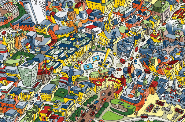
This cartoon of the area around Trafalgar square is a small section of a rather interesting caricature created by Hartwig Braun, of a view of
More...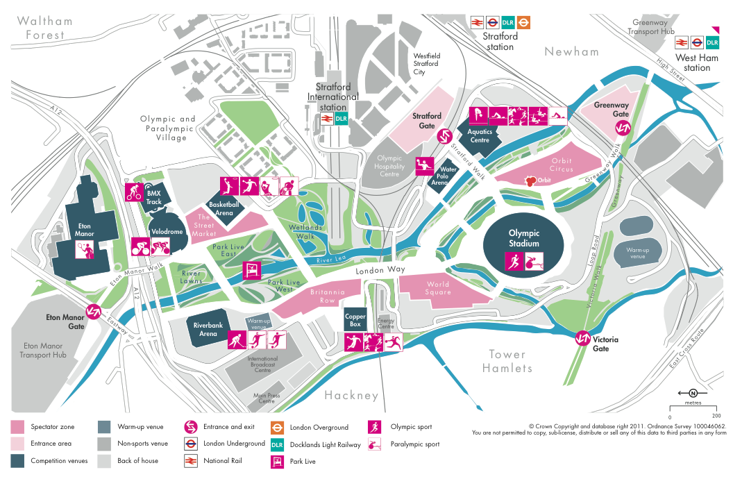
LOCOG (The London Organising Committee for the Olympic Games) yesterday released a new map of the key Olympic Park in east London, as part of
More...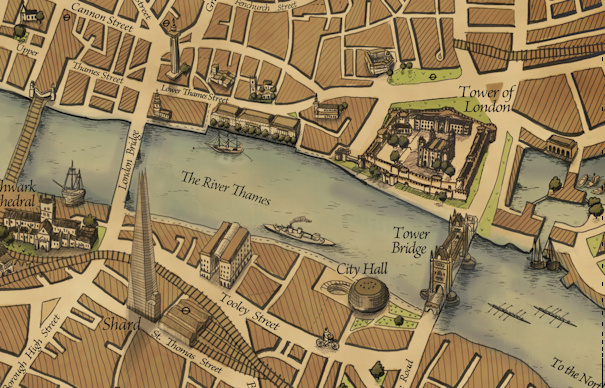
After featuring many very modern maps on Mapping London thus far, it was a pleasure to hear about the Grand Map of London, produced by
More...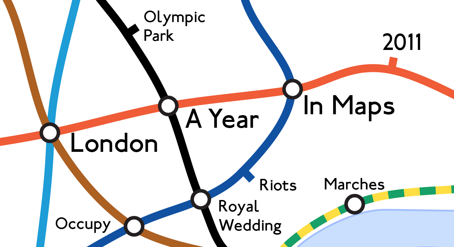
Mapping London editors James and Ollie look back at some of the many maps produced each year in London to highlight the highs and lows
More...