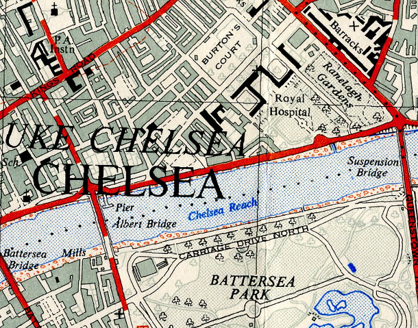

The OpenStreetMap Out-of-Copyright (OOC) project aims to scan in old Ordnance Survey maps of the country, so that they may be of some use when filling in the modern map. The maps have to be at least 50 years old to be used in such a way – as Crown Copyright expires after this time. There is often a burst of activity as new maps are added in January each year. Currently much of London is missing, apart from the far-southeast and the area featured here, the Wandsworth, Battersea and Chelsea area. [Update – the area is grid-square TQ27 and this particular map is from 1947 – see the comments for more detail.]
You can browse the current Out-of-Copyright collection. My favourites are the 1:25000 1st Series maps. These have been scanned in professionally and look lovely. It’s fascinating seeing just how London has changed, which is easy to do by changing between the old and modern maps (the links on the right of the OOC website.)
Here is a direct link to the map above, and here is a page with more information about the project.
Scanned by the OpenStreetMap Out-of-Copyright map project by Blackadder.
are these maps from 1961 then?
Good question. I had to do some digging to find out.
This particular extract is of TQ27. This can be seen by zooming out from the live link and comparing visually with the graphical index at: http://wiki.openstreetmap.org/w/images/6/62/25kOS_Index_Graphical.pdf
Then, looking at the list: http://wiki.openstreetmap.org/w/images/1/11/25kOS_maps_Held.pdf – reveals this particular map is from 1947.