This is an extract of a map, by Matt Ashby, formerly of the UCL SECReT (Security and Crime Science) lab, that takes police.uk open data
More...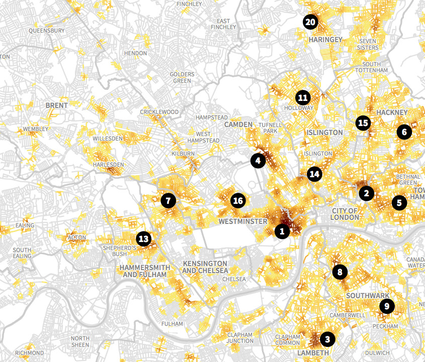
Highlighting the best London maps
This is an extract of a map, by Matt Ashby, formerly of the UCL SECReT (Security and Crime Science) lab, that takes police.uk open data
More...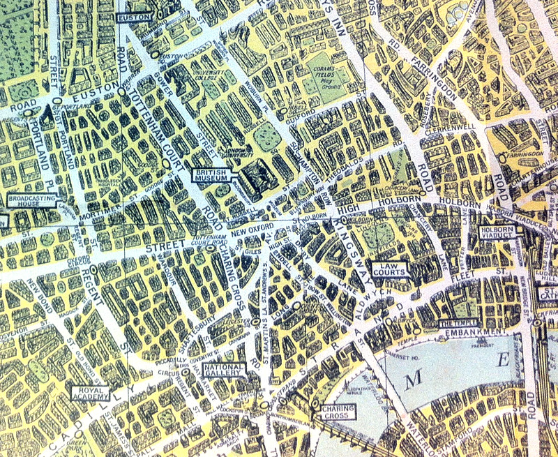
The above map is an extract from a reproduction of the “Pictorial Map of London” published in 1938 by what was then known as the
More...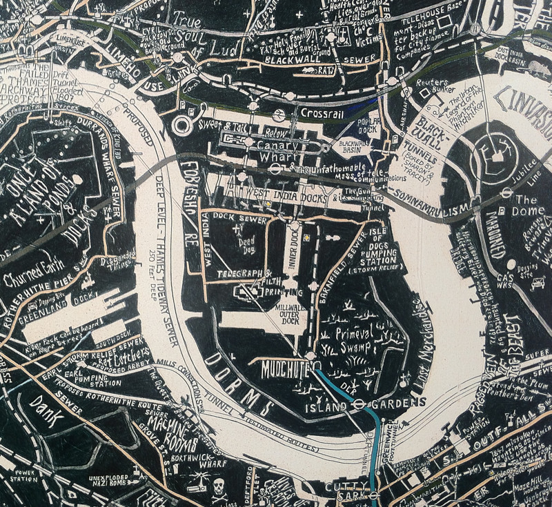
Stephen Walter, most famous for his “Hub” map of London, a fantastically detailed hand drawn map of London with a distinctive repeating style and thousands
More...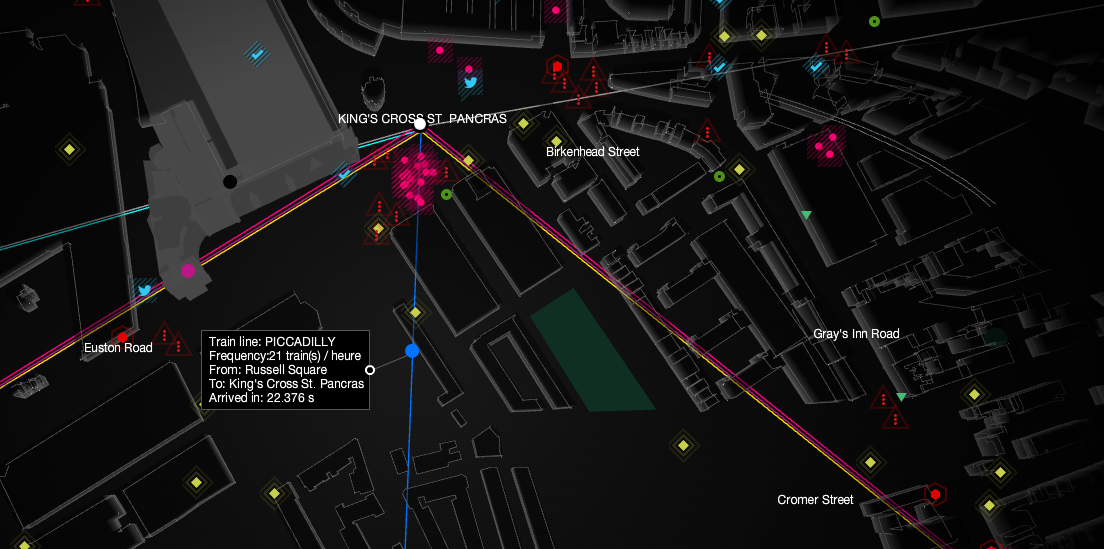
UbiSoft have created this compelling live map of London’s sensor and social media data, as part of a promotion for their upcoming game “Watch Dogs”.
More...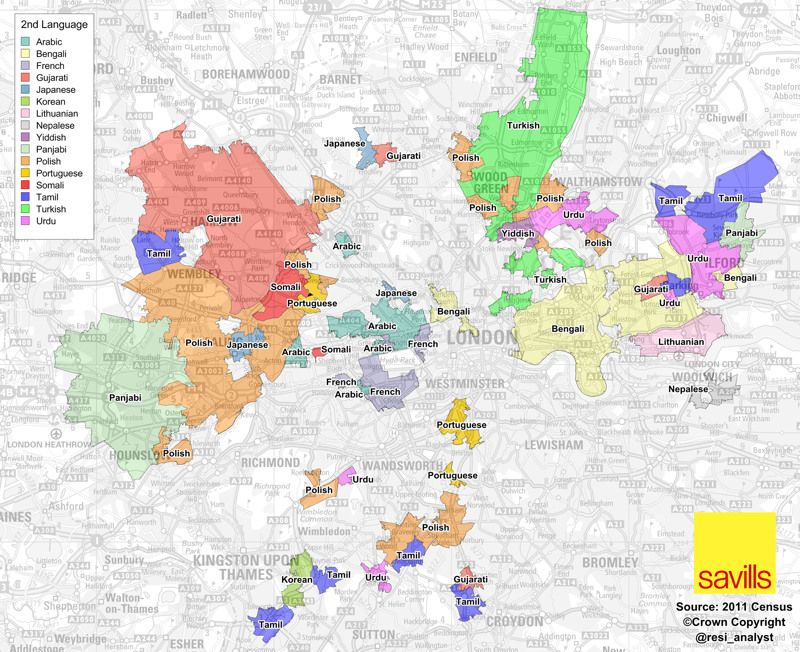
A map full of striking patterns, from Savills’ analyst Neal Hudson. It shows the areas of London where, for each area, the second most popular
More...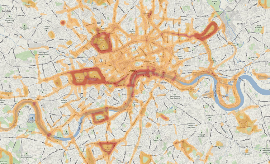
This is a screenshot of a heatmap of runs carried out in central London, using the Nike+ training “app” which utilises a phone’s built-in GPS
More...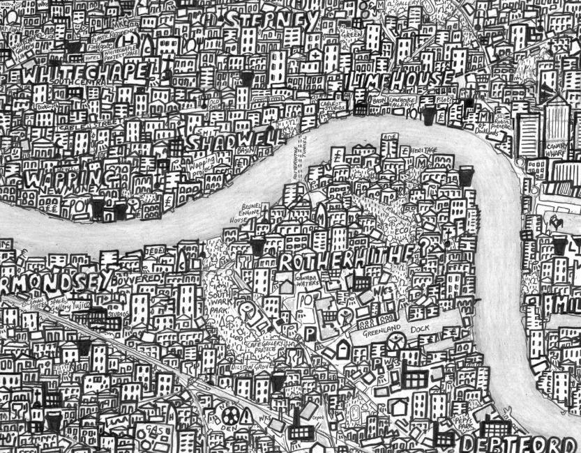
The above is just a small extract from Stephen Walter’s “Hub” Map of London, a hand-drawn map of painstaking detail, drawn during 2007-8. You can
More...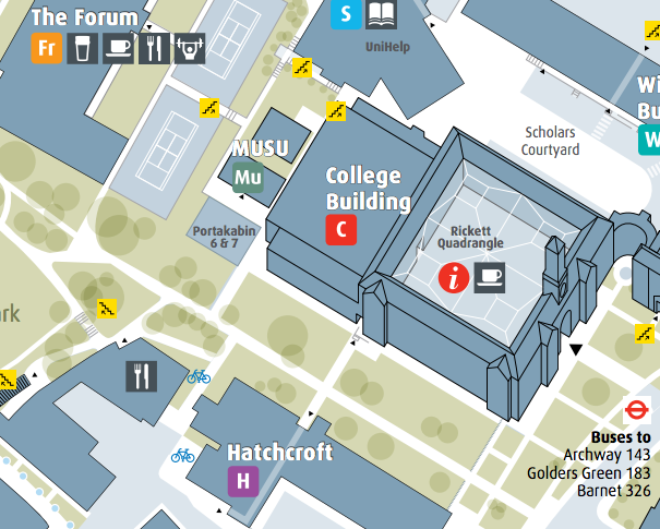
As a followup to last week’s post about university campus maps in London, my attention was drawn to the Middlesex University campus map which I
More...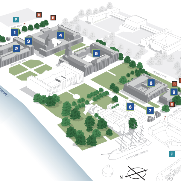
[Update – additional article on Middlesex University] I was talking to the UCL cartographer recently and he mentioned that there aren’t many dedicated cartographers left
More...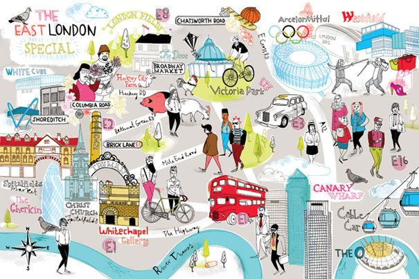
These two artwork maps (East London above, and South-East London below) were created by Brighton artist Tilly of Running for Crayons, for the Observer newspaper
More...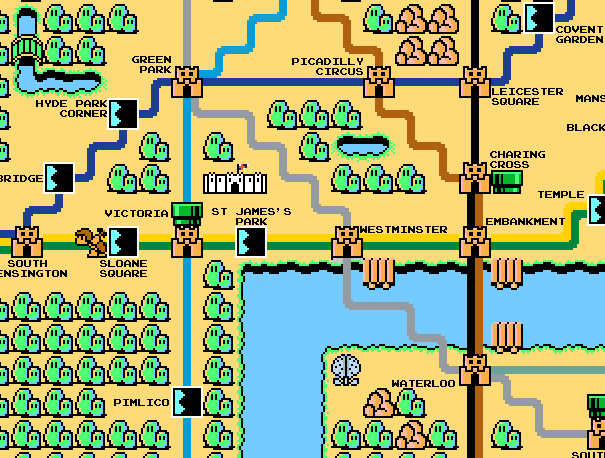
Here’s a map of Zone 1 London (concentrating on the tube lines) constructed with sprites from the old-skool (80s!) console game Super Mario Bros 3.
More...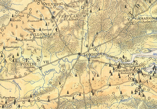
Here is part of a map, The Map of Roman Britain, Second Edition, published by the Ordnance Survey in 1931 and scanned by Bibliographics. The
More...