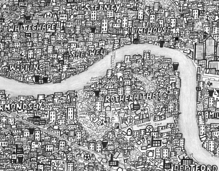

The above is just a small extract from Stephen Walter’s “Hub” Map of London, a hand-drawn map of painstaking detail, drawn during 2007-8.
You can see the full version of Stephen’s map on his website, along with his most famous work “The Island”, which is in a similar but more autobiographical style, and featured in a British Library exhibition London, and London Subterranea, which was commissioned by the London Transport Museum.
Stephen is exhibiting his cartographic work, including new material and an interactive exhibit, at an exhibition, From the Anthropocene, at the Londonewcastle project space on Redchurch Street in Shoreditch, from 3 to 26 July. The exhibition is presented by TAG Fine Arts.
Map copyright Stephen Walter.
Loving Stephen Walters’ map of London on tv https://t.co/zGCmaGx7RD