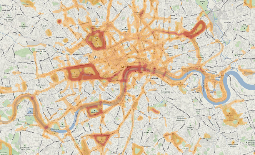

This is a screenshot of a heatmap of runs carried out in central London, using the Nike+ training “app” which utilises a phone’s built-in GPS to record the route. Many runs are aggregated and then combined into this heatmap, which is overlaid on the regular Google Maps terrain layer.
The result reveals the most common running routes in London. Hyde Park, Regent’s Park, Battersea Park, Victoria Park and Clapham Common stand out, as does the canal network, particular the section of the Regent’s Canal between Victoria Park and Dalston, and also routes along the river – particularly the classic loop between Westminster Bridge and Blackfriars Bridge. Narrow Street (near Canary Wharf) also appears. A few surprising areas – Southampton Way near Burgess Park, and Kilburn Grange Park, also show strongly on the heatmap – likely due to a very keen local regularly uploading their routes.
Background map copyright Google 2013. Foreground data copyright Nike and the running participants.
We need to plan cities for sport and physical activity too! Great data is available for this task… https://t.co/zFQZSGa994