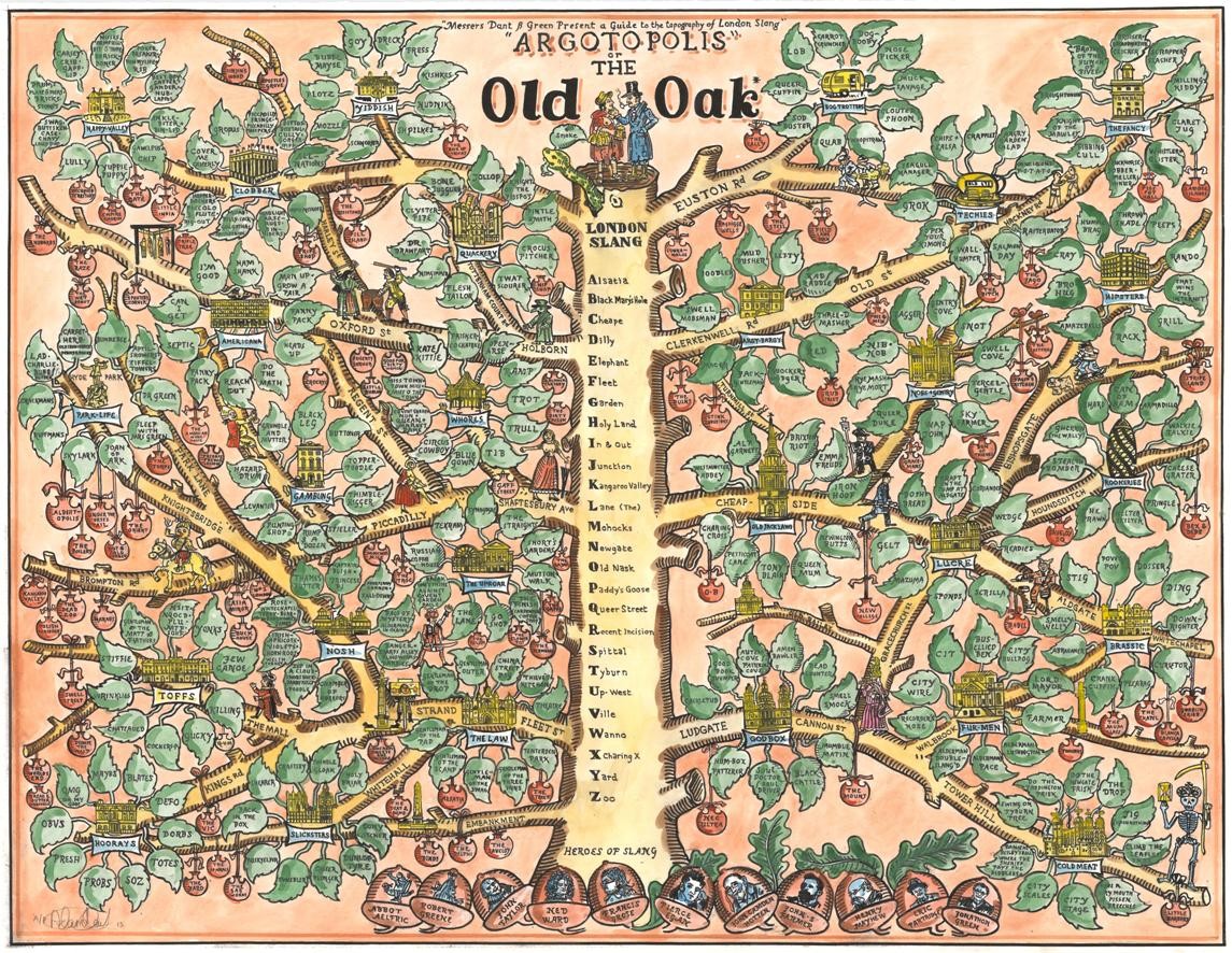
Argotopolis is a map of London slang, created by Adam Dant (cartographer) and Jonathon Green (lexicographer). At first glance it looks like an ornate tree, look more closely and you’ll realise it is indeed a map, with Farringdon Road acting as the trunk of an “Old Oak” (aka the “Big Smoke”, aka London) – and with leaves clustering around branches of the trunk.
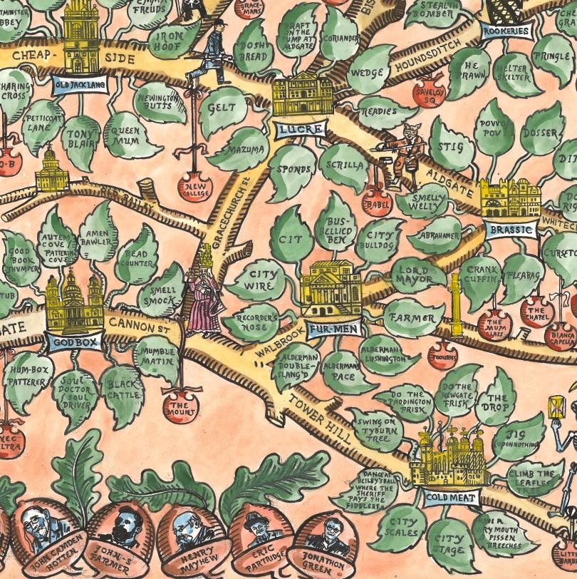
Each group of leaves outlines the slang associated with a particular profession that is traditionally clustered around the corresponding geographical location. For example, at Bank, represented by a little Royal Exchange building subtitled “Lucre” and sitting on a branch that splits four ways, the leaves surrounding the building read “Gelt” and “Sponds”, amongst others. The northern tip of Bishopsgate, i.e. Shoreditch, has “Hipsters” around the Tea Building – aka “Amazeballs” or “Humblebrag”. Recently, Londoners have become astomoned to giving nicknames to the various crazy tall towers sprouting in the City, and there is a branch for that, with the Gherkin sprouting leaves with the names of other skyscrapers, planned or built – namely the Cheesegrater, Walkie Talkie and the Can of Ham, to name but three. It’s really rather fascinating to study, especially once you spot all the detail hidden in the “branches”.
Being a hand-drawn piece of artistic cartography, created by the careful hand of Adam Dant, the colours are appropriately arboreal and the piece is very pleasing to the eye.
A hand-tinted limited edition print of the map is available at TAG Fine Arts.
Spotted on Spitalfields Life. The map is the copyright of its creators – scanned by TAG Fine Arts.
