
The National Library of Scotland’s (NLS) Map Department has recently completed a huge georeferencing exercise, taking a set of Six-Inch-To-Mile (1:10560) maps for the whole of England and Wales, scanning them in to create high-quality images, and lining them up with Google Maps and OpenStreetMap modern maps. The maps were drawn between 1888-1913 and so represent a complete picture of the countries a hundred years ago.
They have developed a side-by-side tool to allow for easy comparison between the old and new maps.
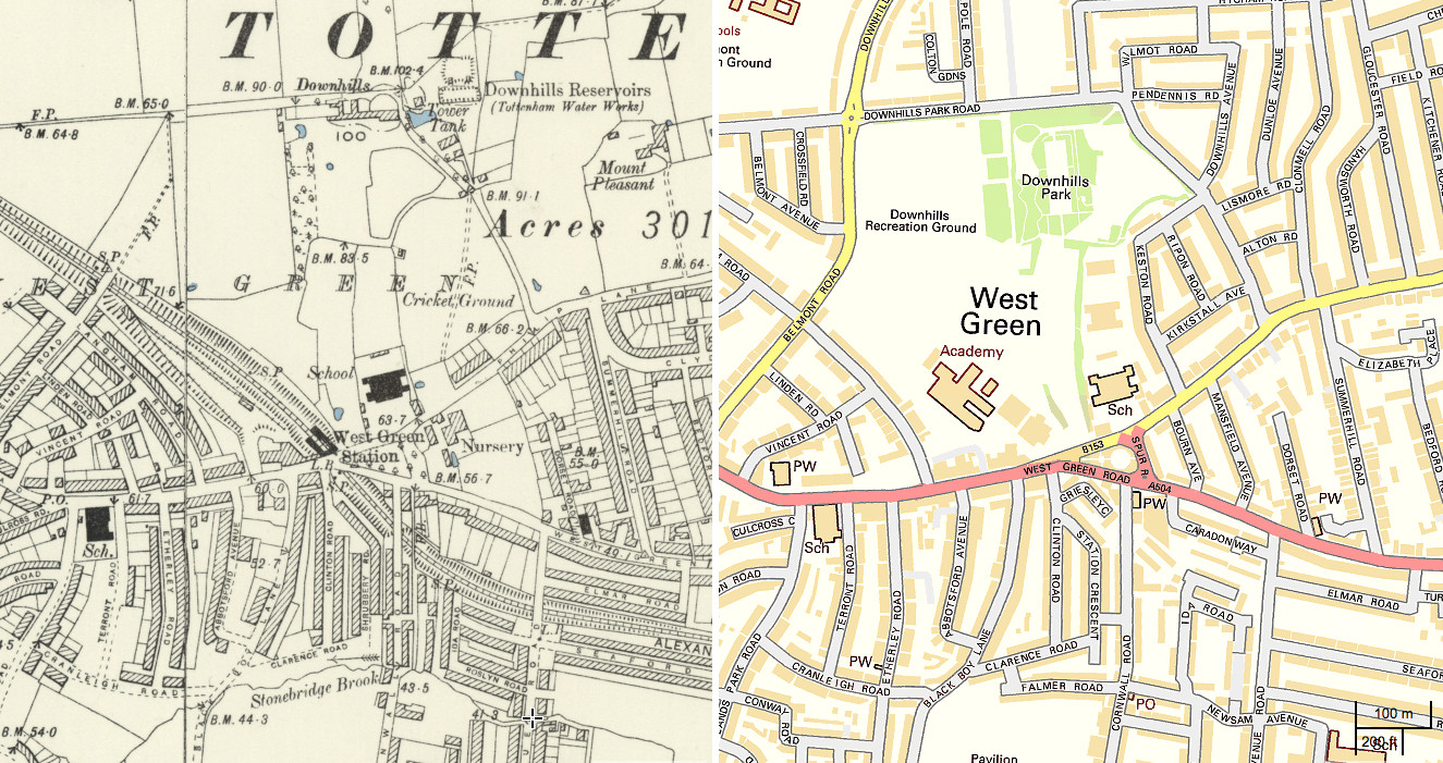
Above (click for larger version) shows the Six-Inch map of the West Green area, near Tottenham. On the left is the old map, and on the right is the modern Ordnance Survey 1:10000 map for comparison (which, surprisingly, isn’t as detailed as the older one!) I wonder if residents on Newsam Avenue (on the bottom right of the extract here) know that the reason for the wiggles on their road is that it runs directly above the now culverted Stonebridge Brook? One other prominent feature that has disappeared, but is traceable by the angles of the replacement roads and houses, is the old railway line, going through West Green Station.
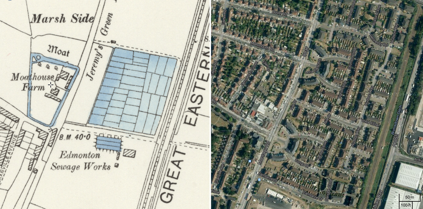
Below – Moathouse Farm – a farm appropriately surrounded by a moat – is long gone and replaced by suburban housing, in this part of Edmonton. The modern aerial imagery reveals that no trace of it exists.
The scans are of a very high quality and the images have been adjusted to line up well with the contemporary mapping projection. The seams at sheet edges are generally very small and sometimes unnoticeable. This is key to the old imagery becoming a useful dataset for comparing old with new.
We featured an older and even larger scale map of London, a few months ago, this was also scanned by the NLS and covering inner London only, the capital being a lot smaller at the beginning of the 20th century. The newer project here covers a wider area, allowing those in Zones 4-6 to see how their area was 100 years ago – mainly countryside and small towns rather than the suburban sprawl we have now.
Thanks to Christopher Fleet at the NLS for letting us know about the release. The modern aerial imagery is Copyright Google, and the modern map is Crown Copyright and database right Ordnance Survey.
p.s. Mapping London has moved! Our new address is: Oliver O’Brien or James Cheshire, Dept of Geography, University College London, Gower Street, London WC1E 6BT.
Just wanted to say how awesome your side by side mapping is. I am an amateur genealogist and being able to pinpoint where people lived has always been hard but this just makes it so much easier. So thank you.
Hi Sarah, the NLS created the side-by-side mapping, we are just reporting it!