London has a long and gruesome history – indeed part of its tourist industry is focused on tours and attractions based on the “Jack the
More...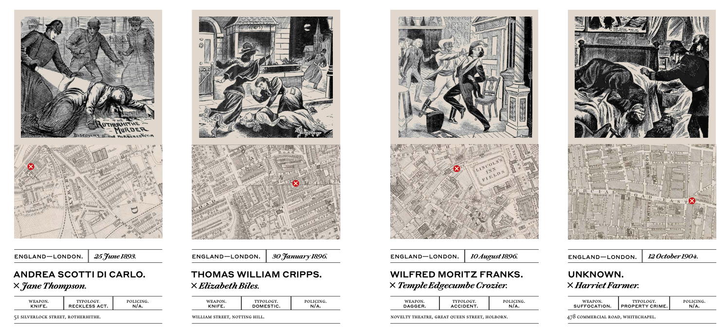
Highlighting the best London maps
London has a long and gruesome history – indeed part of its tourist industry is focused on tours and attractions based on the “Jack the
More...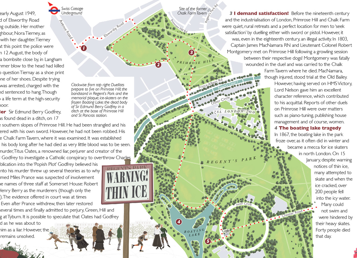
“Bloody London” is a new book by author, illustrator cartographer David Fathers. Previously writing about the Thames Path in London, the Regents’ Canal and London’s
More...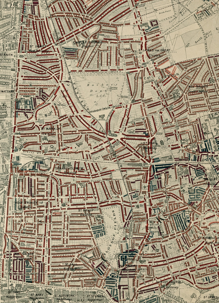
Buy the book. Perhaps the world’s most famous historical geodemographic maps, the London Poverty Maps were created by Charles Booth over the course of a
More...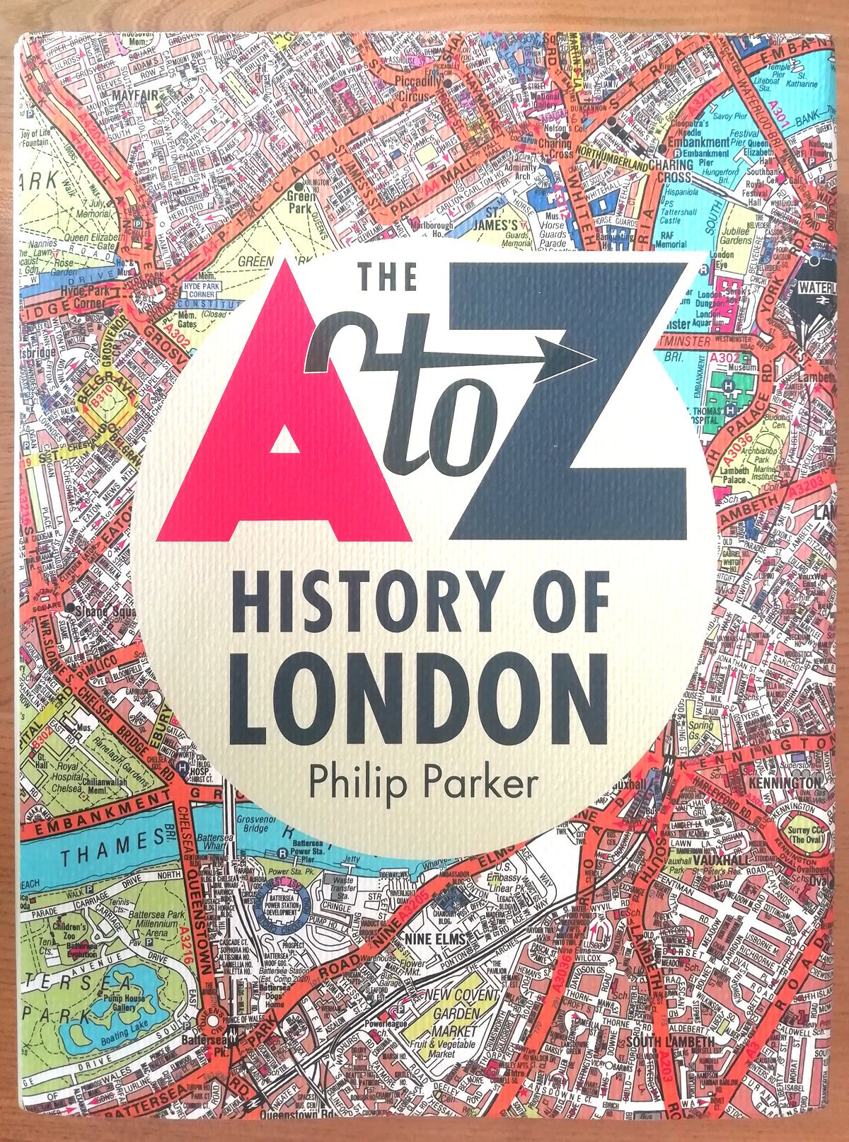
The A to Z is a bit of an institution when it comes to London maps. It, along with the Tube Map, is probably the
More...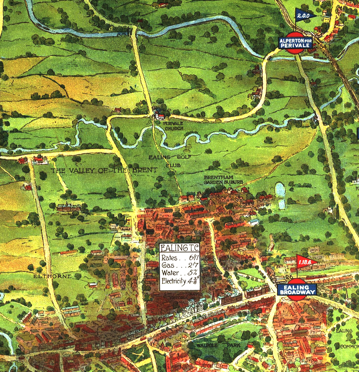
Drawn in a similar era to the historic map of Kew, here is another map from the archives of Transport for London at the Transport
More...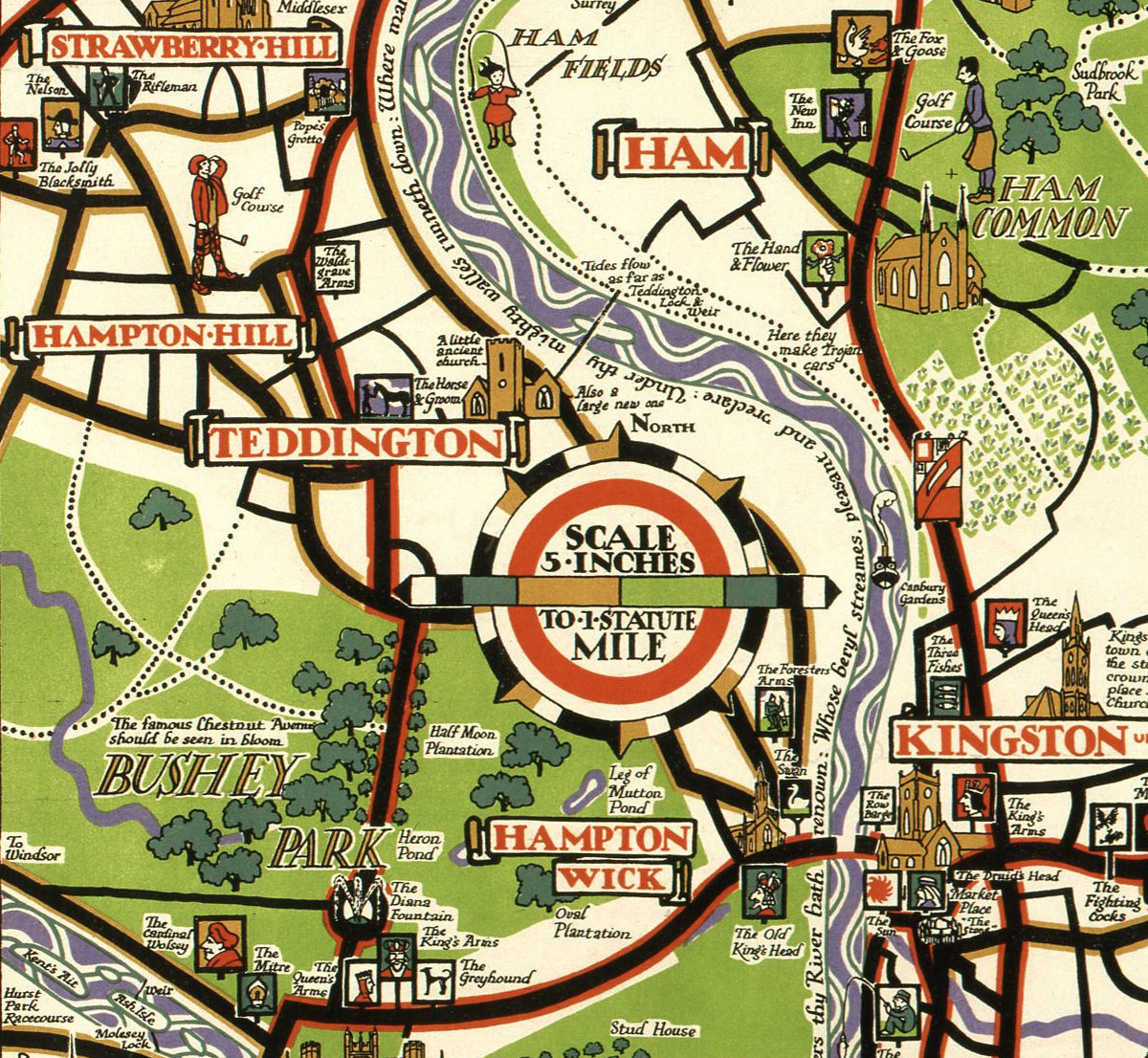
This decorative map, simply called “Kew”, was produced by Herry Perry of Vincent Brooks lithographers in 1929. It was part of a series of posters
More...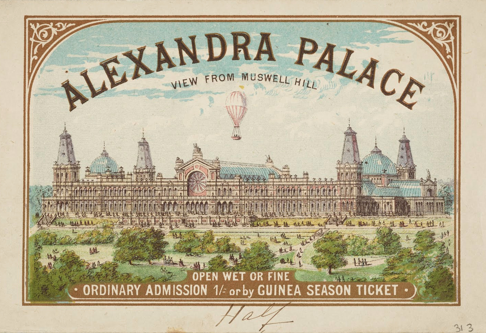
This map, dating from 1875, appears on the back of a “Guinea season ticket” for entry to Alexandra Palace, in north London. The palace was
More...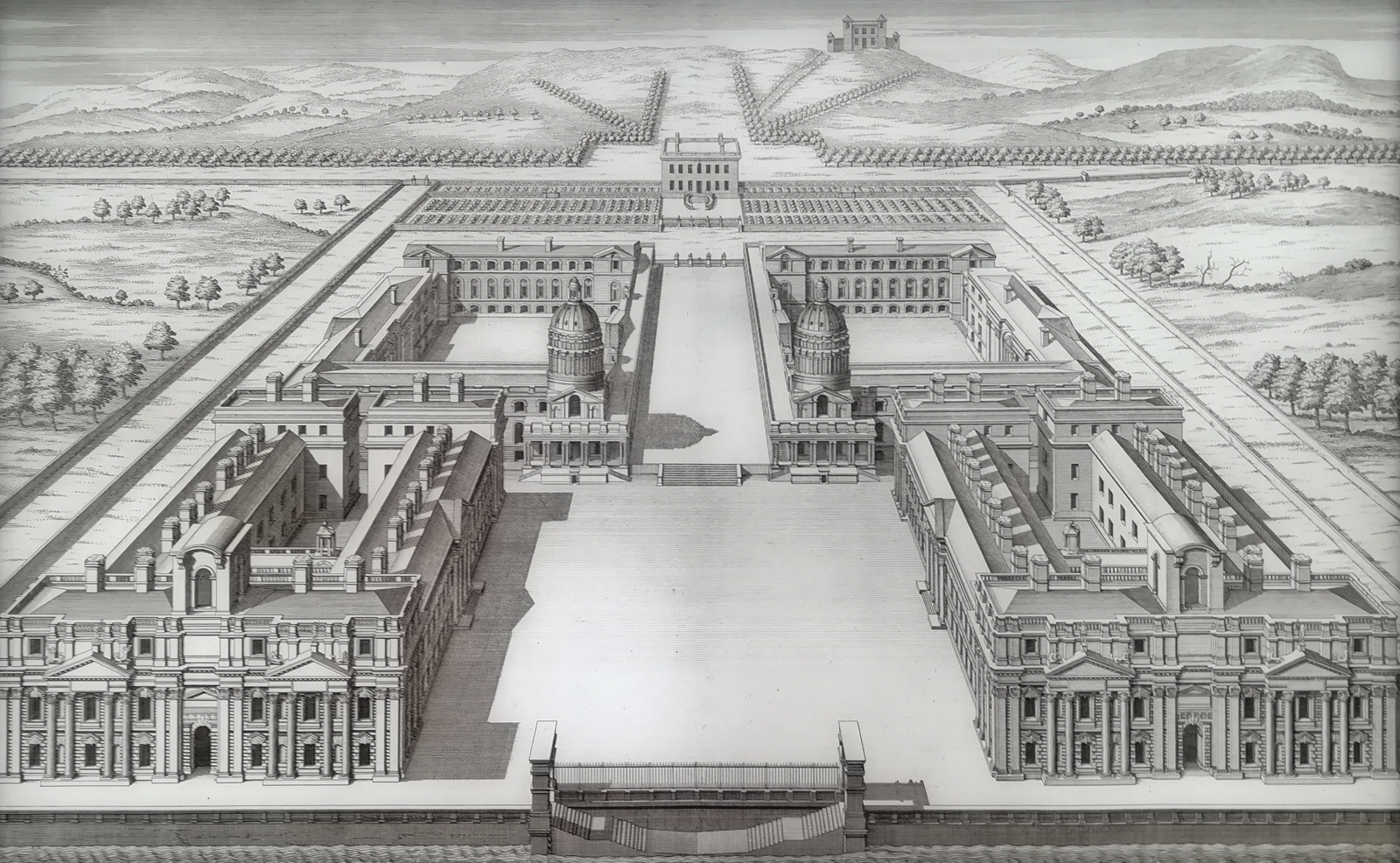
The Painted Hall at the Old Royal Naval College in Greenwich reopens this weekend after a two-year renovation and restoration. At the entrance to the
More...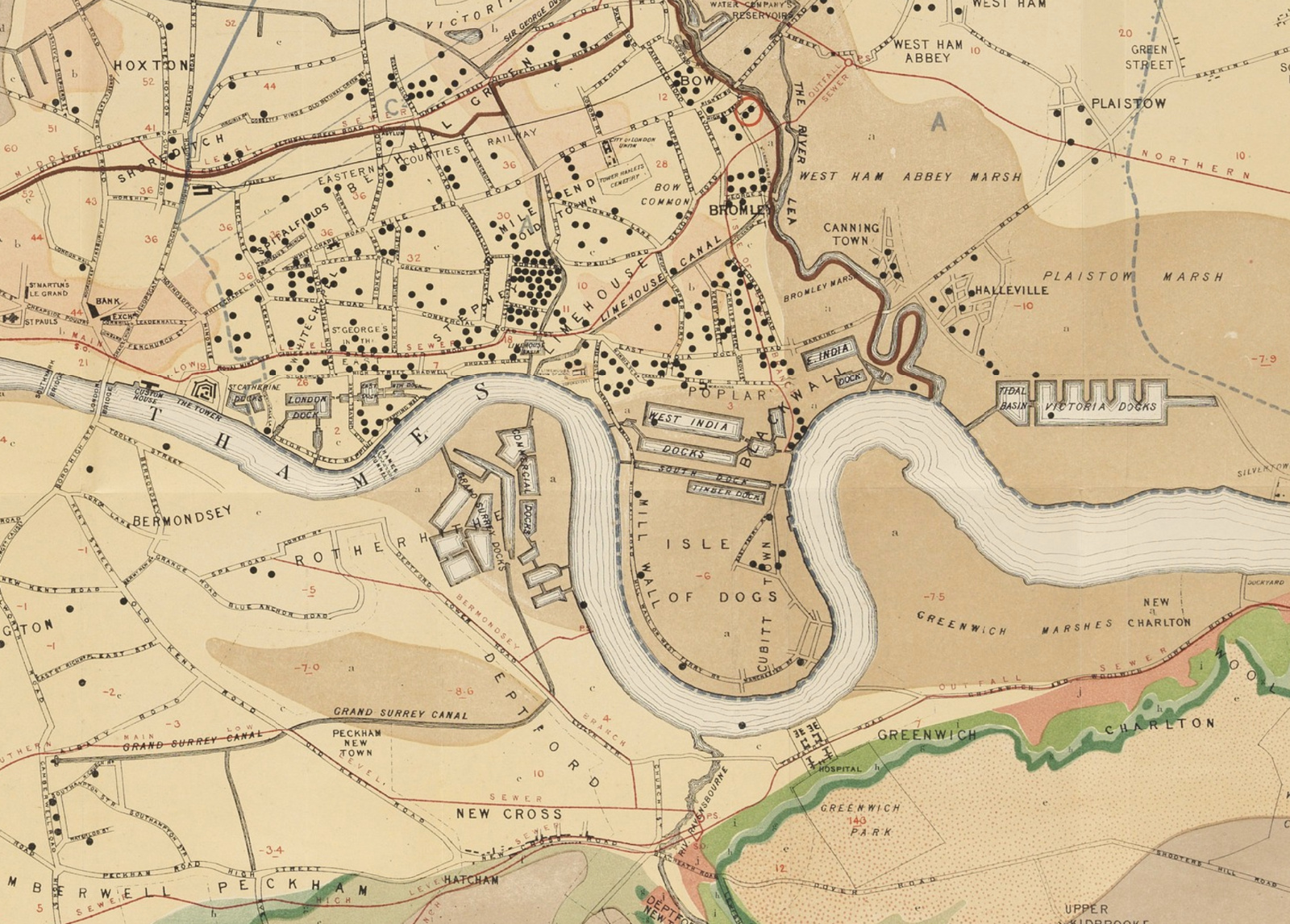
The John Snow Cholera Map is world famous as the map that identified the cause of the disease, and was one of the first epidemiological
More...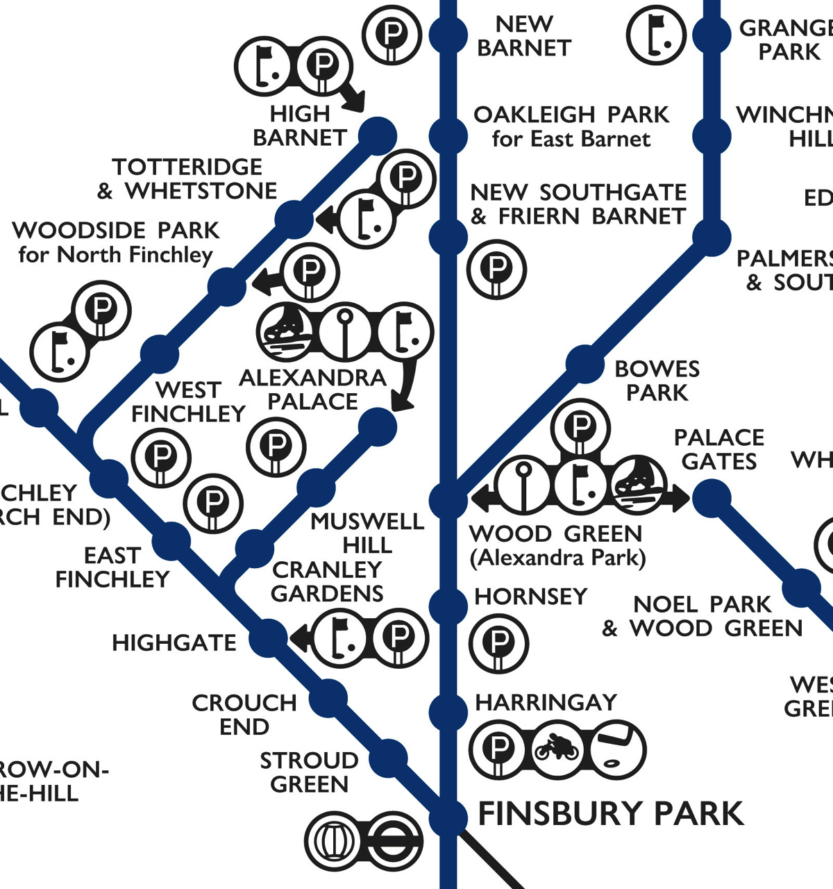
This lovely schematic diagram was first created in 1939 by George Dow. It shows the three LNER (London and North Eastern Railway) north London networks
More...
Readers of Mapping London, and Londoners in general, will be very familiar with the striking straight lines of the Tube Map. But you probably won’t
More...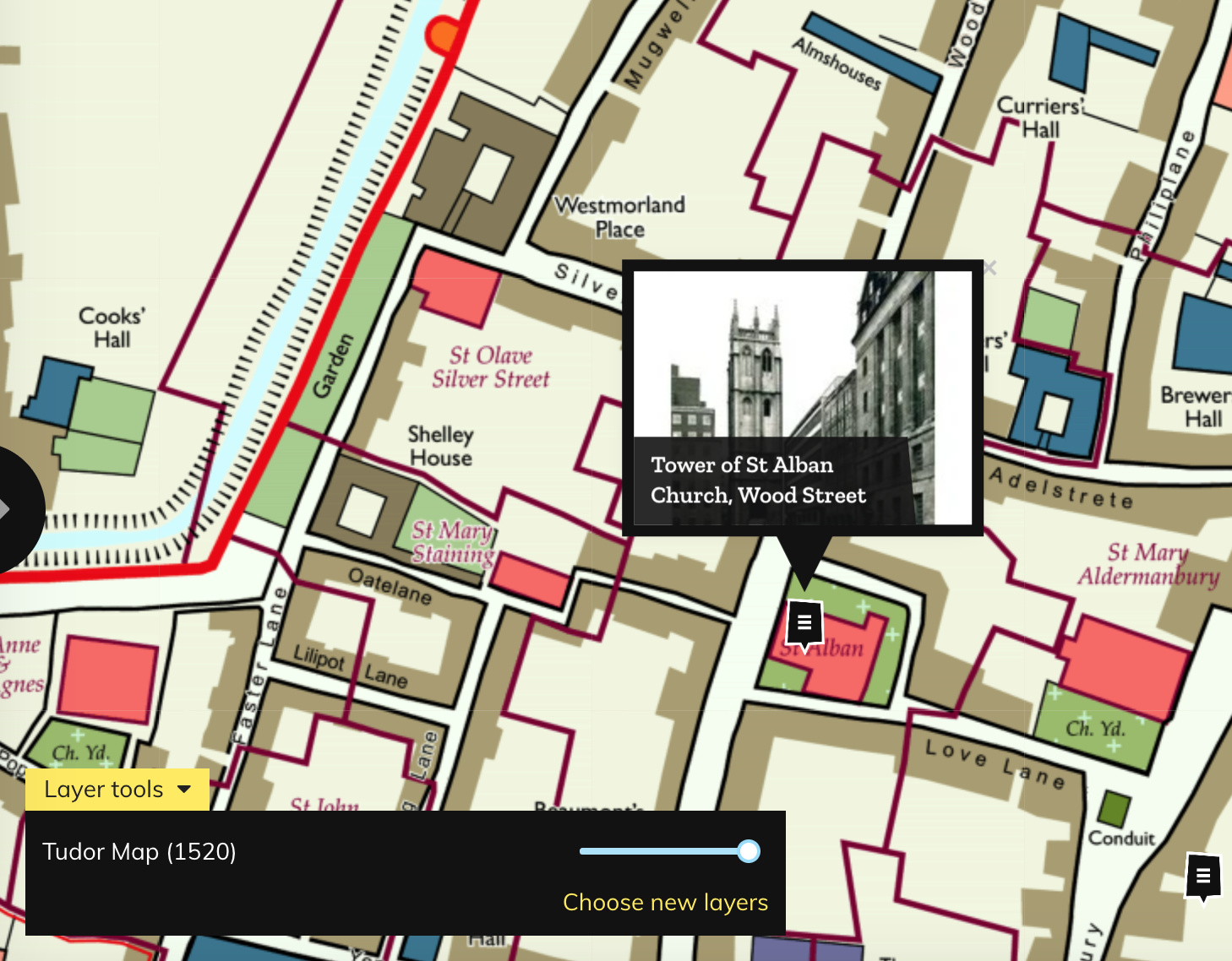
Layers of London, which has just launched, aims to be a platform for geolocating and documenting the local history of the capital. It works by
More...