London has a long and gruesome history – indeed part of its tourist industry is focused on tours and attractions based on the “Jack the Ripper” cases, so there was always going to be plenty of London-related content in this new book written by Dr Drew Gray at the University of Nottingham and published by Thames & Hudson, “Murder Maps“, which focuses on revisiting crime scenes, from 1811 to 1911.
The book does not disappoint London-based readers, indeed, with the main part of the 220-page, 730-illustration book being focused on regions and cities, the first such area is London, with 30 pages of grim stories, maps and pictures.
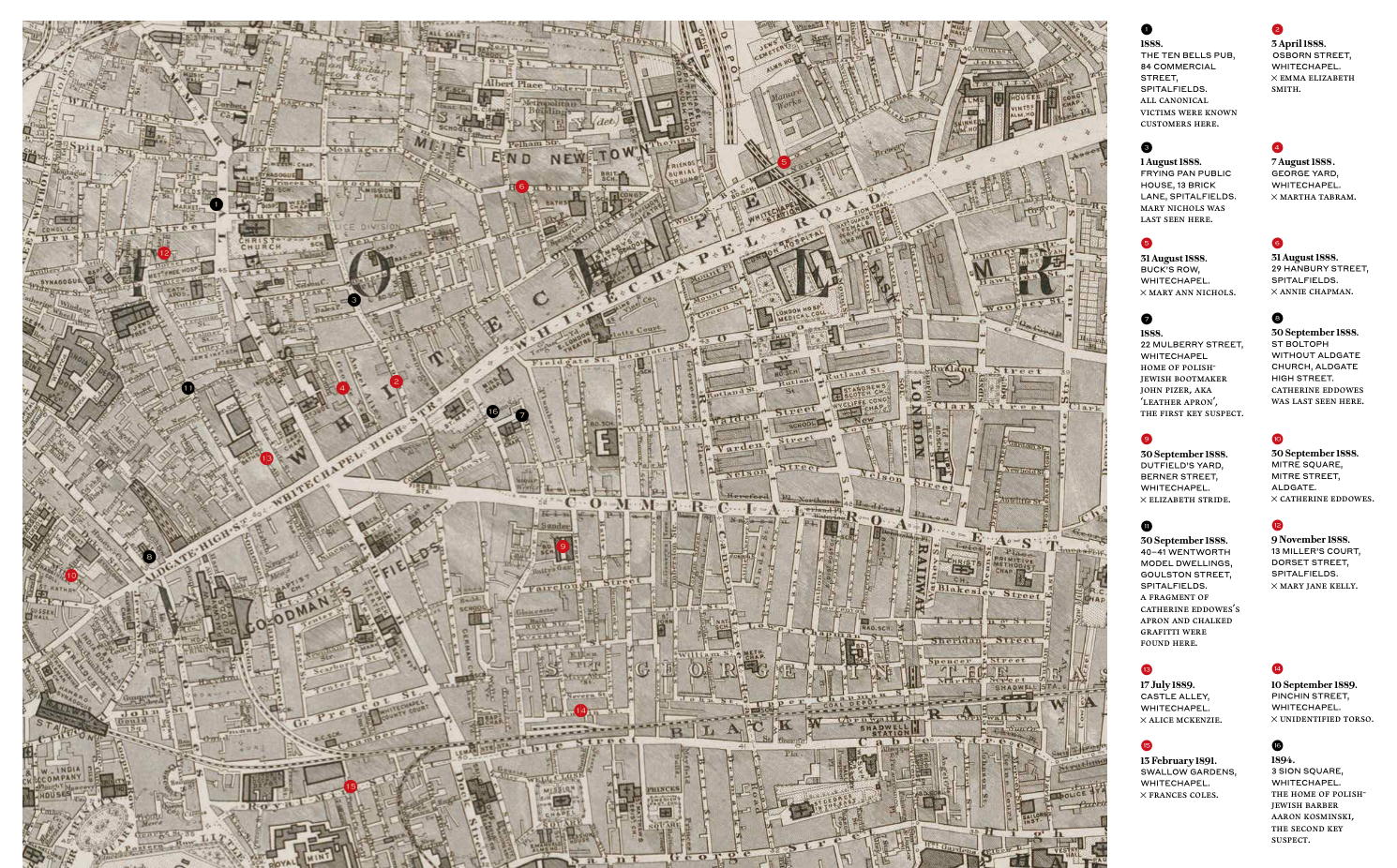
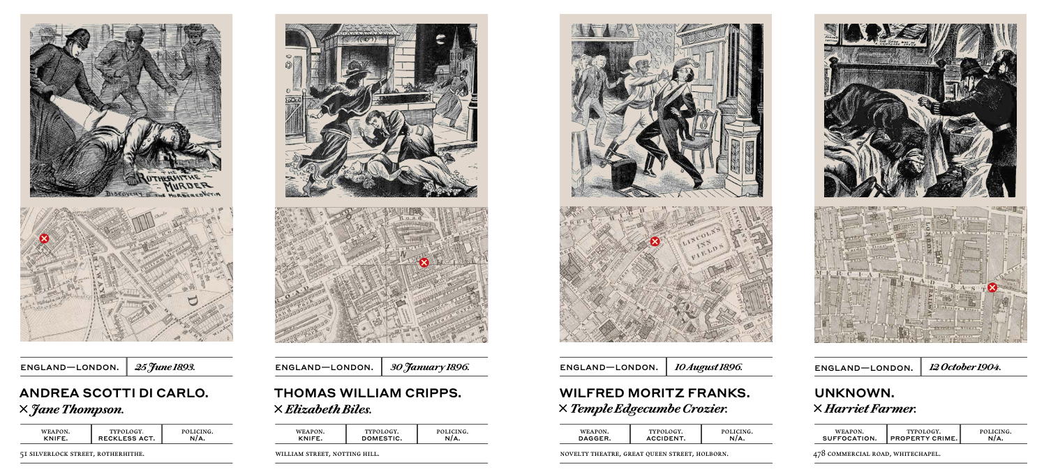
The author has used historical maps, representing the area at the time of the incident and showing the chronology of notorious crimes, simply highlighted on the maps with red and black numbered dots. The quality of reproduction of the map is excellent, allowing in most cases a clear understanding of the street structure of the time.
Jack the Ripper gets 6 pages, including a double-page map showing the pub that was the common link, the 10 murder locations and the 2 homes of the main suspects (Dr Gray having recently proposed an alternative suspect). Each case has a date, name of murderer and victim, weapon, typology (e.g. accidental) and policing information, location, map and a newspaper drawing, typical of the press at this (pre-photography) time, often from Illustrated Police News:
Many of the maps incidentally come from the excellent David Rumsey map collection, a fantastic online resource of historic maps from around the world.
Murder Maps: Crime Scenes Revisited; Phrenology to Fingerprint 1811–1911 is available now from Amazon and all good bookstores.
Thanks to Thames & Hudson for supplying a review copy and imagery.
Murder Maps — https://t.co/QievcyWSbg
Murder Maps https://t.co/L4JF7C5Q69