Welcome to the Mapping London Christmas List 2016! Not long now until Christmas Day – if you are having a last minute present crisis, our
More...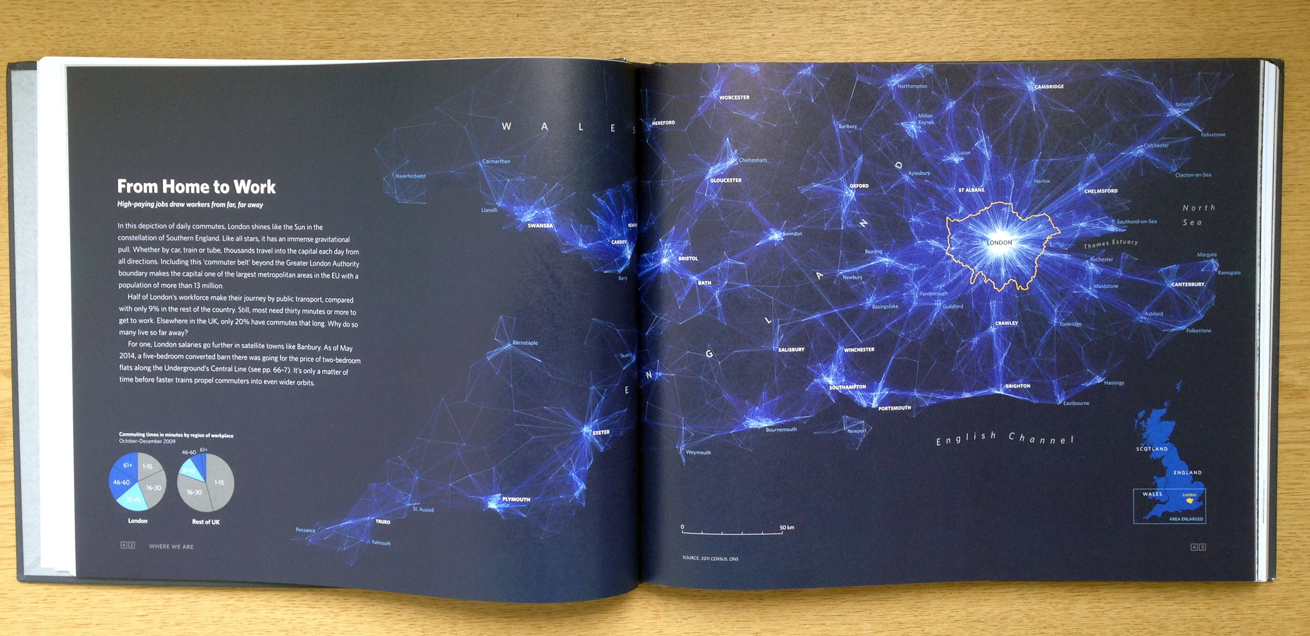
Highlighting the best London maps
Welcome to the Mapping London Christmas List 2016! Not long now until Christmas Day – if you are having a last minute present crisis, our
More...
Mapping London’s co-founder and “Editor at Large” Dr James Cheshire co-produced “London: The Information Capital” with Oliver Uberti in 2014. We mentioned the book on
More...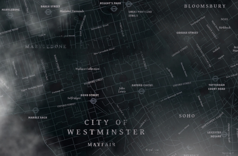
Just in time for Hallowe’en comes Grim London, a spooky and atmospheric map of central London. Navigate around the bleak, faded map of the city
More...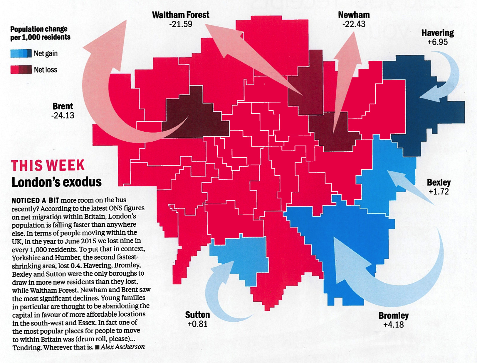
Time Out London, the venerable London free magazine, have spotted that everyone in London loves maps, and so have launched a regular London Mapped feature
More...
This map shows the cross-borough London commuting flows in a different way to the conventional approach of drawing lines between the start and end of
More...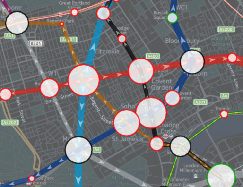
Tube Heartbeat visualises one of Transport for London’s most interesting and detailed open dataset, RODS. This has data on the approximate weekday volume of passengers
More...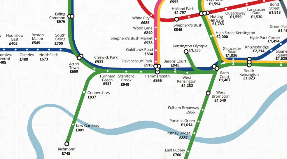
The tube map is a useful base for data maps of London, because most people (north of the river, at least) tend to think of
More...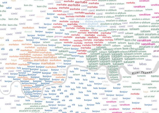
London boasts over 300 different spoken languages – more than any other city in the world. The capital’s lingua franca, of course, remains English: 78%
More...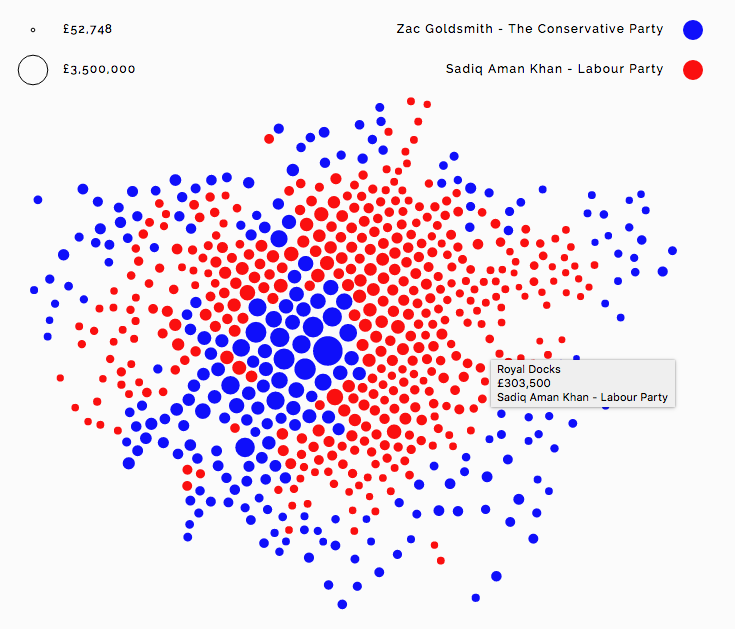
Alexander Brett has created this interactive map of London using the D3 visualisation framework and its “Force Layout” view. This places the data points (London
More...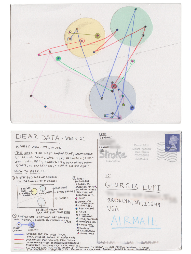
This is one of the many data visualisation and design postcards that Stefanie Posavec and Georgia Lupi sent each other of the course of a
More...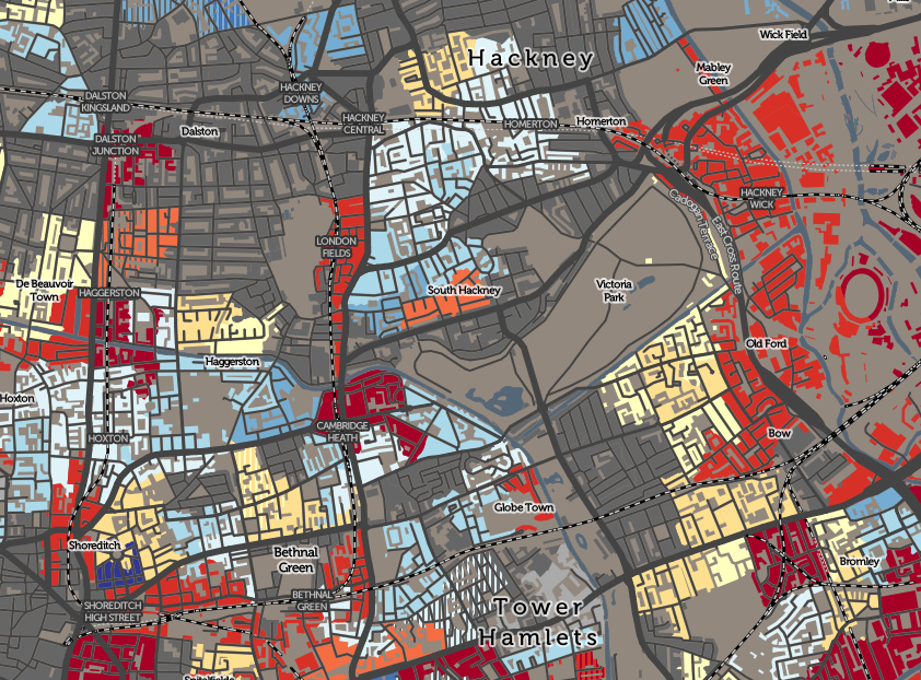
The Valuation Office Agency publish some interesting open data sets from time-to-time. One that caught my eye recently was a breakdown of counts of residential
More...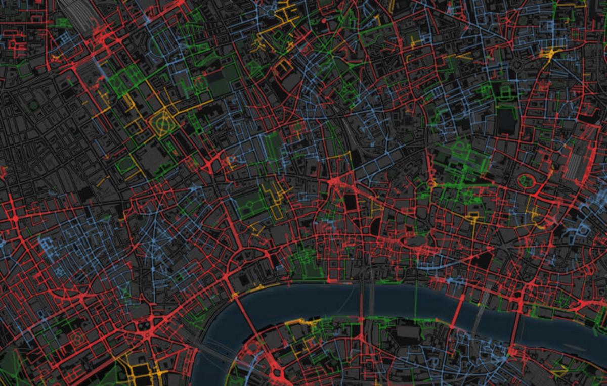
SmellyMaps reveals the “olfactory footprint of London” – the streets which are dominated by traffic fumes, the animal smells emanating out from London Zoo, and
More...