We’ve all had plenty of to explore our local areas, over the last year, with several lockdowns and other movement restrictions meaning that our local village, town or part of London is our exercise arena.
With this in mind it’s always nice to discover good quality local maps, ones that focus on a particular area, highlighting things that might be missed at first glance.
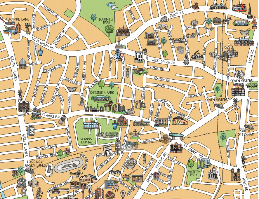
This walking map of the southern part of Tottenham, created by the Bridge Renewal Trust (a charity in the area) as part of a community history project and drawn by illustrator Jane Smith, is a great example of a local interest map – every area of London should have one!
We like the fact this is a map created specifically for the Tottenham area, rather than be excerpted from an OpenStreetMap of Google Maps screenshot. It both contains the almost complete road network and also in-place miniature sketches of points of interest – not just pins on a map. The map covers the area roughly bounded by Green Lanes, Tottenham High Road, the New River and West Green Road. It includes attractions as diverse as the fantastical Tottenham Town Hall, the High Cross and the “Seven Sisters Snail” (a personal favourite), along with the many now brightly decorated factories-cum-artist-studios of the Warehouse District. Existing features are coloured, but, as this is a history map, it also includes in black and white, things that are no longer present, such as the Harringay Stadium (now a supermarket). This is a wonderful idea for mixing the past and present.
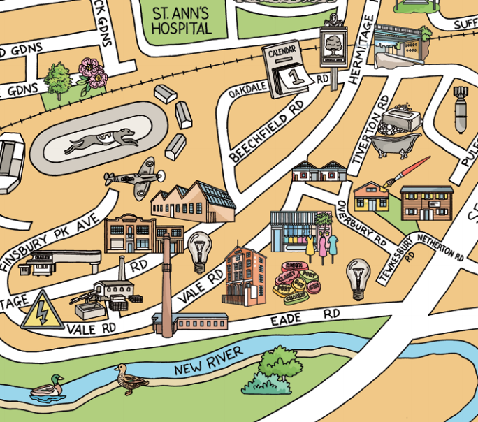
One side of the leaflet contains the main map, which is drawn in a pleasing brown and green colour palette. The other side has more maps – three old maps of the same area – one dating back several hundred years – along with some old photography.
The original can be downloaded from the BRT website or here.
Found online.
Lovely although you missed of Markfield Park with the beam museum and the river lea. And the last/first road in Haringey craven Park Road