Route Plan Roll is the creation of Dermot Hanney – his concept is to marry a map of safe London road cycle routes, with proper infrastructure, with the “tube map” which famously simplifies the London Underground network into straight lines and connection points.
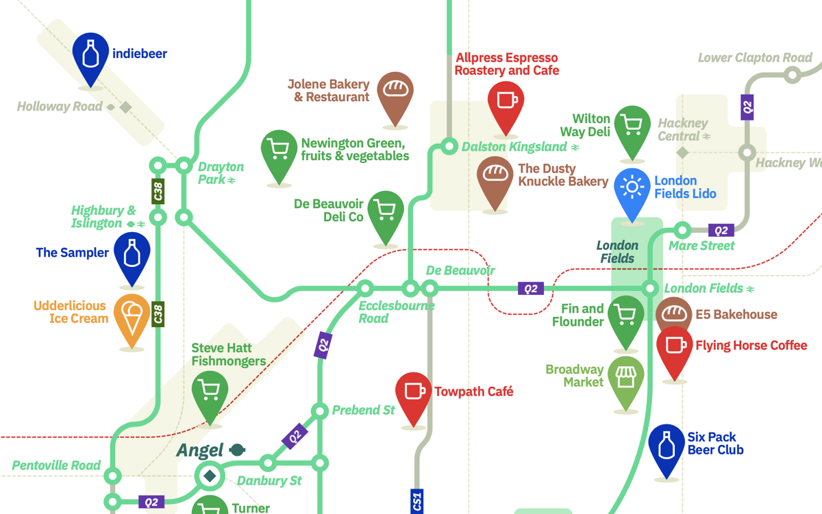
We’ve featured his maps before, but now Route Plan Roll has taken the concept one step further and linked the network to “places worth cycling across London for” which is surely a nod the the Michelin guide’s definition of a three-star restaurant as “worth a special journey”. Sadly there are not many of the latter in London – and they are still closed anyway due to the pandemic – but Dermot has spotted plenty of places worth hopping on your saddle for, navigating the network of safe routes, and arriving at your destination in style.
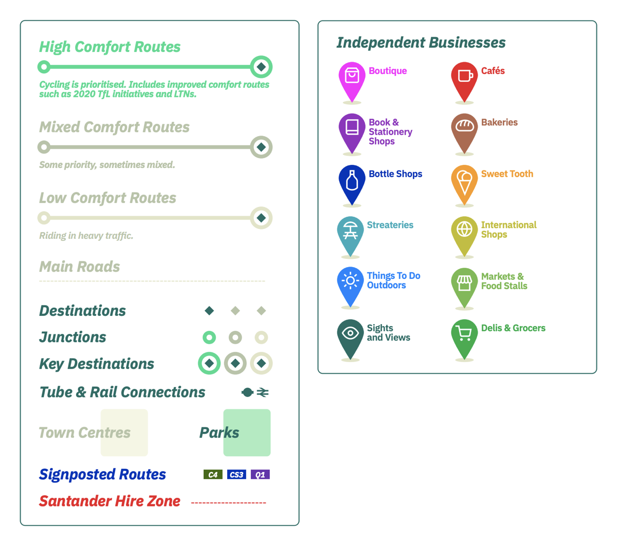
Mapping London is a fan of both tube maps and cycling so this was always going to feature. We think it’s a great map – a little too much green perhaps (used for parks as well as the very best quality of the cycleways) but the “network” is clear to see – along with obvious gaps in it, often due to political reasons in west London and some other areas. The Thames is on there, of course. It’s just as much a challenge to cycle across as walk across. The approximate boundary of the sadly stagnated Santander Cycles zone is shown with a red dotted line. The map doesn’t show off-road cycling routes such as along towpaths or through paths – this is very much focused on getting people out on the streets to visit businesses, as lockdown eases.
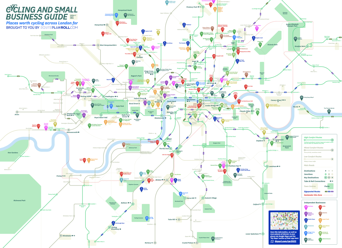
See Dermot’s tweet here or download a PDF of the map directly here.
Spotted by Mapping-London co-editor-at-large Prof James Cheshire. © Route Plan Roll.