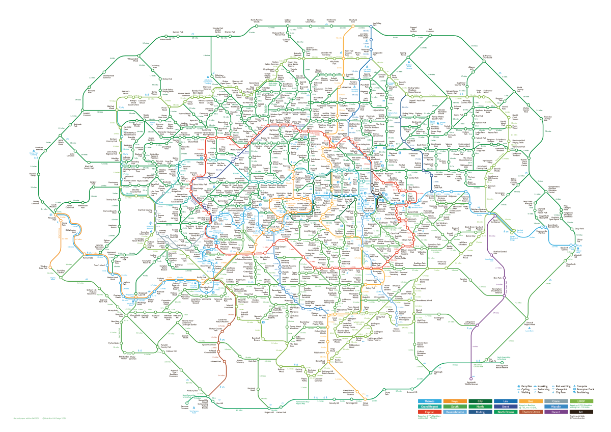
The London Greenground Map, by designer Helen Ilus (Hi Design), takes its inspiration from the famous tube map to create a network of walking routes, with parks as “stations” in and around the capital. The map was first created a couple of years ago, but Helen has since refined the map and added detail, while also producing Bristol and Edinburgh editions. Recently, a second edition was unveiled – as well as a fold-up version (just like the pocket tube maps you find in stations in London) there are A0 and A1 posters, and a purchasable digital download.
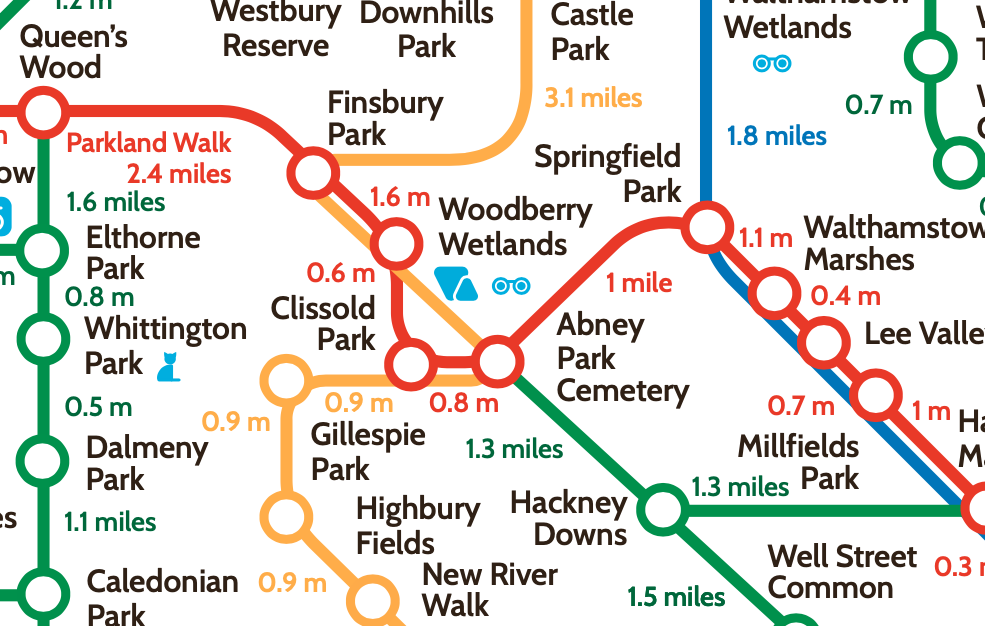
The tube map is non-geographical – you don’t need to know how close each station is to the next, because you aren’t doing the moving yourself. However, a walking map does need to have geographical “correctness” – so the Greenground map sits between the two models. The network is simplified to a serious of straight lines and 45-degree bends, but distances are approximately to scale, and the distances between each link, in miles, is shown. Certain parks, with nature facilities such as bird hides or city farms, are adorned with appropriate symbols, and individual links with locally known names, such as the Parkland Walk above, are also captioned on the map.
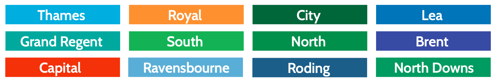
The colour choices used in Greenground are key to the overall visual appeal to the map. The initial version of the map was predominantly just green which reinforced that this was a map of green spaces, but was a bit overwhelming and made the map look a little too technical. Helen has refined the colours in this new version. River and canal walks use various shades of blues, and some major routes use yellows and reds. This helps create a map that is easier on the eye, while still emphasising its “greenness” – dark green is now used for “generic” walking links and parks that are not part of the specific named ones. London’s biggest official trails, the Capital Ring and the London LOOP, are shown in red and lime green respectively. Here’s just part of the key:
The other intriguing thing about this map is that Helen has identified another “ring” walk, outwith of the three more well known ones (a Royal Parks loop in the centre of London, and the aforementioned Capital Ring and London LOOP) – this one sits entirely outside the London boundary but does encircle it.
London of course has a lot more to it than just paths and parks, so ultimately, you’ll need another, fully geographical map, such as OpenStreetMap or Google Maps, when you are actually walking many of these routes, or use the signage on the ground for many (but not all) of the links, but Greenground acts as as great planning tool or starting point, whether you are spending an hour or a day, or a week, walking the metropolis.
You can find out more details about the Greenground map at Helen Ilus Design, and buy it directly from the designer’s online shop.
With thanks to Helen Ilus for providing a review copy.
One comment