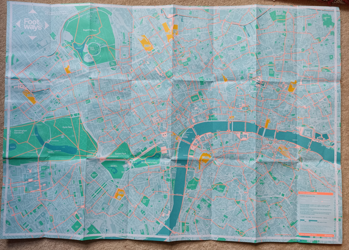
Various central London locations are this week, as part of London Car Free Day (which is today!), stocking free copies of a paper map (you can also order a copy online) for walking routes in central London – it’s called Footways, and was first published last year. The map is in fact an evolution of a map from “Urban Good”, a Community Interest Company based in Hackney, from way back in 2017, and linked to the London National Park City initiative. We reviewed the original and liked the concept, but struggled with some of the cartography. It’s good to see that the Footways version has tweaked the mapping to make it clearer and crisper, while still retaining the “turquoise, pastel and fluorescent” colour ramp that makes it looks so distinctive.
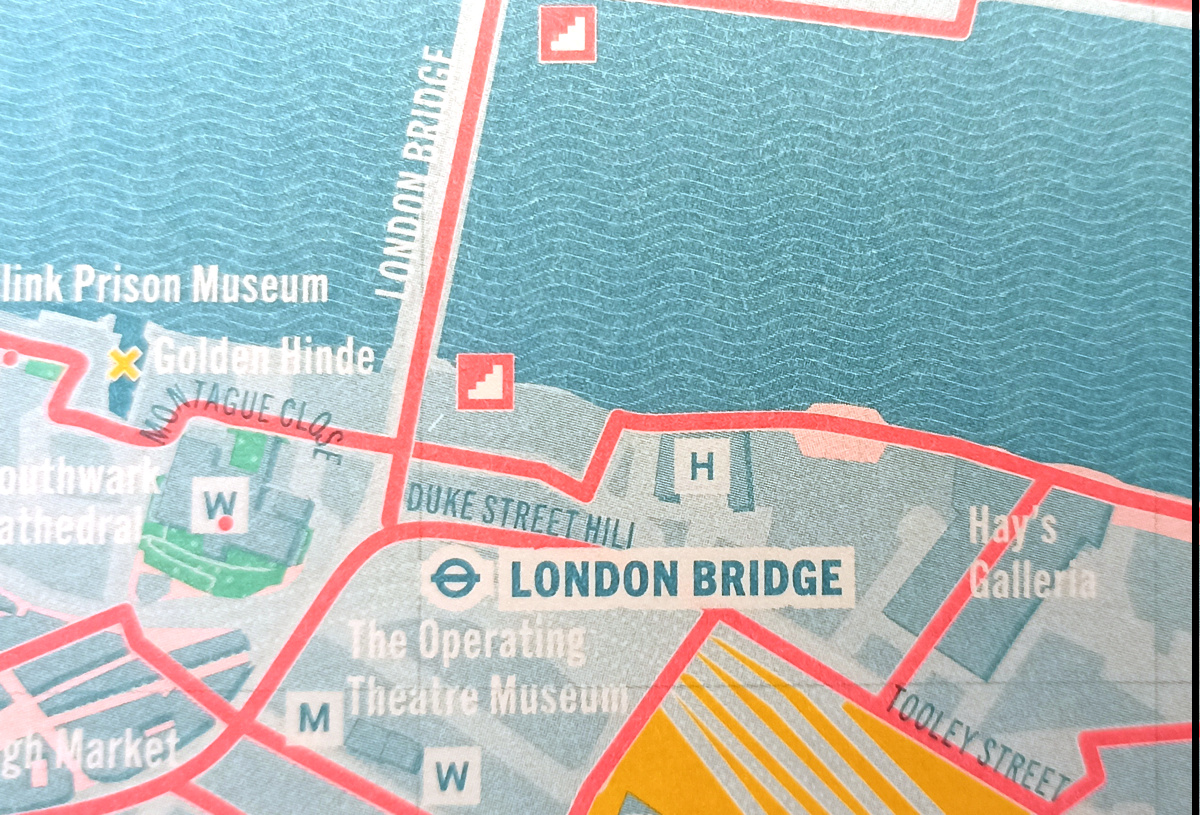
The map covers much of “Zone 1”, the central part of London, that is in fact pretty walkable, but as central London has a huge, old and confusing street network, this kind of mapping is a real boon. Much better than just following the line on Google Maps, take a copy of Footways and follow the bright orange lines which thread through the inner city. Large pedestrian-only plazas – oases from cars and other transport noise – are shown in pink. Tube stations are highlighted in block text while major London railway terminuses – which is where many visitors to the capital start their exploration – are prominent in yellow. Unusually for a modern map, there are some textures – the River Thames has wavey lines, and parks and canals have some dot “stipple”. Key prominent buildings are also shown extruded with a slight 3D effect. These cartographic tweaks are subtle but add interest to the visual effect. One really nice touch is that steps on the orange-marked walking routes are highlighted so that step-free routes can be planned.
It is great to see the 2017 concept taken forward and, with a de-emphasis recently from Transport for London in promoting walking, this publication has its place as one of London’s core paper maps. London continues to evolve, of course, so there is the odd route that is now closed (e.g. Drummond Street) which future editions will no doubt correct.
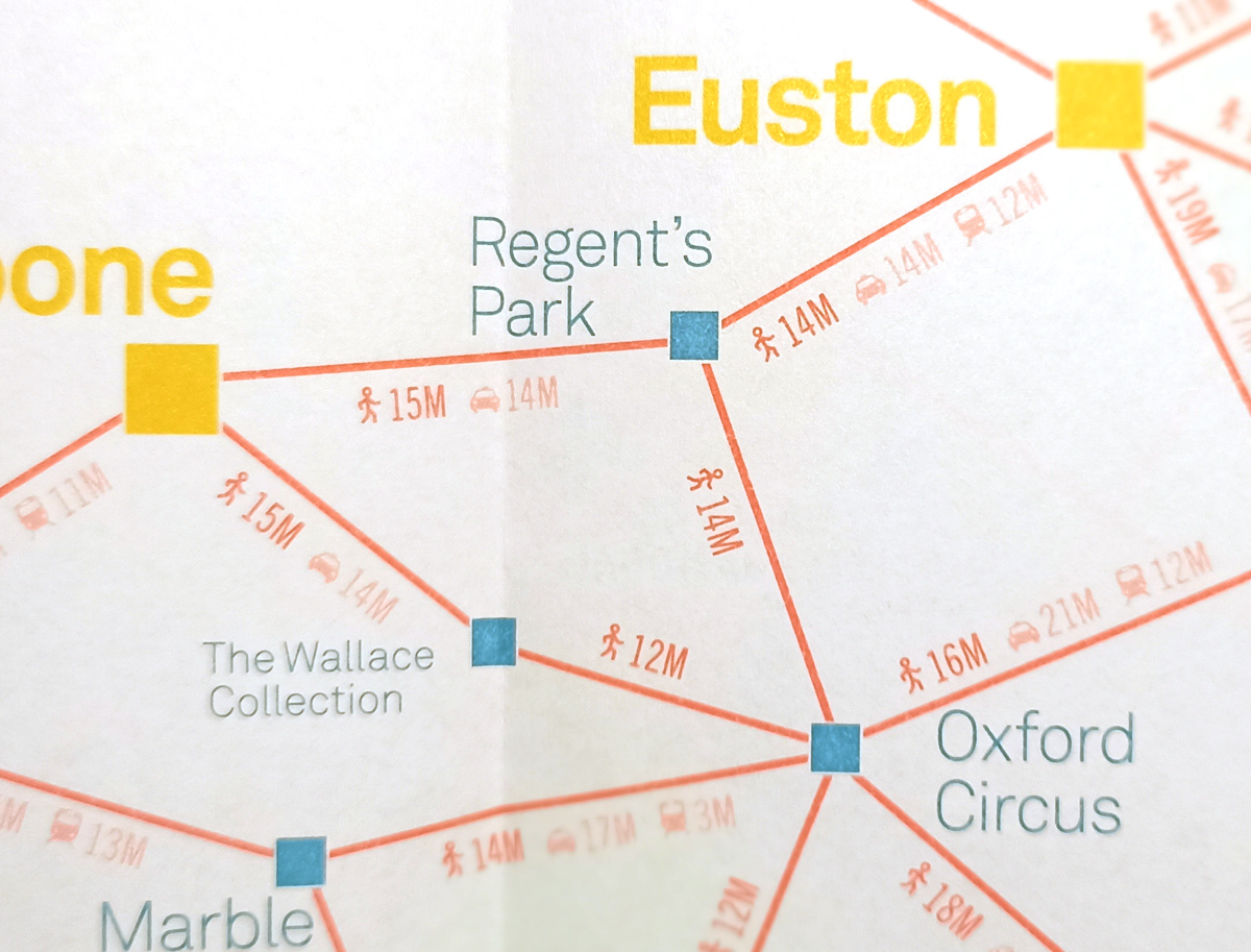
There is a surprise on the back of the map – along with a guide to attractions, there is another map! It shows walking (and driving/public transport locations) between key central London places of tourist interest – stretching from the Design Museum in leafy Kensington, to Columbia Road Flower Market in Hackney, and from London Zoo to Maltby Street Market. This is a simply shown visual, but we really like the concept. Plan your day trip using these guide distances, and then use the main map to find the exact walking route between them.