We featured TrainTracker, a live circuit board map of where the trains are on the London Underground – with lights representing the train locations –
More...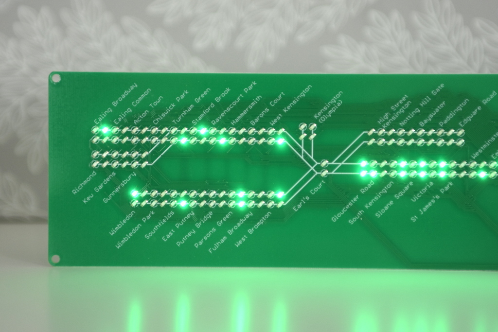
Highlighting the best London maps
We featured TrainTracker, a live circuit board map of where the trains are on the London Underground – with lights representing the train locations –
More...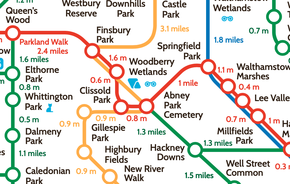
The London Greenground Map, by designer Helen Ilus (Hi Design), takes its inspiration from the famous tube map to create a network of walking routes,
More...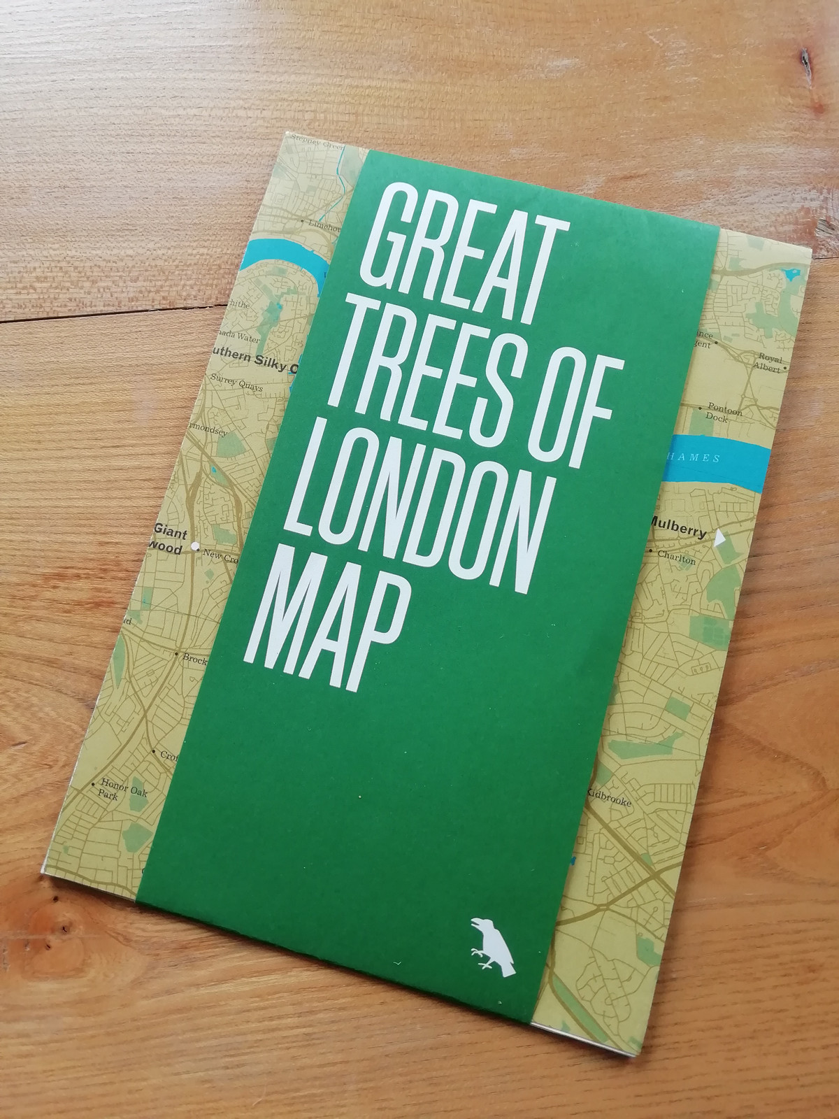
Blue Crow Media, long-time makers of bespoke themed maps of London and other places, have switched from their regular architecture focus and produced a lovely
More...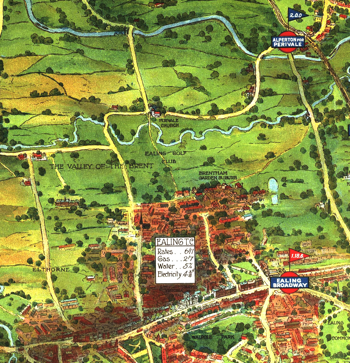
Drawn in a similar era to the historic map of Kew, here is another map from the archives of Transport for London at the Transport
More...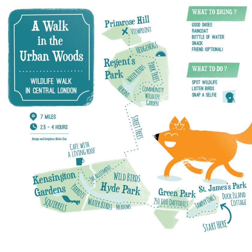
This artistic map of a green walking route in central London has been created by graphic designer Helen Ilus. By showing just the parks that
More...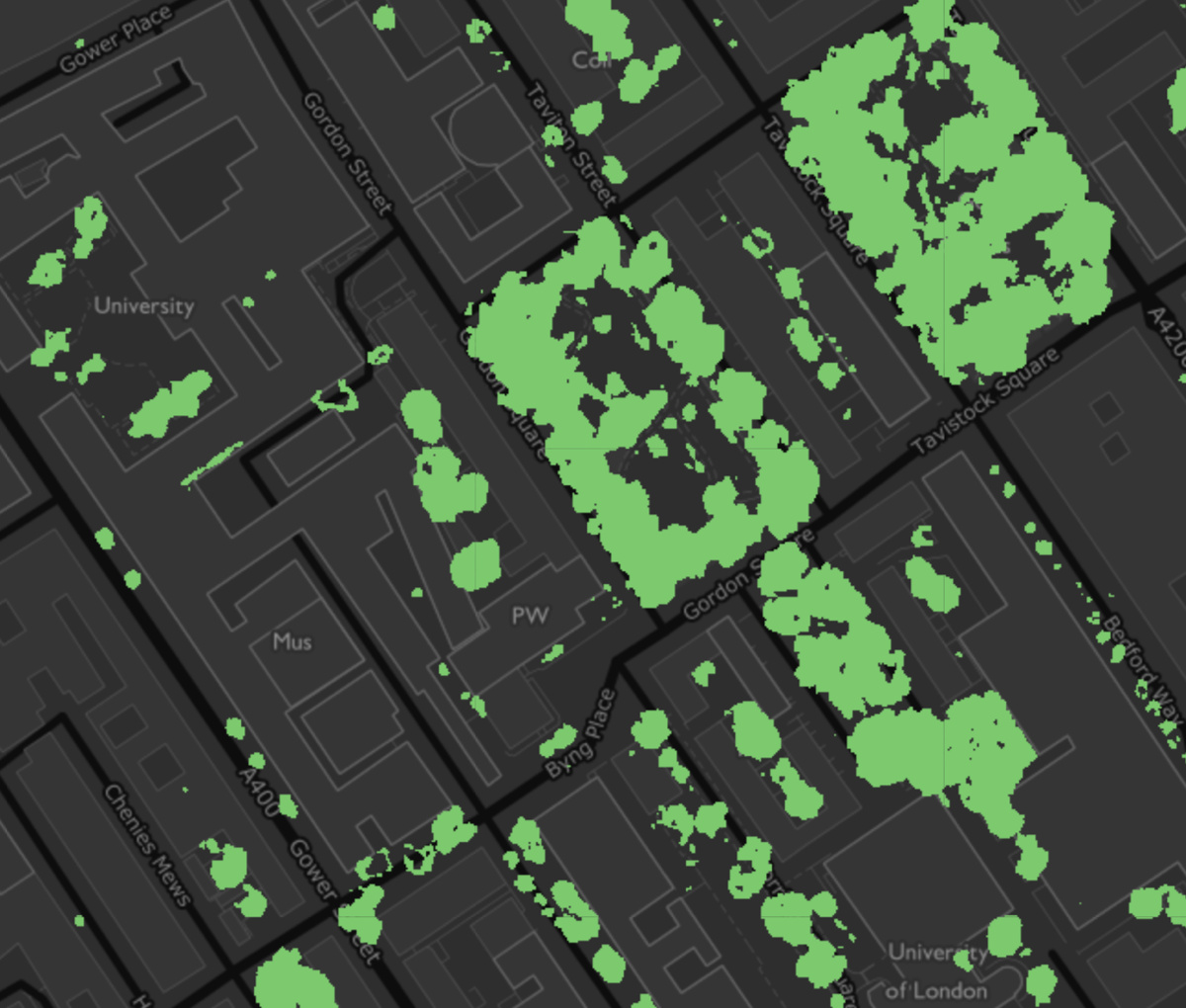
The Greater London Authority has published a data map, showing the locations within London where tree canopies can be seen from overhead. There are about
More...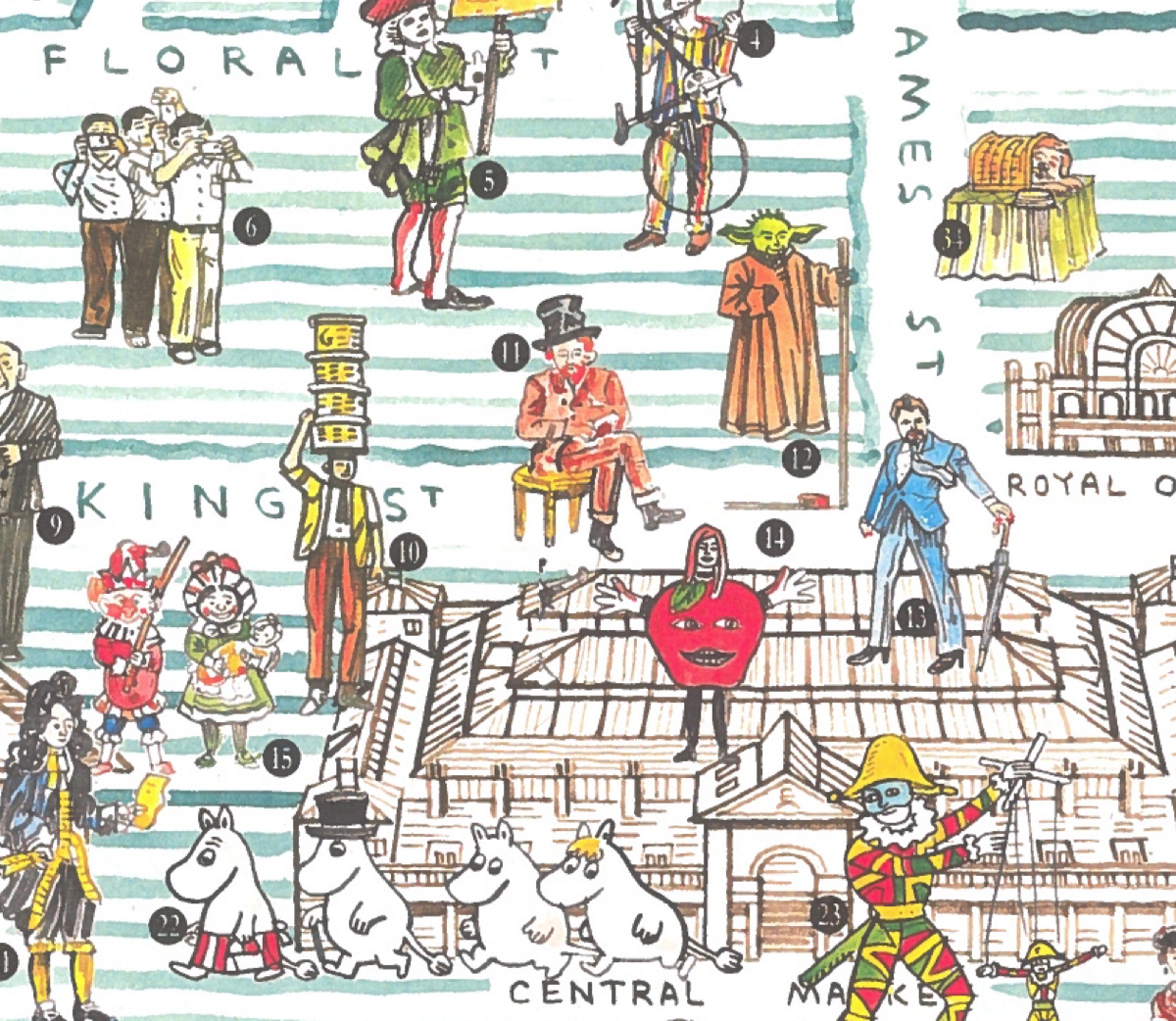
In celebration of the Christmas lights being switched on in Covent Garden this evening, we feature this lovely map of the precinct, which has been
More...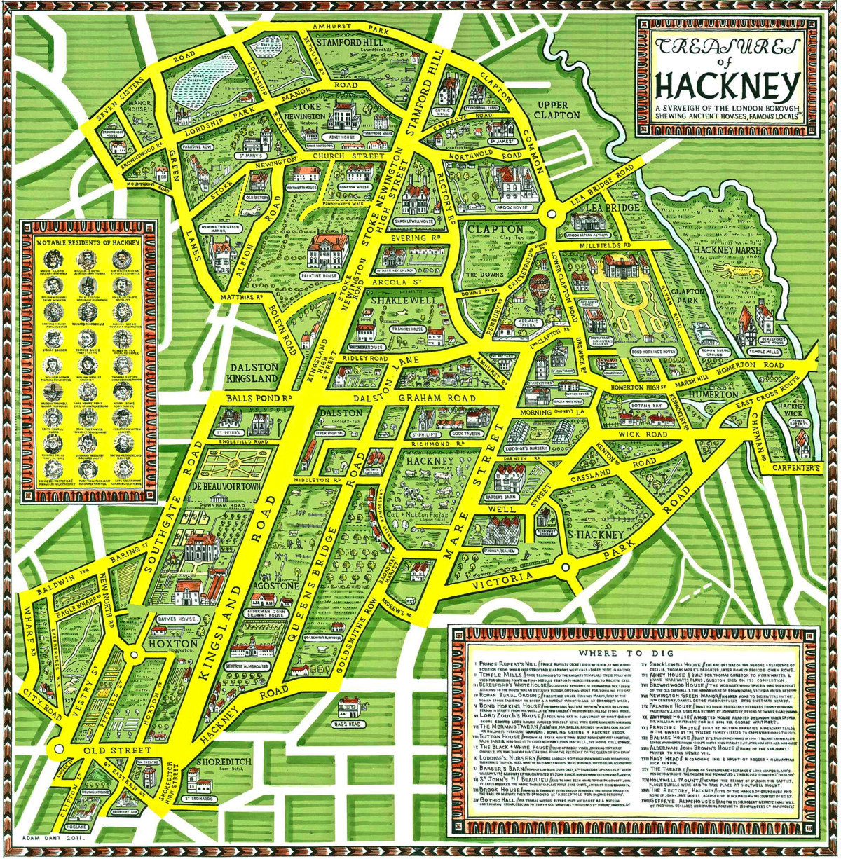
This is a map of Hackney Borough, from the perspective of its old, wealthy houses, and the discovered and undiscovered treasures buried under them, from
More...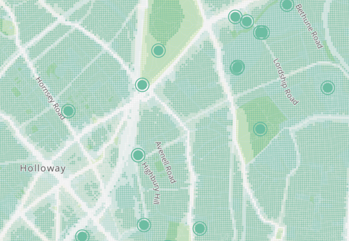
Tranquil Pavement is an online map recently launched by the Tranquil City project based in London, in association with the Outlandish Cooperative and funded by
More...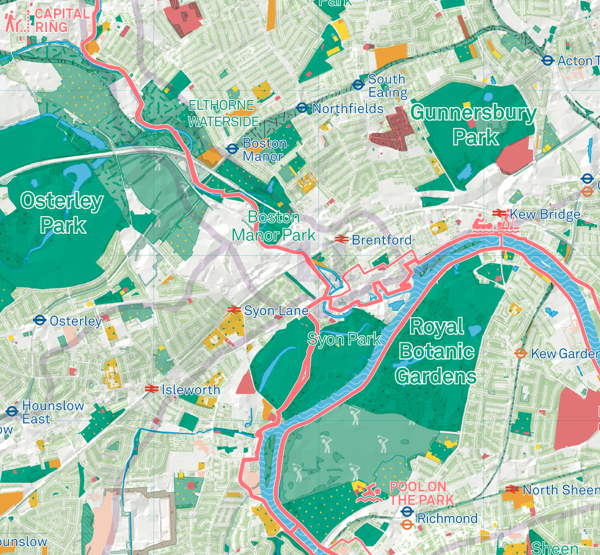
Urban Good, a new community interest company created by Charlie Peel, have this month published the first edition of their London National Park City Map.
More...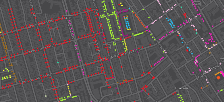
Following a data release of Southwark’s publically maintained trees a couple of years back, the Greater London Authority recently published a map which shows street
More...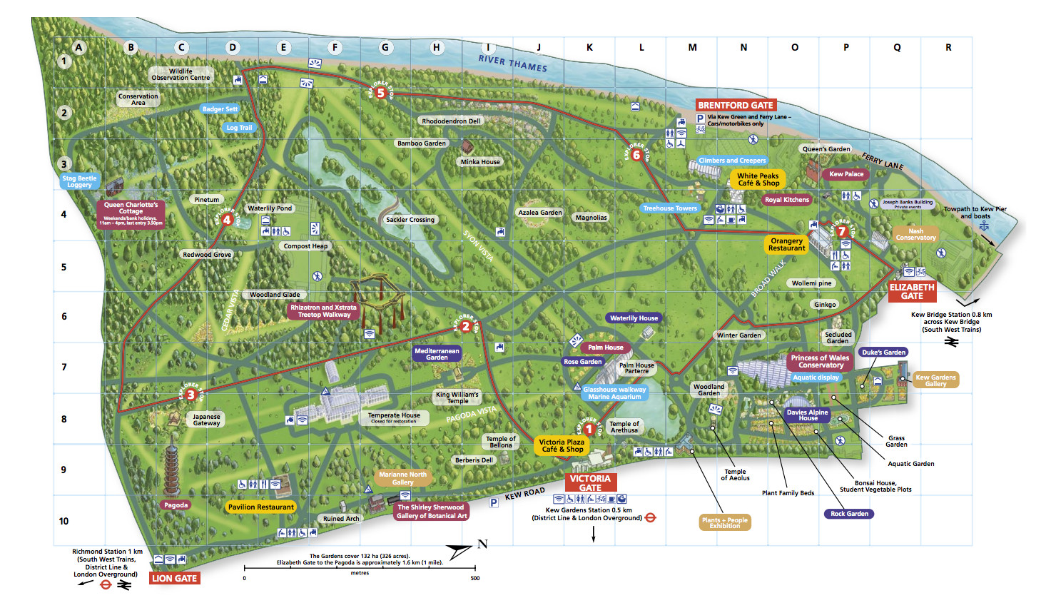
London has some grand gardens, many open to the public, and often with a special map to help with their exploration. Here are some of
More...