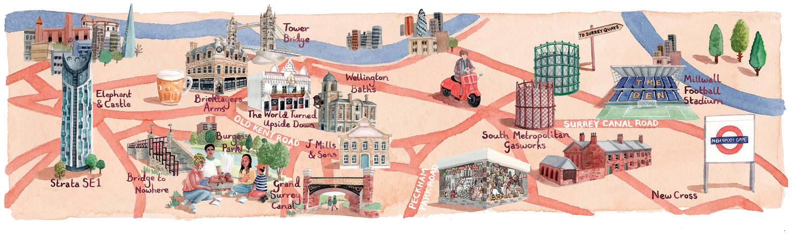
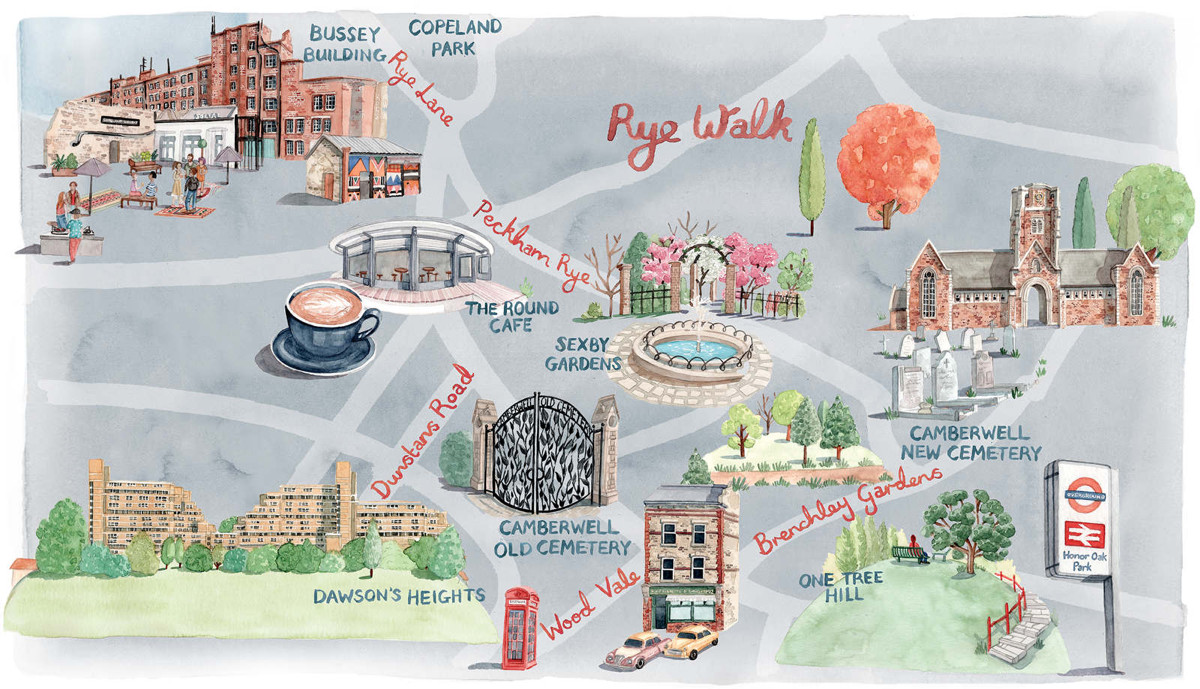
The FT has run a couple of articles [$] recently on housing in Peckham and the Old Kent Road area in south-east London – the latter being the focus of an extension – some day – of the Bakerloo tube line – and to accompany both of them, they commissioned freelance illustrator Laura Hallett to draw these illustrations of the area.
We like the distinctive colour accents for the maps, with roads and terrain in different shades of the same hue. Road names give a general indication of the location, and the meticulously detailed illustrations of places of interest help bring the area to life. Key railway stations are highlighted with illustrations of their signs outside. Trees remind the viewer that it’s a green part of the capital. The overall cartography is a nice balance of detail and attractiveness, and the watercolour “grain” gives it a crisp, historical feel.
Illustrated Maps of Peckham — https://t.co/oTjFA0oCGv
Illustrated #maps of Peckham https://t.co/ISqAoLtK2o
Illustrated Maps of SE London: https://t.co/sYfLU8tKOm https://t.co/V77Lp9qvax
Illustrated Maps of SE London https://t.co/FmmgSqSZdq