The FT has run a couple of articles [$] recently on housing in Peckham and the Old Kent Road area in south-east London – the
More...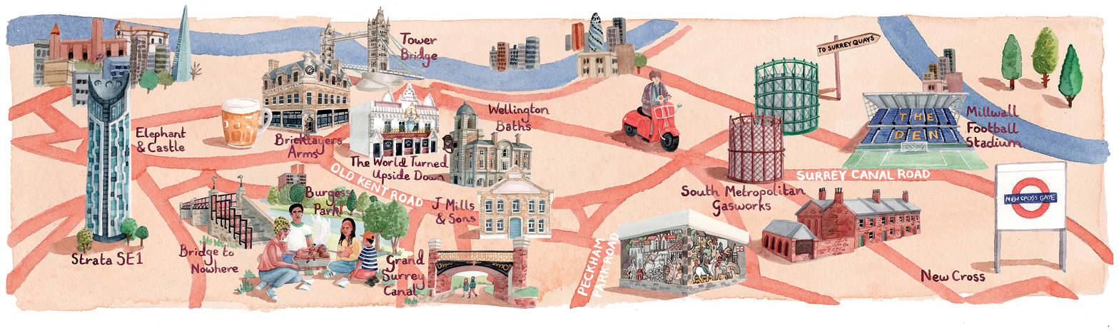
Highlighting the best London maps
The FT has run a couple of articles [$] recently on housing in Peckham and the Old Kent Road area in south-east London – the
More...
An eye-opening version the Tube Map for central London was published by the FT today (& on Twitter). The graphic, created by Steven Bernard of
More...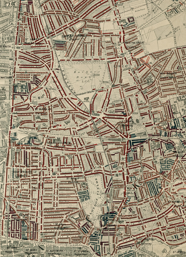
Buy the book. Perhaps the world’s most famous historical geodemographic maps, the London Poverty Maps were created by Charles Booth over the course of a
More...