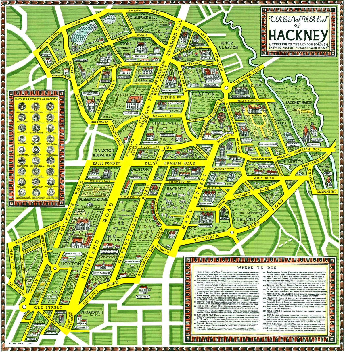

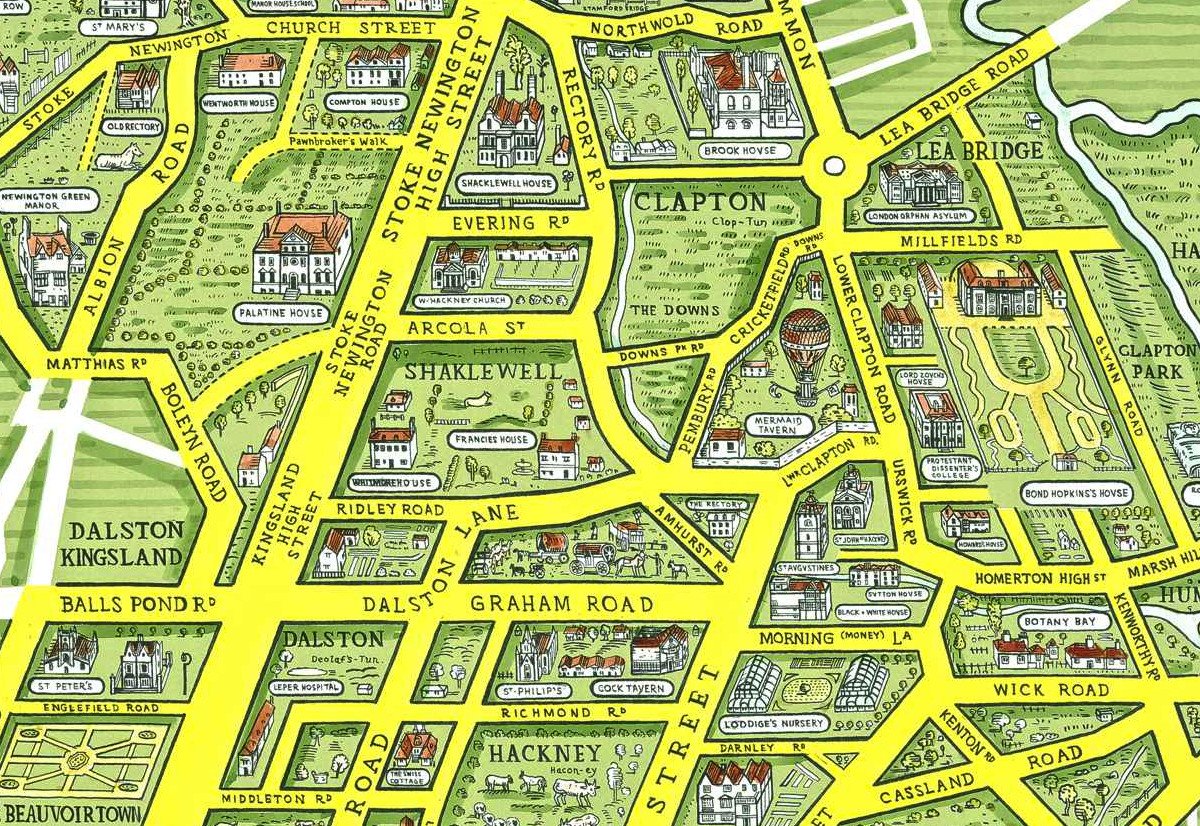
This is a map of Hackney Borough, from the perspective of its old, wealthy houses, and the discovered and undiscovered treasures buried under them, from the days when Hackney was full of country estates, before the ready sources of water led to a boom in industry. It was drawn by Adam Dant, and is one of the maps featured in his book “Maps of London & Beyond” which was published last month and we reviewed. The map is also available as a fine art print from TAG Fine Arts.
We really like the green and yellow colour palette – Hackney is a bustling, inner city borough, but this is a reminder of its more rural times, and its many parks that remain. The use of Kingsland Road as the defining geographical feature, showing it as the widest road, and a straight line (both which are true in real life too), is striking, particularly as it’s shown with a slant, rather than just being part of a grid. The little building sketches, complete with signpost style captions, also act to enhance the map, as do the individual house details. Other inscriptions reveal the heritage behind modern features of the borough. For example, London Fields was once known as Cat & Mutton Fields – a pub nearby retains the old name. Morning Lane was once known as Money Lane. I’m not sure of the reason behind the dinosaur on Hackney Marsh though…
There is an exhibition showing large format versions of some of the maps in the book, and other works, at The Map House in Knightsbridge, running until 14 July. The Map House is just around the corner from Harrods and is open during normal working hours. The shop and gallery is worth an extended browse – the gallery showing the Dant works is at the back, and the other rooms are packed floor to ceiling with historic maps of all shapes and sizes.
Treasures of Hackney — https://t.co/fi8lTPtbMP
Treasures of Hackney https://t.co/q9JaORrXtc