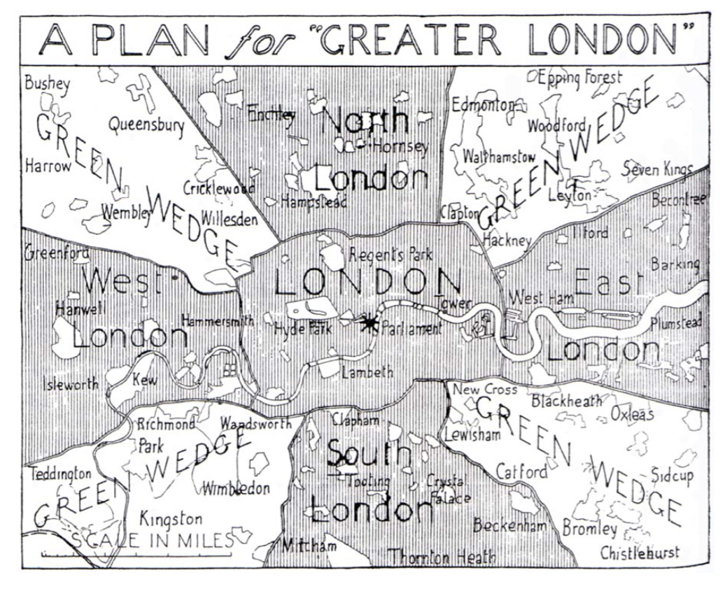

This map, “A Plan for Greater London”, is a 1943 masterplan for the rebuilding and enlargement of London, following the damage of the Blitz. Instead of the Green Belt (which hadn’t come into existence), the author, A. Trystan Edwards of the Hundred New Towns Association, proposed four green wedges, ensuring that Londoners had nearby access to large areas of protected open space, while allowing the city to expand outwards as it needed, without coming to the current barrier caused by the Green Belt. An area slightly larger than the current Zone 1 would be unaltered, while more distant parts of London would be altered significantly. People would never be more than a few miles from a very large area of open space.
The map was published in The Builder journal in 1943 and can be seen, with accompanying further explanation, in this report from Birmingham City University’s Centre for Environment and Society Research.
For another 1943 London plan/survey, see the Abercrombie maps.