Quite a bit of creative activity is going on in the south-west London borough of Wandsworth, as this map & guide, produced late last year,
More...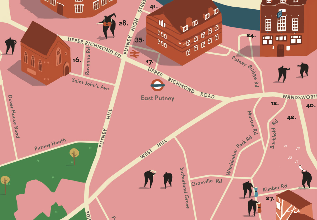
Highlighting the best London maps
Quite a bit of creative activity is going on in the south-west London borough of Wandsworth, as this map & guide, produced late last year,
More...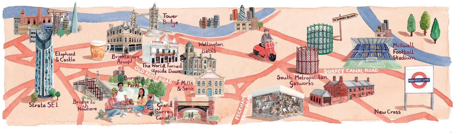
The FT has run a couple of articles [$] recently on housing in Peckham and the Old Kent Road area in south-east London – the
More...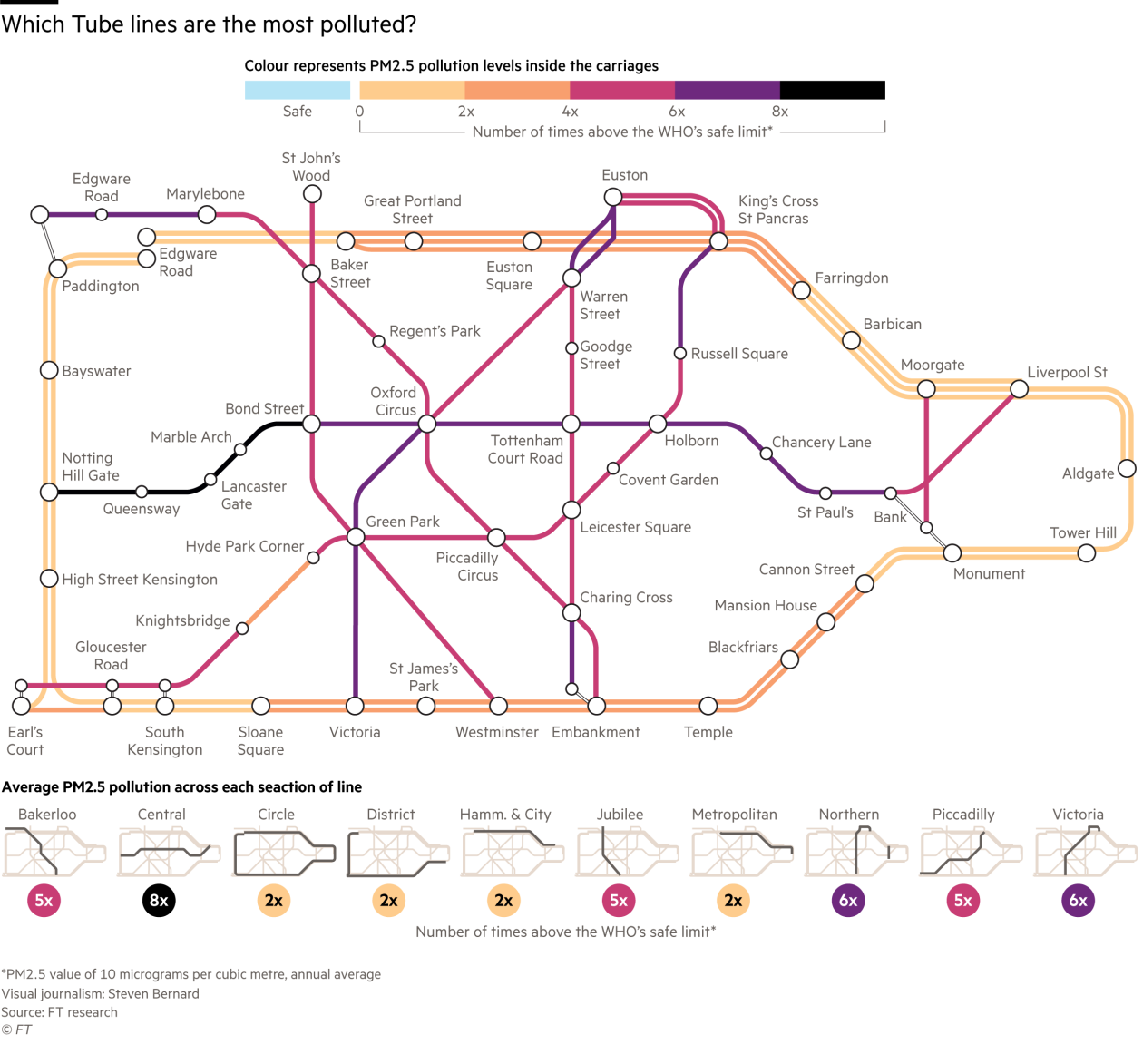
An eye-opening version the Tube Map for central London was published by the FT today (& on Twitter). The graphic, created by Steven Bernard of
More...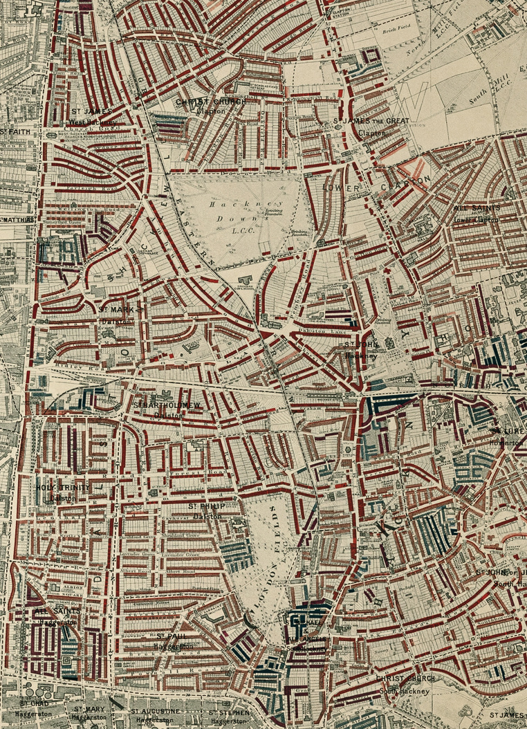
Buy the book. Perhaps the world’s most famous historical geodemographic maps, the London Poverty Maps were created by Charles Booth over the course of a
More...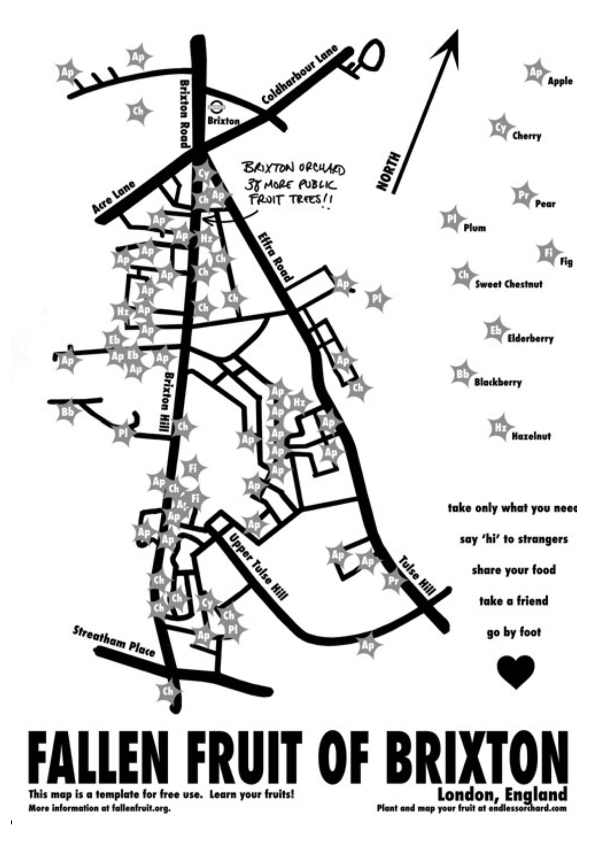
The Fallen Fruit project, by David Allen Burns and Austin Young in the US, allows communities to map publically owned/accessible trees in their neighbourhood which
More...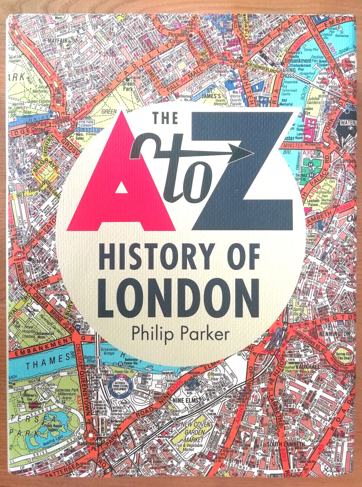
The A to Z is a bit of an institution when it comes to London maps. It, along with the Tube Map, is probably the
More...
London is taking part in World Car Free Day, and the Mayor of London’s office has produced a special map showing the extent of road
More...
Drawn in a similar era to the historic map of Kew, here is another map from the archives of Transport for London at the Transport
More...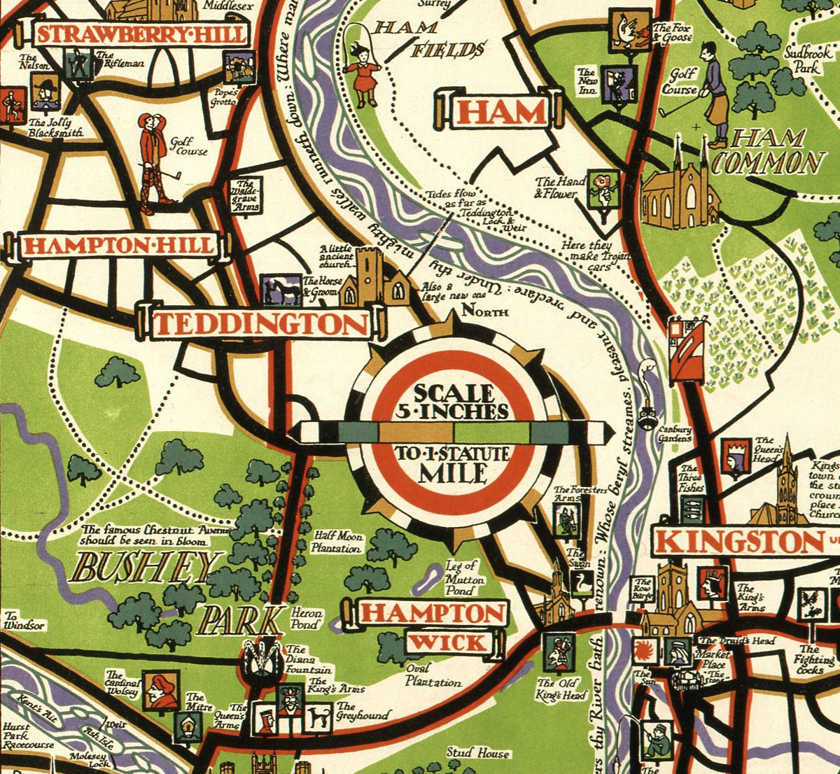
This decorative map, simply called “Kew”, was produced by Herry Perry of Vincent Brooks lithographers in 1929. It was part of a series of posters
More...
This stylised map of central London was created by MUTI, a South African design studio, and is “as seen in Mary Poppins Returns”, a film
More...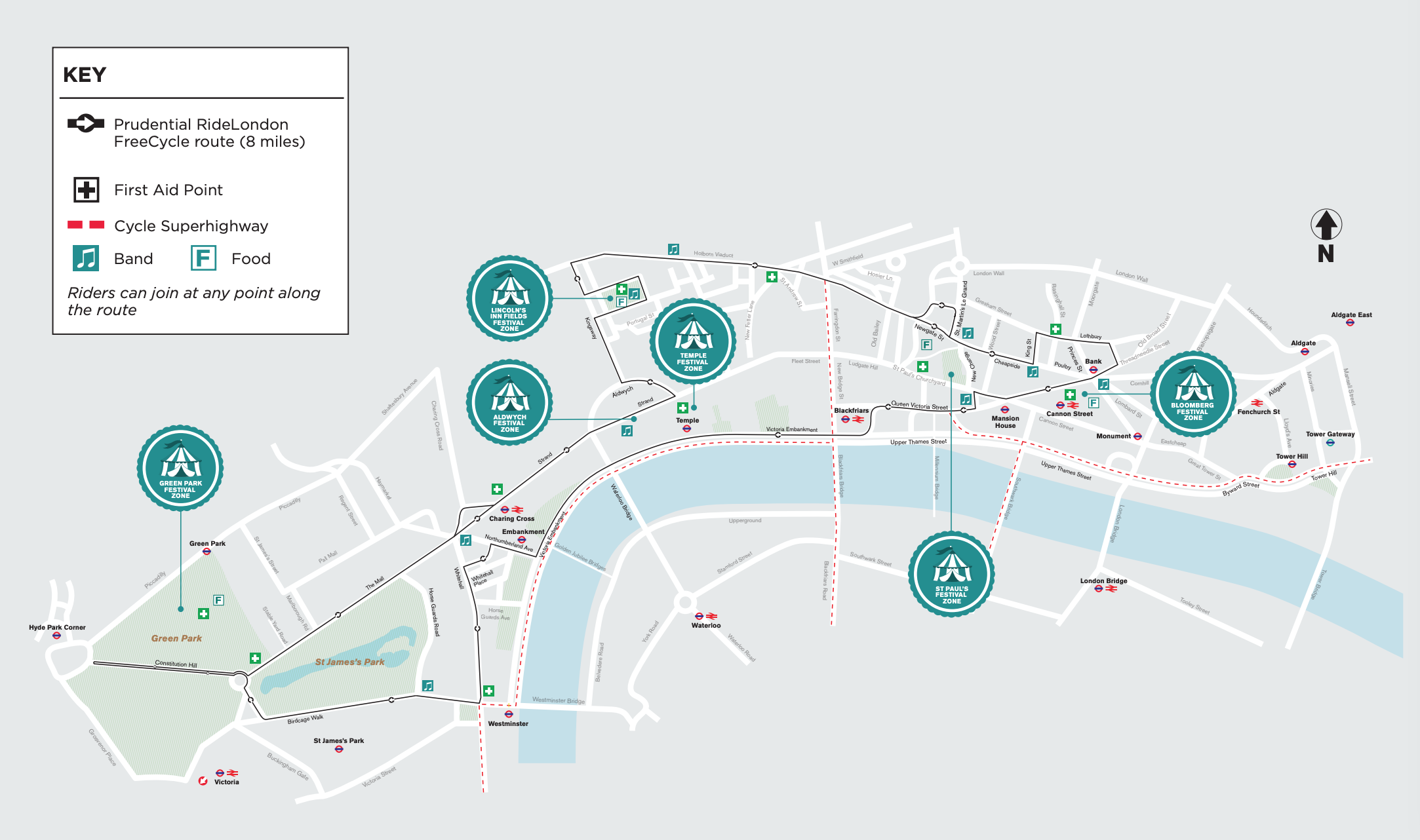
The Prudential RideLondon weekend takes place this year on August 3-4. One of the events is Freecycle, when some of central London’s biggest roads are
More...
We featured a map showing London’s North Bank earlier in the summer – just in time for the peak holiday season, the rivals across the
More...