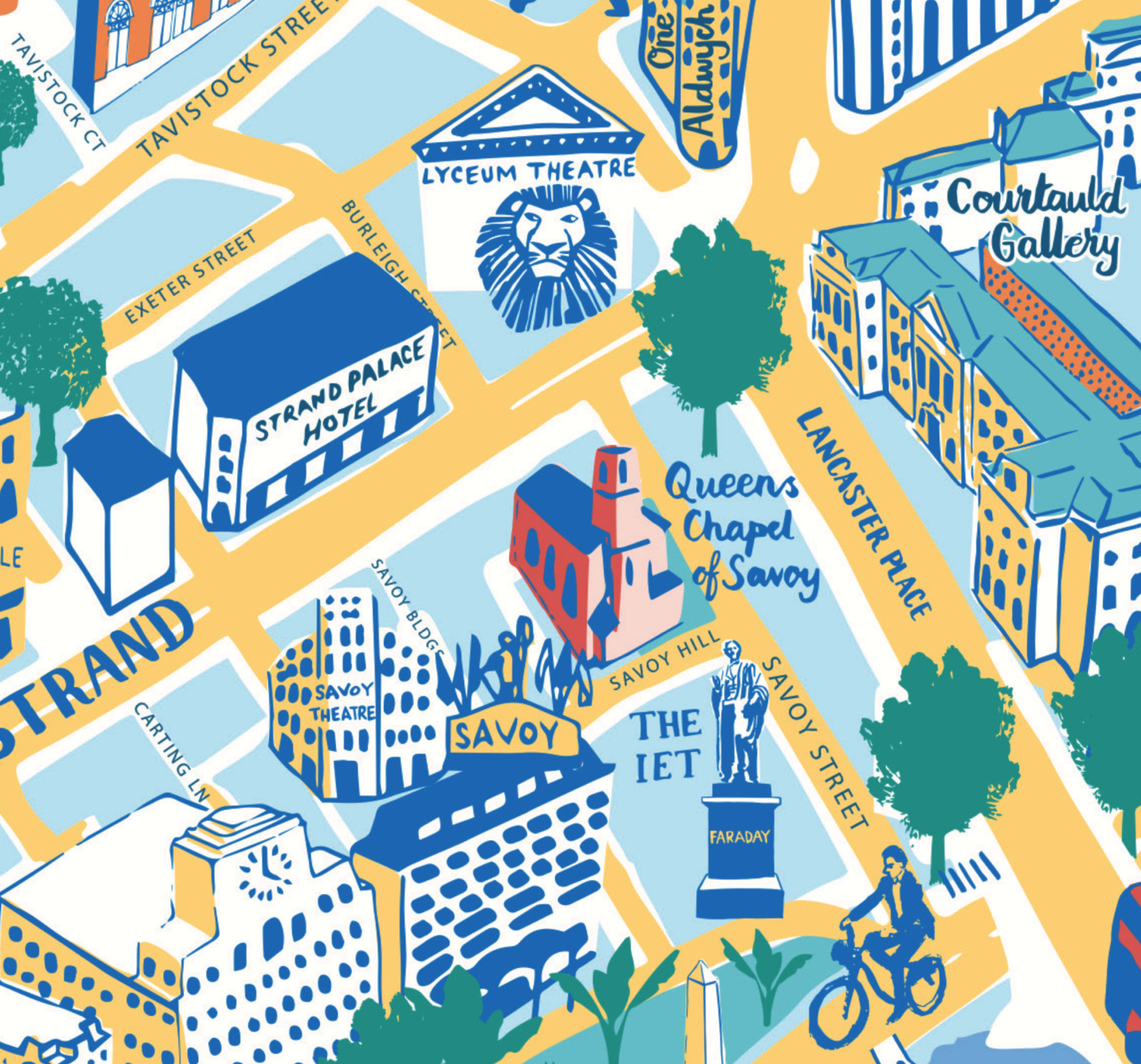
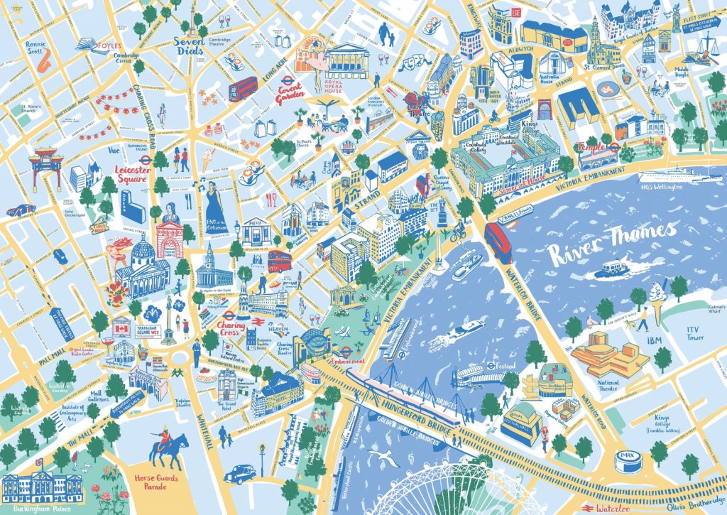
You know about London’s South Bank – the other side of the river has been looking on at envy at the pedestrian utopia over there and has created this guide and walking map to the “Northbank” – the area stretching from Trafalgar Square to Aldwych. The map has been drawn by Olivia Brotheridge and was commissioned by Northbank BID (Business Improvement District).
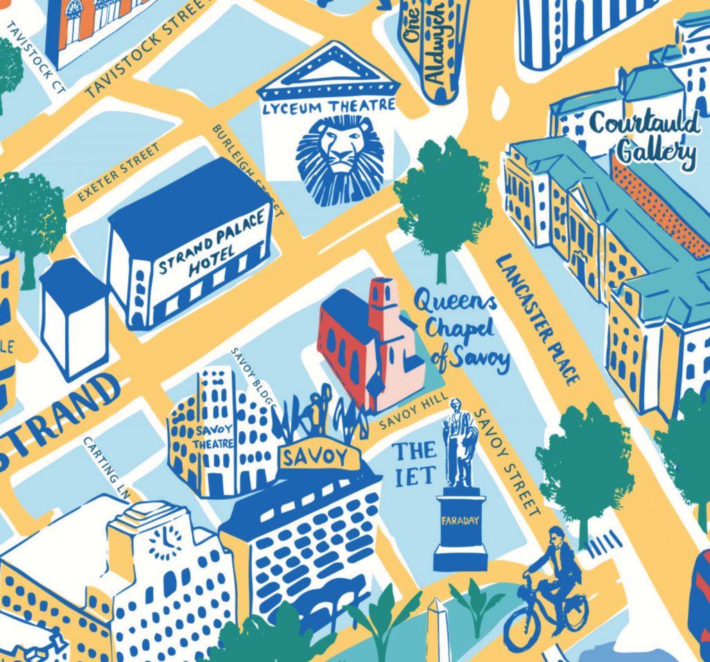
It’s great to see so much detail in a map like this – it doesn’t overwhelm, but the full street and alley network is included, along with the many landmarks that crowd the streets in this very central part of the capital. The slightly pastel yellows, blues and greens that dominate the map give it a nice uniformity in design. A number of font styles help provide navigational and feature order, from small alleyways to major streets and key building names.
With the junction of Strand and Waterloo Bridge being one of London’s pollution hotspots, and with tens of thousands of cyclists, pedestrians, bus-users and taxis passing the junction every day, a focus of the map is on encouraging walking routes – given the intensity of this area, this focus is understandable and encouraging.
You can find out more about the map and their initiative to encourage walking and reduce pollution in this area, on the Northbank BID website. – you can also download a PDF copy of the map with an accompanying guide. Some local businesses in the area may also have paper copies available (and if you are a local business here you can order your own.)
Spotted in the Covent Gardner magazine.
Northbank Guide — https://t.co/Rja2I659xu