One of my earliest projects at UCL, back in 2009, was to create a customisable online map of all the 2001 Census key statistics. The
More...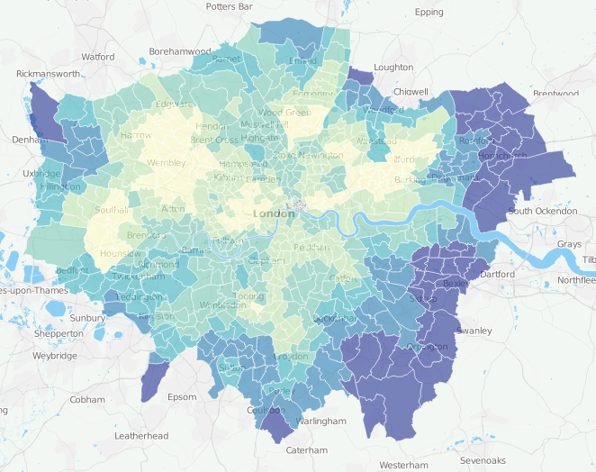
Highlighting the best London maps
One of my earliest projects at UCL, back in 2009, was to create a customisable online map of all the 2001 Census key statistics. The
More...
Here’s a real treat. The National Library of Scotland’s Map Department, supported by David Rumsey, have taken some very high-resolution scans of the Ordnance Survey
More...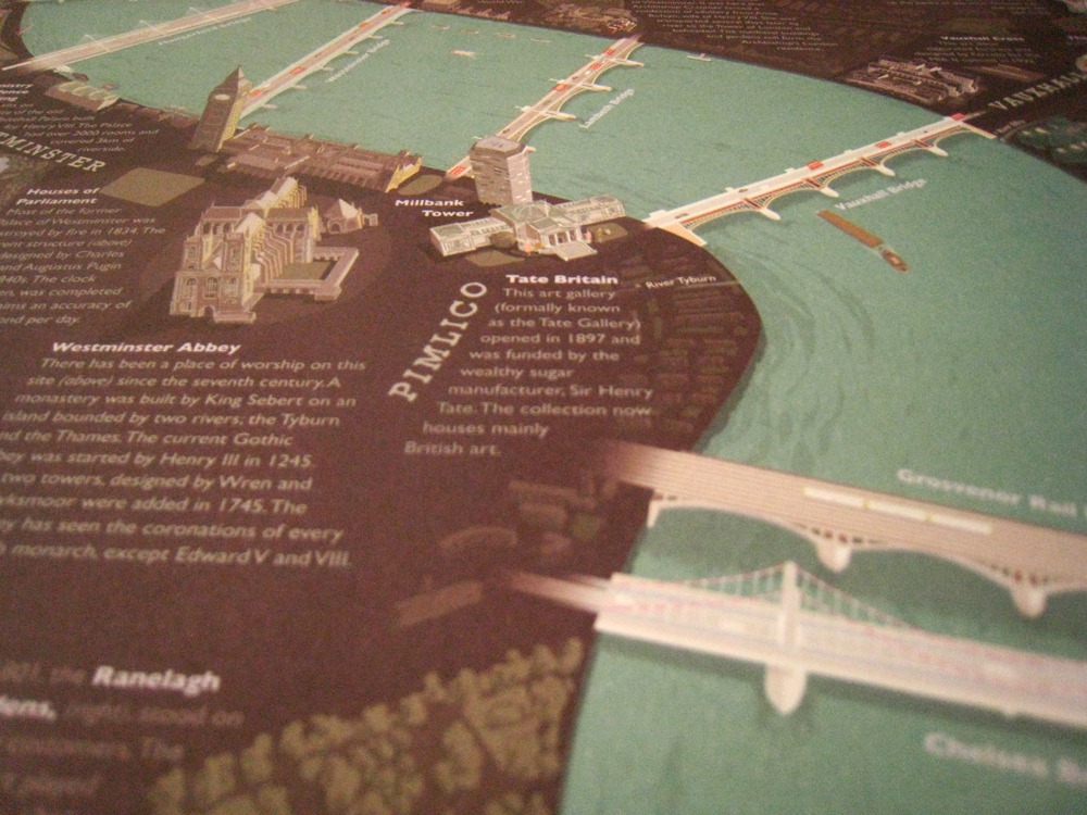
The London Thames is a new poster – a small extract is shown here – created by David Fathers, which features illustrations of the 16
More...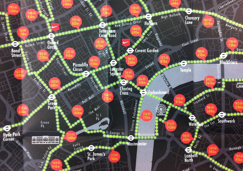
After reviewing many fine maps produced by others, it’s always nice to feature our own work once in a while. Above is an extract of
More...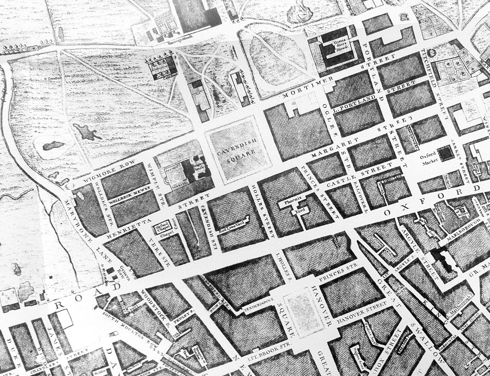
Mapping London has always been most interested in modern maps of London, however we are happy to make the occasional exception, and so when this
More...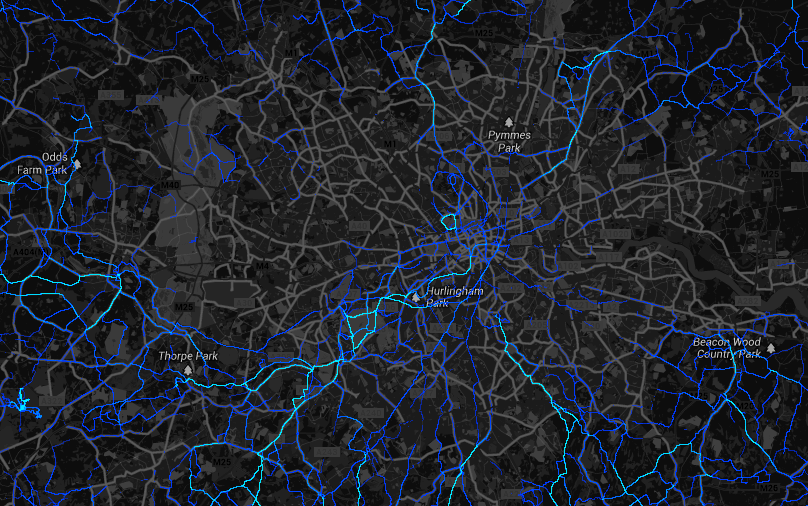
Strava, one of a number of services that walkers, runners and cyclists can use with their smartphones, recording and uploading their routes, has released a
More...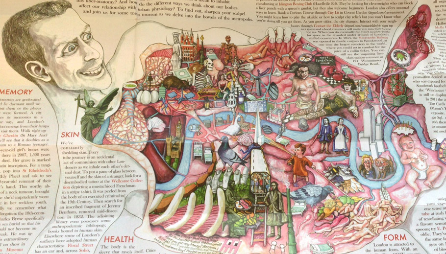
London dissected is the latest brilliant edition of the Curiocity maps series. For the princely sum of £2.50 you can purchase this gory interpretation of
More...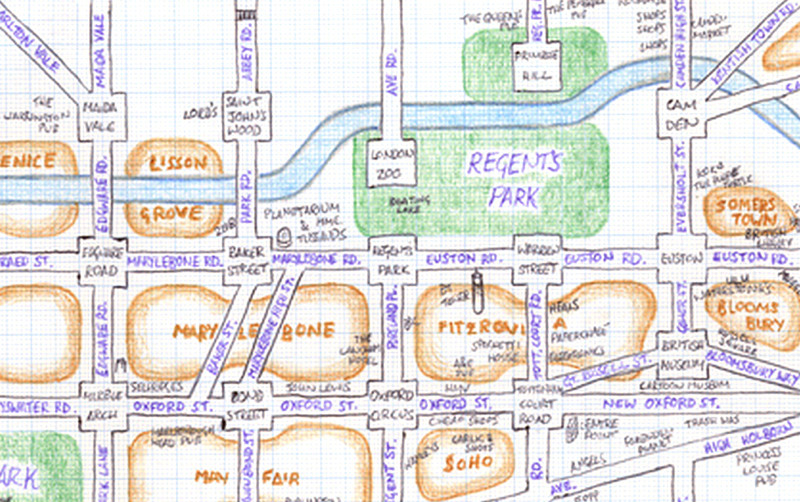
Mappa Lundi is a hand-drawn map of central London which simplifies the street network, districts, parks and tourist attractions into a simple, pseudo-grid like structure.
More...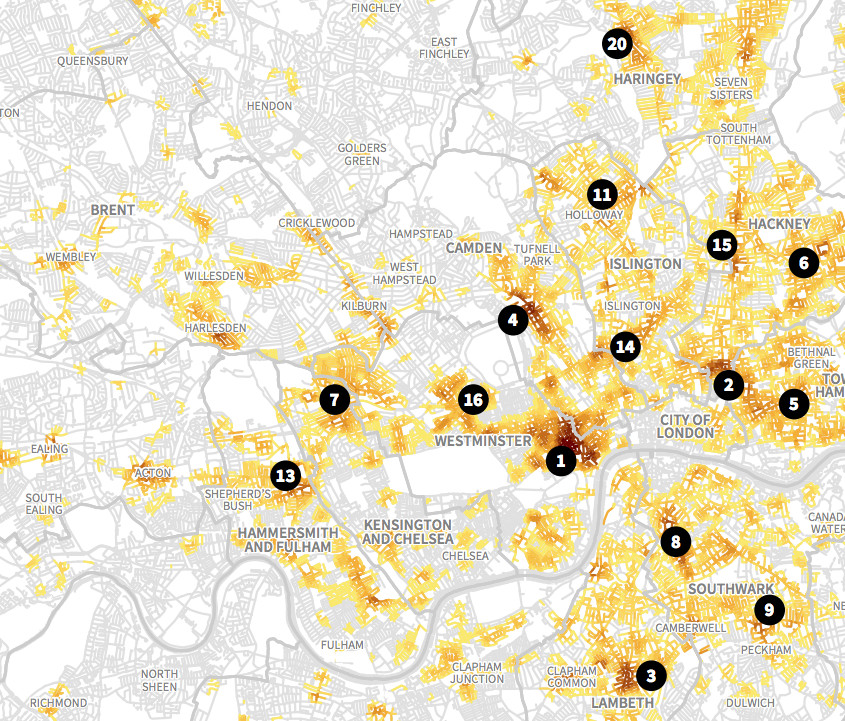
This is an extract of a map, by Matt Ashby, formerly of the UCL SECReT (Security and Crime Science) lab, that takes police.uk open data
More...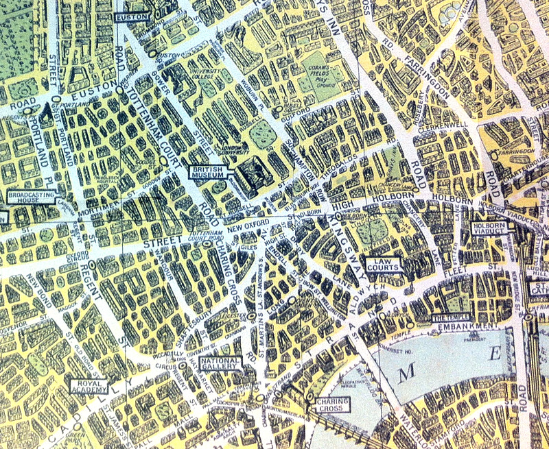
The above map is an extract from a reproduction of the “Pictorial Map of London” published in 1938 by what was then known as the
More...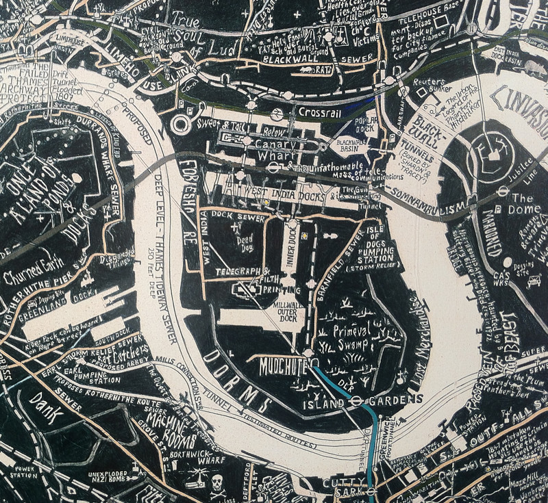
Stephen Walter, most famous for his “Hub” map of London, a fantastically detailed hand drawn map of London with a distinctive repeating style and thousands
More...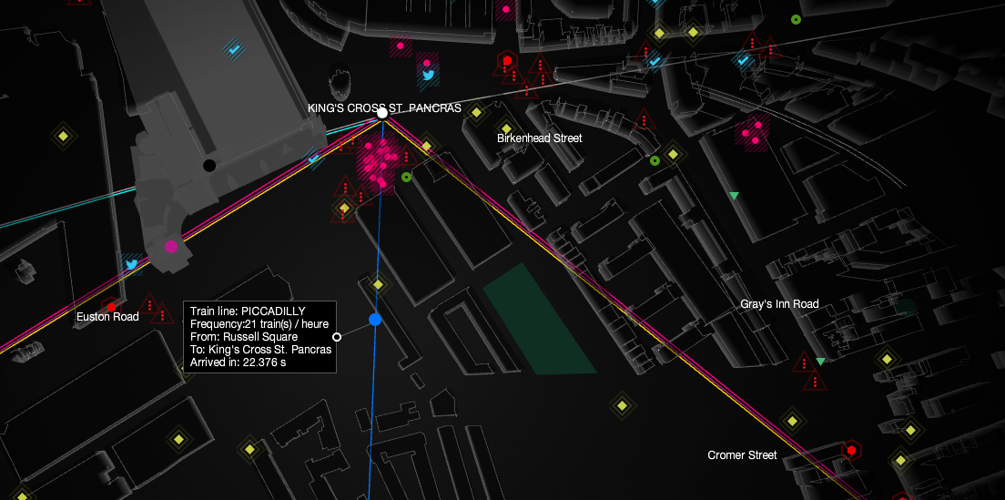
UbiSoft have created this compelling live map of London’s sensor and social media data, as part of a promotion for their upcoming game “Watch Dogs”.
More...