London has many football clubs – but where in London do their supporters live, work or go out? In the area immediately near their hallowed
More...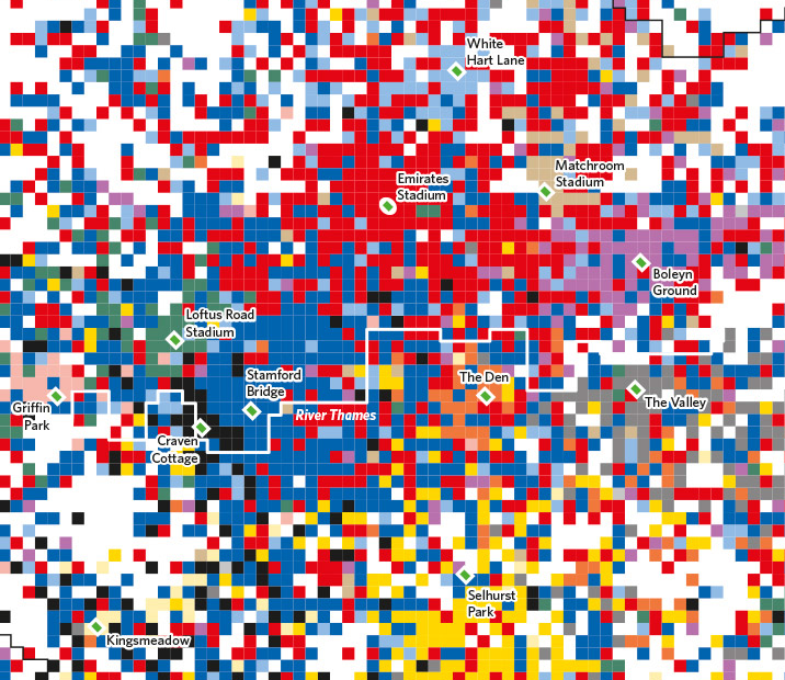
Highlighting the best London maps
London has many football clubs – but where in London do their supporters live, work or go out? In the area immediately near their hallowed
More...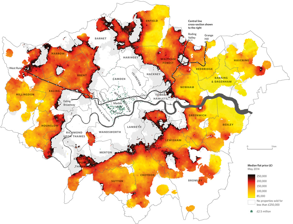
Above is a map from Mapping London co-editor Dr Cheshire’s new book The Information Capital that appeared in this week’s Time Out (print & online).
More...
Today, a new version of the Greater London Authority (GLA)’s London Datastore launches, with an updated look, a new responsive data dashboard, and various new
More...
London has been home to many great cartographers and has been the subject of many stunning maps that depict all aspects of life in the city. Drawing
More...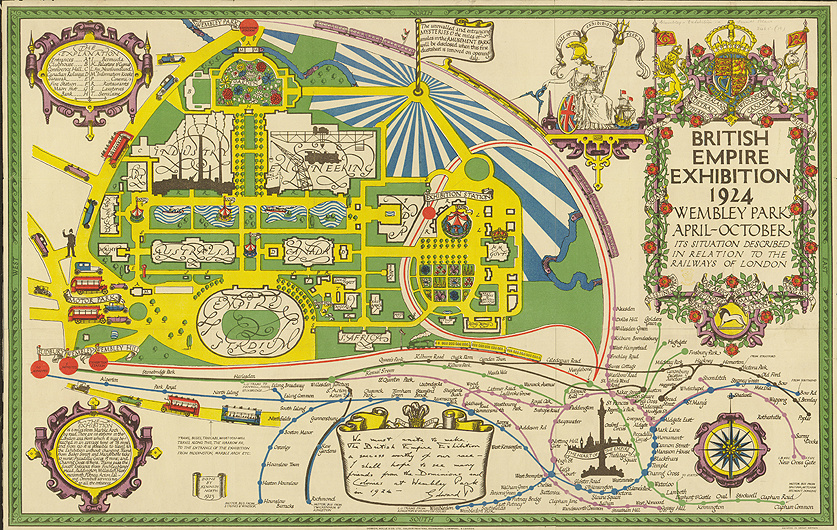
This colourful, much adorned map was produced as a fold-out poster on the back of the official guide for the British Empire Exhibition which took
More...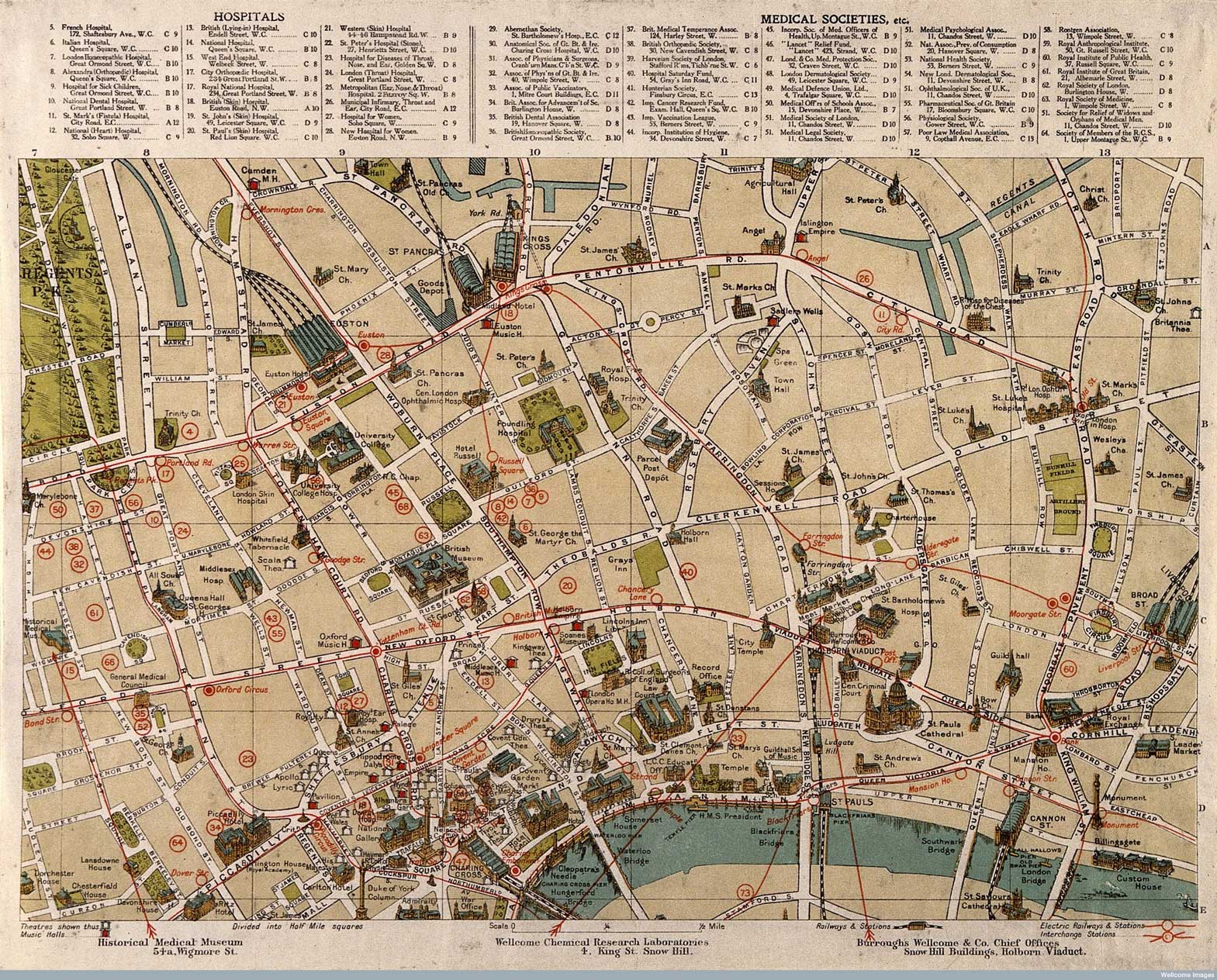
Published in 1913 (and available to download from the Wellcome Library) this series of intriguing maps depict London’s “sites of medical interest”. It looks like
More...
[This was first published in 2014, however Mapping London was asked to remove this while the event took place, we have now republished it as
More...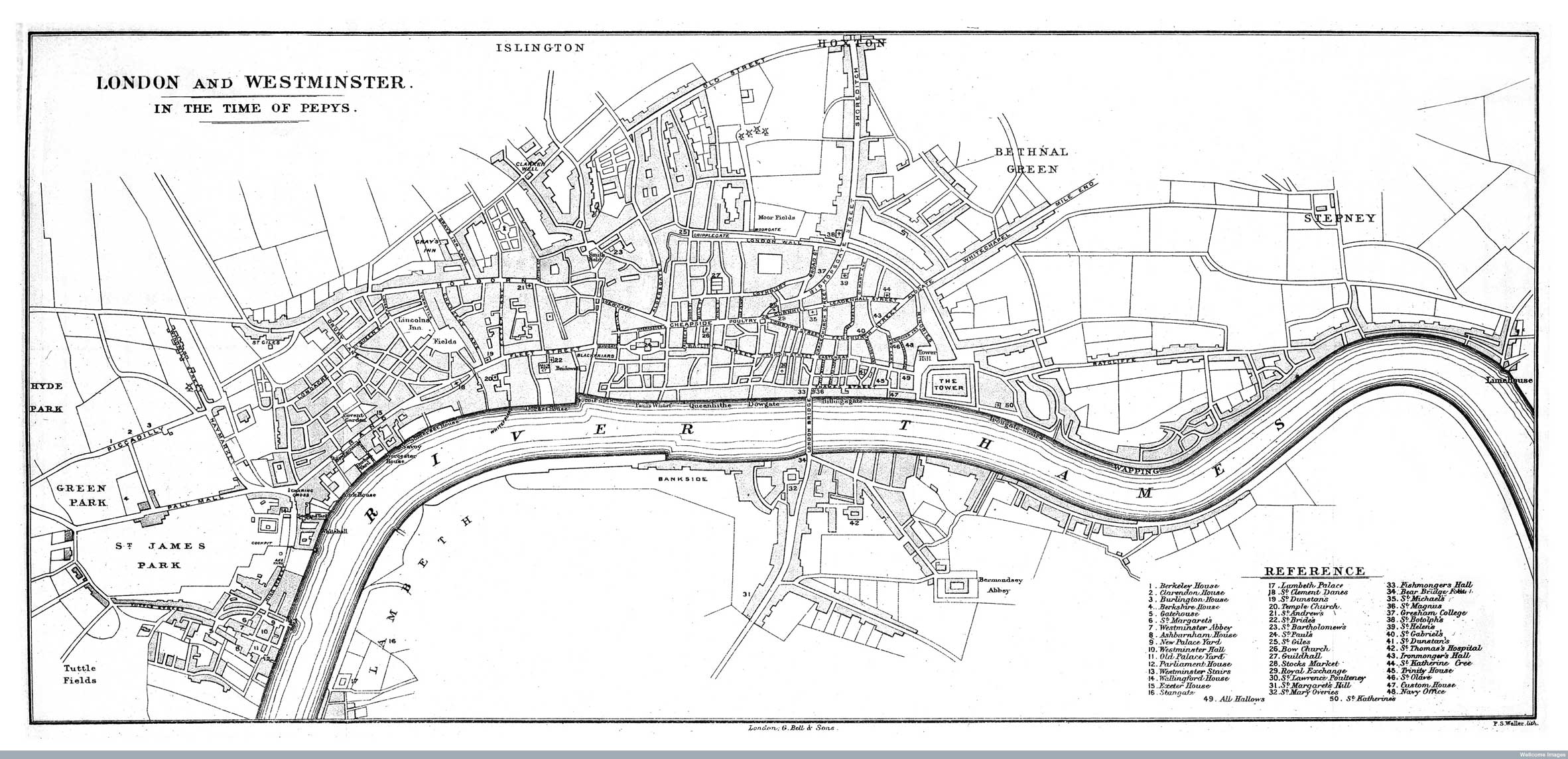
The Wellcome Image Library contains a number of interesting maps of London that are all free to use. I recently spotted a couple relating to
More...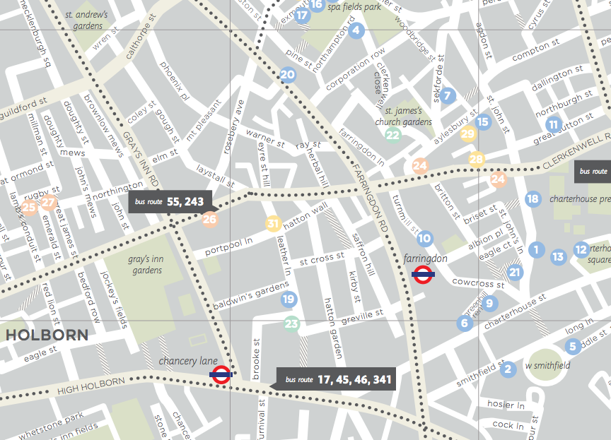
This attractive fold-out map (extract above) is produced by Urban Walkabout. It is the fifth in a series of maps of London tourist areas that
More...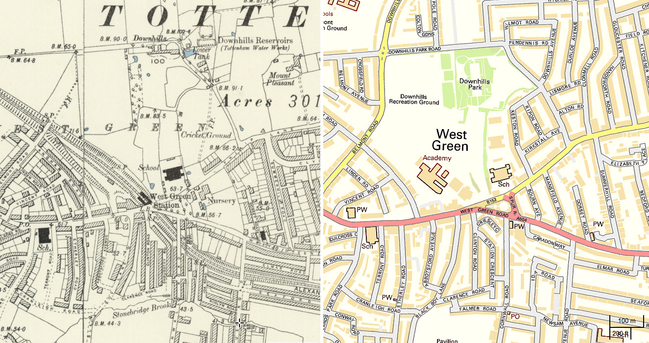
The National Library of Scotland’s (NLS) Map Department has recently completed a huge georeferencing exercise, taking a set of Six-Inch-To-Mile (1:10560) maps for the whole
More...
Mapping London is just back from a holiday in New York City. Here is one last iconic map from the city which never sleeps. The
More...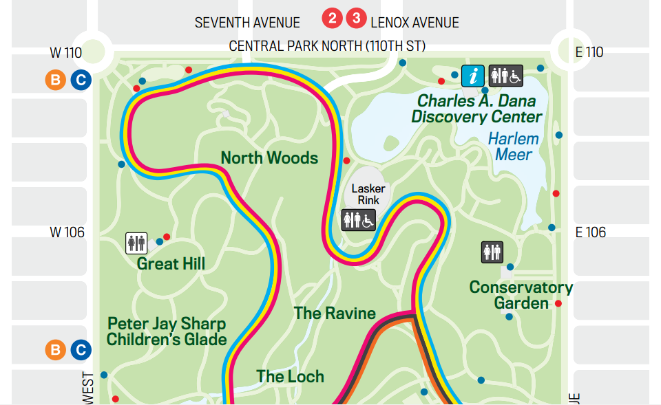
Mapping London is on holiday in New York City this week. In the centre of Manhattan lies one of the world’s most iconic parks, Central
More...