
Mapping London is on holiday in New York City this week.
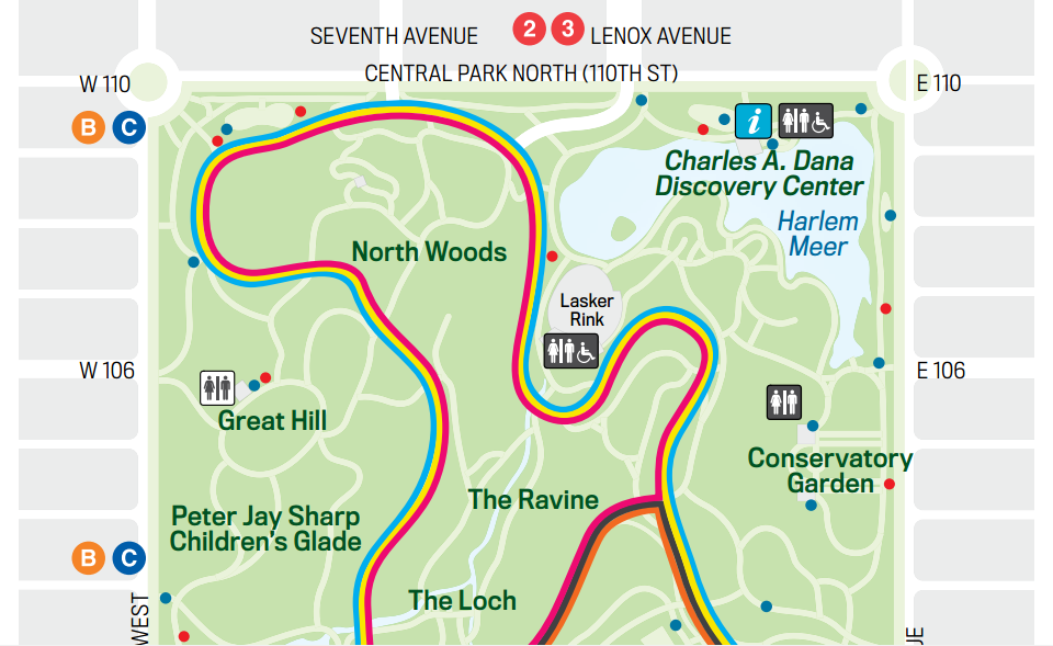
In the centre of Manhattan lies one of the world’s most iconic parks, Central Park. It’s a hugely popular place for people to walk, cycle or run. With the latter group in mind, the Central Park Conservancy have produced this attractive map of running routes using the park roads that meander through the 400+ acres of greenery. You can run elsewhere of course but the park roads have dedicated running lanes (as well as slow and fast cycle lanes) and they are hugely popular with the jogging community.
The map shows eight running loops, from a short (2km) hilly loop in the north end, to a grand circuit of the whole park, which is almost 10km. Multiple coloured lines are used to show each route clearly and simply. The complex network of other paths in the park are shown in white and, crucially in the summer heat and humidity of New York City, the many drinking fountains in the park are shown with blue dots.
The extract above shows just the northern tip of the huge park. You can view the full map here.
On a related note, there is also an (old) orienteering map of Central Park. Few orienteering events happen in the park as getting permissions to run on the “terrain” parts of the park are, presumably, very tricky. However there is a permanent orienteering course in the park, and a version of the map has been produced, showing it.
Mapping London is back in its eponymous city next week.