To celebrate one year since the release of London: The Information Capital by Mapping London co-editor James Cheshire and graphic designer Oliver Uberti, and the
More...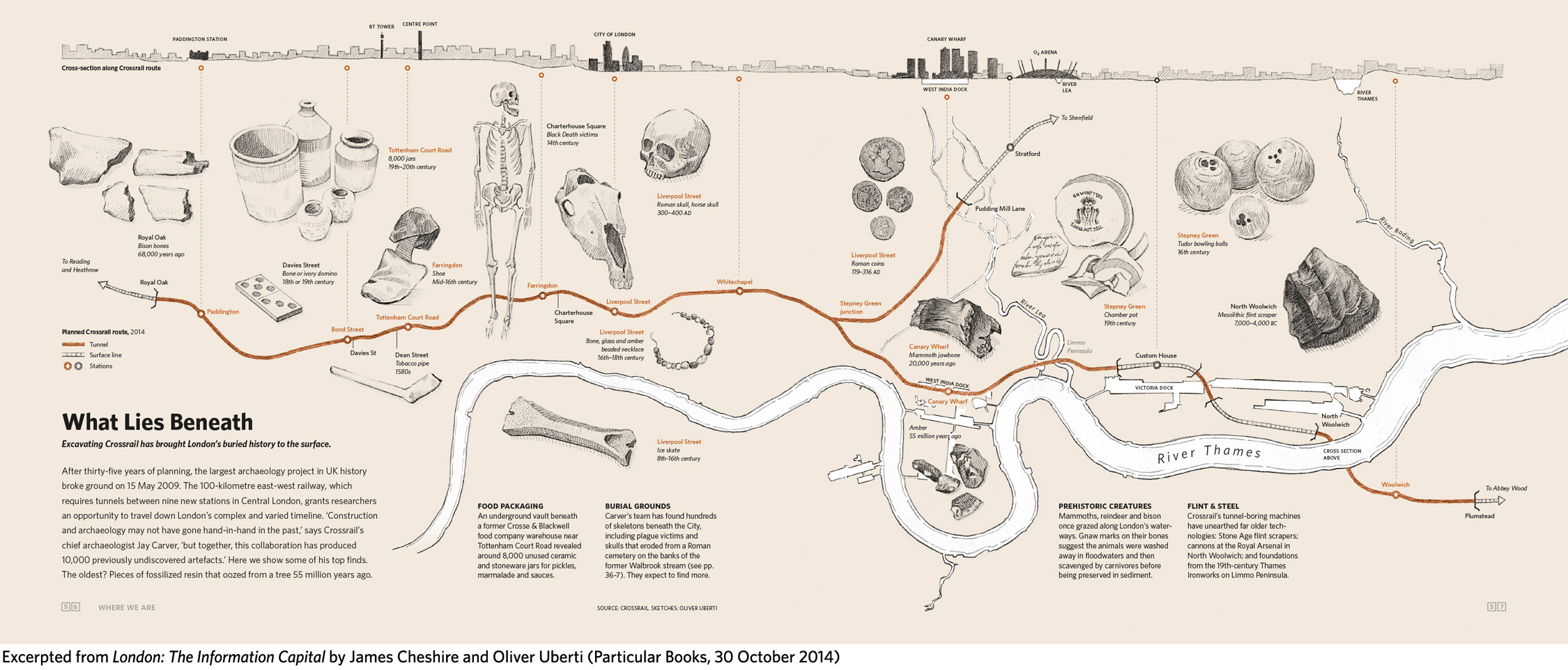
Highlighting the best London maps
To celebrate one year since the release of London: The Information Capital by Mapping London co-editor James Cheshire and graphic designer Oliver Uberti, and the
More...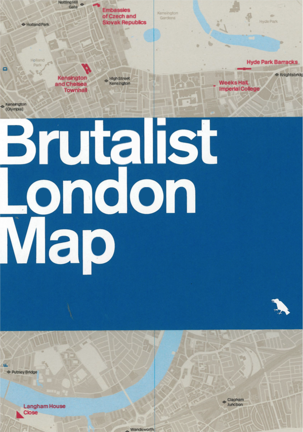
For fans all all things concrete comes this map of London’s most famous Brutalist buildings. Created by Blue Crow Media (see also their craft beer
More...
Today, the London Transport Museum unveils a new permanent gallery in its space in Covent Garden, called “London by Design“. The gallery includes a number
More...
Is this London’s first 3D map? The vivid and historic map of London in 1842, coloured by district, has one unusual feature – it’s embossed.
More...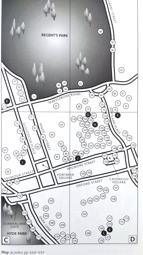
London has a lot of history, of course, and a lot of blue plaques have been erected by English Heritage over the years to mark
More...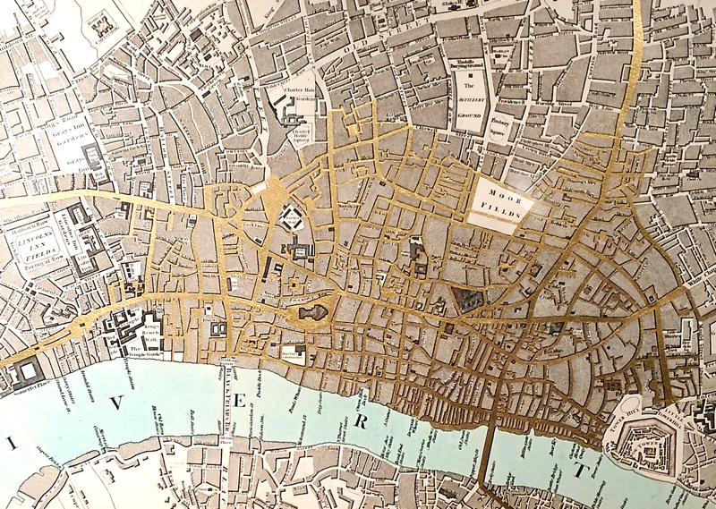
Currency and Cartography is an solo exhibition by artist Justine Smith, available to view in the gallery space at The Map House in Knightsbridge, a
More...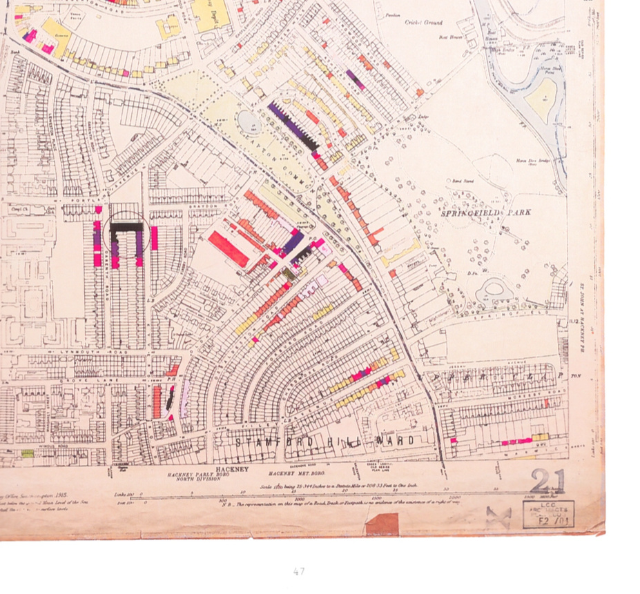
Several years ago, we featured some striking maps from a small exhibition at the London Metropolitan Archive. Each map was a detailed plan of a
More...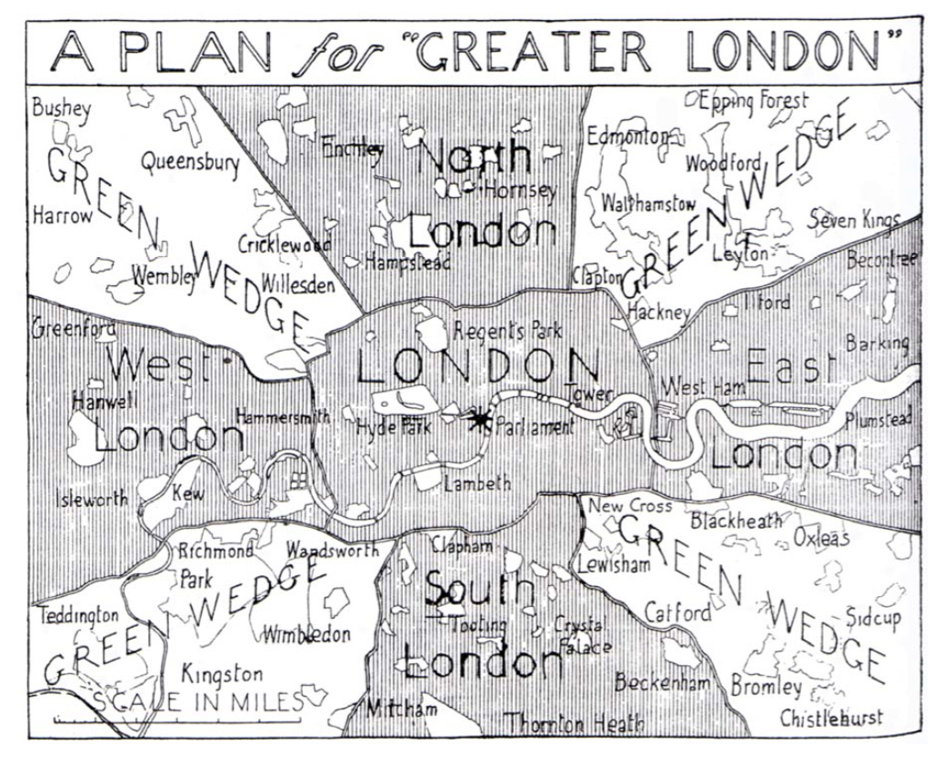
This map, “A Plan for Greater London”, is a 1943 masterplan for the rebuilding and enlargement of London, following the damage of the Blitz. Instead
More...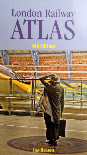
The London Railway Atlas is probably the most detailed map of London’s myriad of tube, train and tram lines, past and present, that you are
More...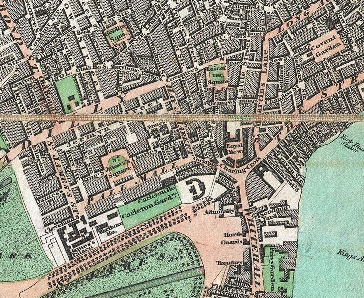
From Geographicus, a US map dealer, by way of a tweet by Rentonomy, an article in CityMetric and a collaboration with Wikimedia, comes this high-resolution
More...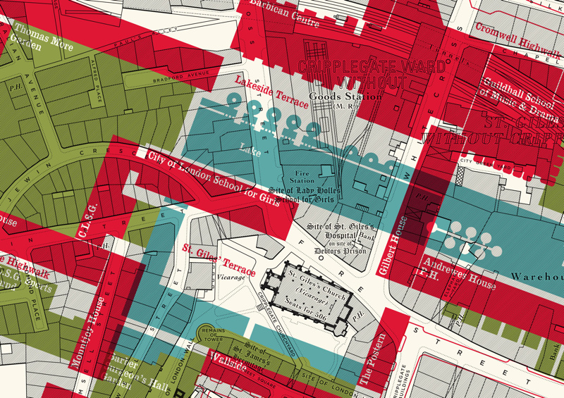
Here is an interesting concept by illustrator Russell Bell. He’s taken a pre-WWII (World War 2) monochrome map of the Barbican area of London (the
More...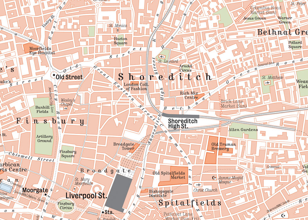
This map, created by illustrator/designer Mike Hall (we previously featured his borough maps) is simply called the “Central London retro style map“. It’s a brand
More...