“Geodemographics of Housing in Great Britain – a new visualisation in the style of Charles Booth’s map” is a map that I have produced that
More...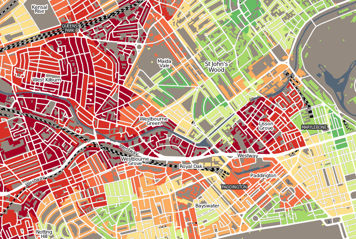
Highlighting the best London maps
“Geodemographics of Housing in Great Britain – a new visualisation in the style of Charles Booth’s map” is a map that I have produced that
More...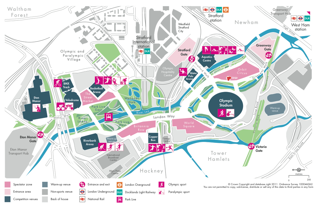
LOCOG (The London Organising Committee for the Olympic Games) yesterday released a new map of the key Olympic Park in east London, as part of
More...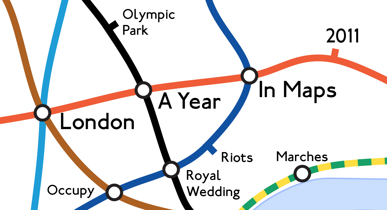
Mapping London editors James and Ollie look back at some of the many maps produced each year in London to highlight the highs and lows
More...
Transport for London would really rather you didn’t travel into Zone 1 – the central part of London. It’s a lot cheaper to travel on
More...
Mapping London Life is the title of the talk I gave at a great event organised by the Londonist and hosted by TAG Fine Arts.
More...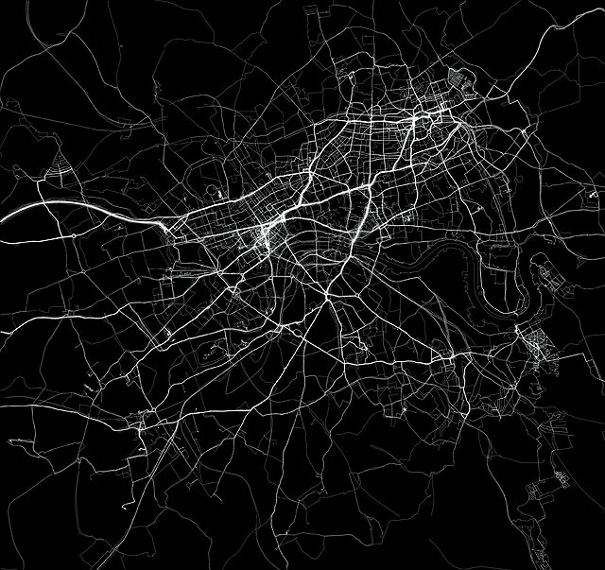
The above extract is an artwork from Jeremy Wood called My Ghost. Jeremy carried a GPS receiver around central London for nine years, gradually building
More...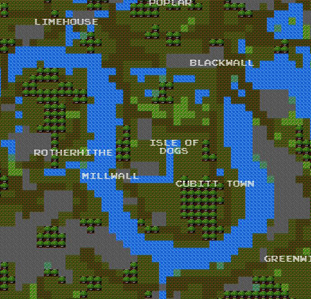
It’s a bit silly, and not exactly very helpful as a map for navigation – but it’s also a lot of fun. Brett Camper has
More...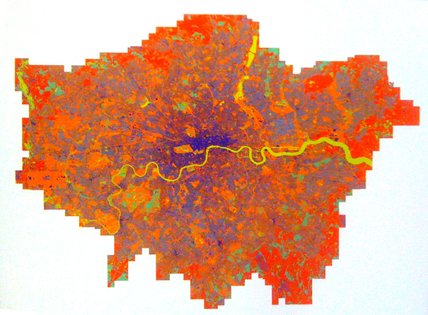
This map of mobile phone signal strength, produced by the GeoInformation Group this year, was one of the graphics featured in the exhibition that accompanied
More...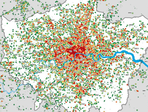
Many Twitter messages, or “tweets”, are sent with latitude/longitude information, allowing an insight into the places where the most amount of tweeting happens. For a
More...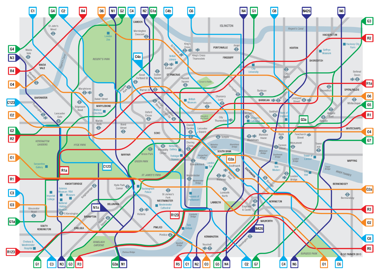
Congratulations to Cycle Lifestyle, who have won £6000 in funding for “creating a colour coded Tube style map of the Capital’s cycling network” in the
More...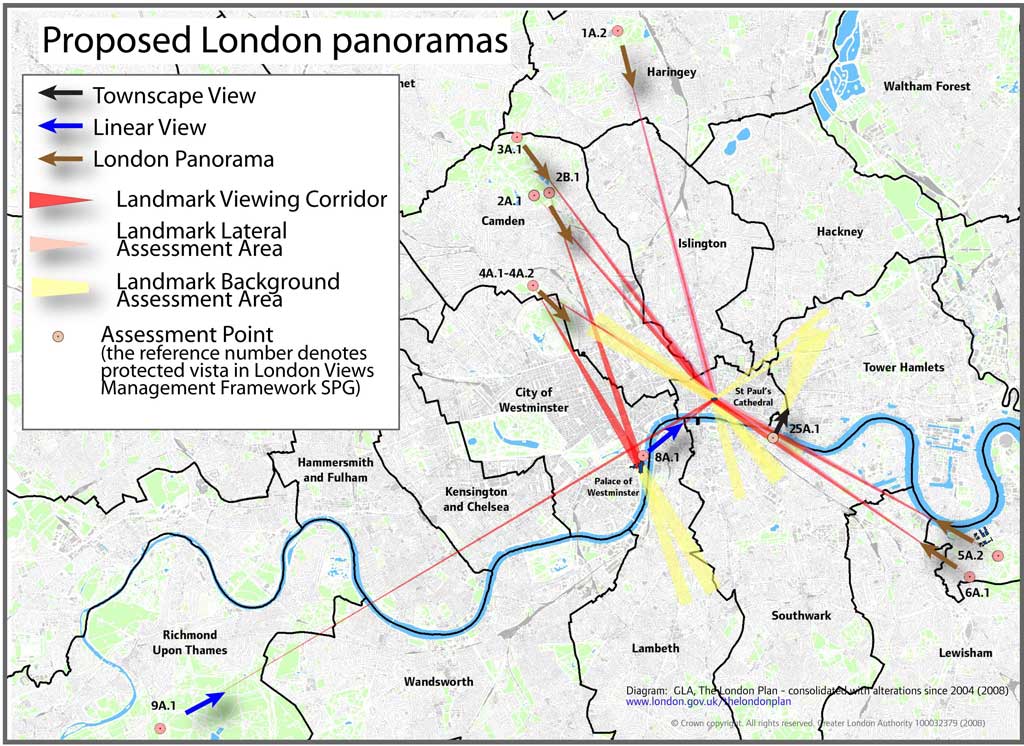
A map, tucked away on the GLA’s London Plan website, reveals graphically the legally “protected vistas” in London – generally views from certain parks in
More...
This is another great map animation from our friends in CASA. It is a year old now (almost to the day) but it remains one
More...