Travelling around London is a little harder today. With a tube strike on, the roads are clogged with traffic jams, and the pavements are full
More...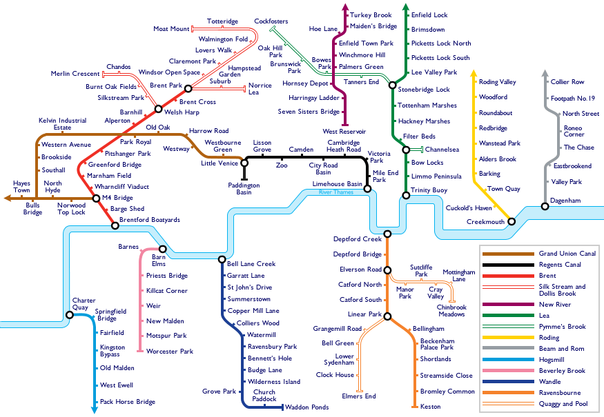
Highlighting the best London maps
Travelling around London is a little harder today. With a tube strike on, the roads are clogged with traffic jams, and the pavements are full
More...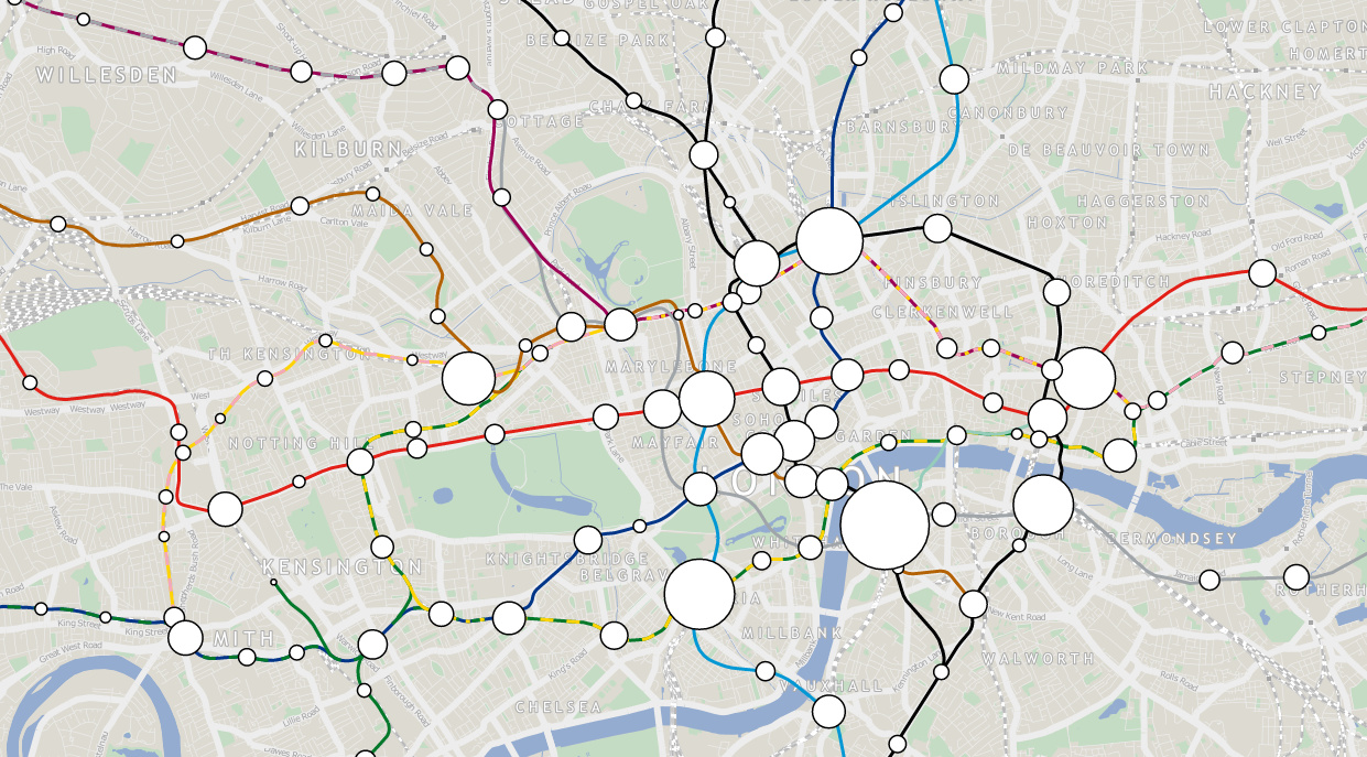
London Tube Data Map takes ten years worth of passenger entry/exit counts for stations on the London Underground network, and sizes the circle representing each
More...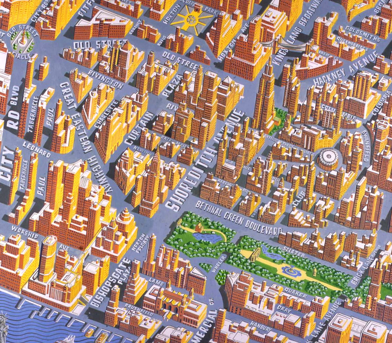
Today, Mapping London brings you not one, but eight maps from prolific cartographer/artist Adam Dant, via the excellent hyper-local blog Spitalfields Life. Firstly, Stories of
More...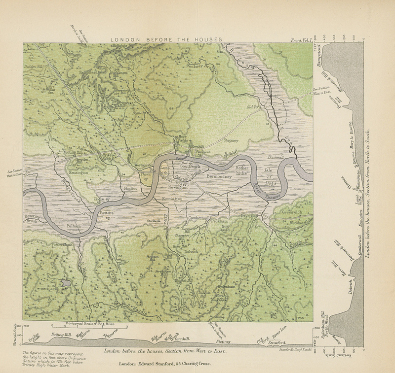
This map (full size version) is a plate in “A History of London” by John William Loftie which was published in 1884. It is one
More...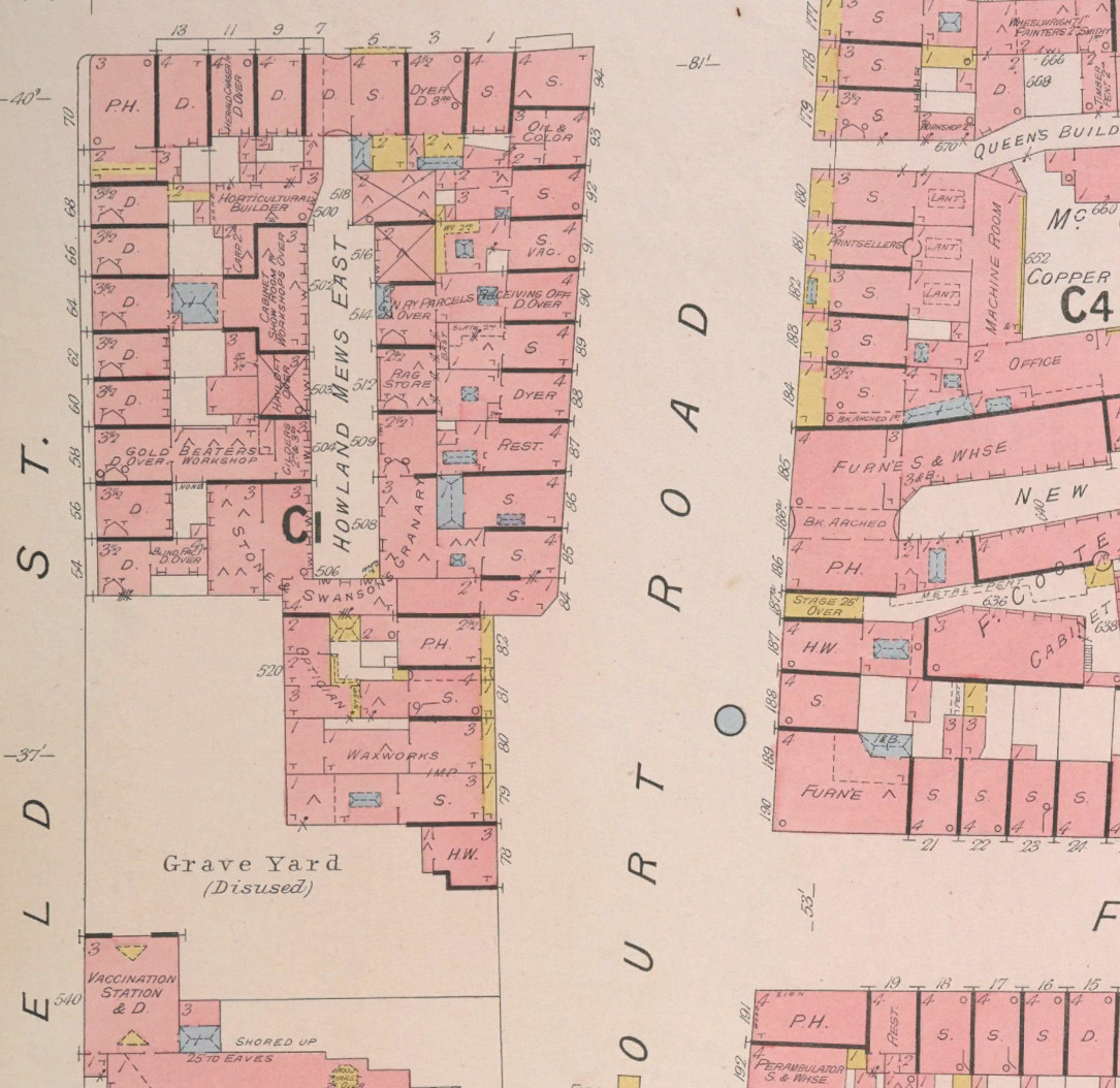
The British Library has launched a portal to let people georeference thousands of historic maps in their collection which have been recently digitised, allowing the
More...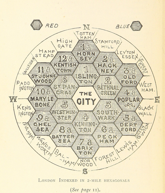
This map is taken from an book “The Unification of London: The Need and the Remedy” written by John Leighton and published in 1895. London
More...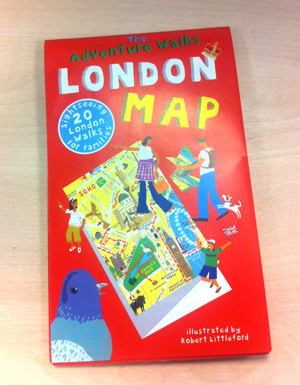
Here’s some of our favourite maps we’ve reviewed over last 12 months, and where you can buy them: Running with Crayons is a fantastic name
More...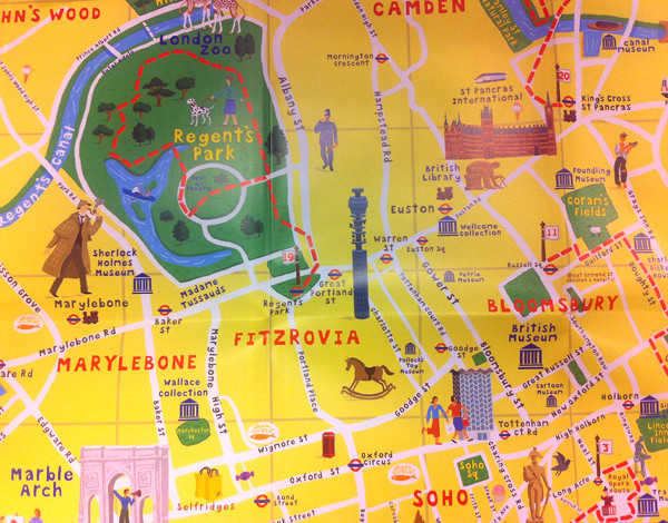
This pocket-sized colourful map, illustrated by Robert Littleford, specialises in highlighting interesting things for young explorers of the metropolis. There is a good mixture of
More...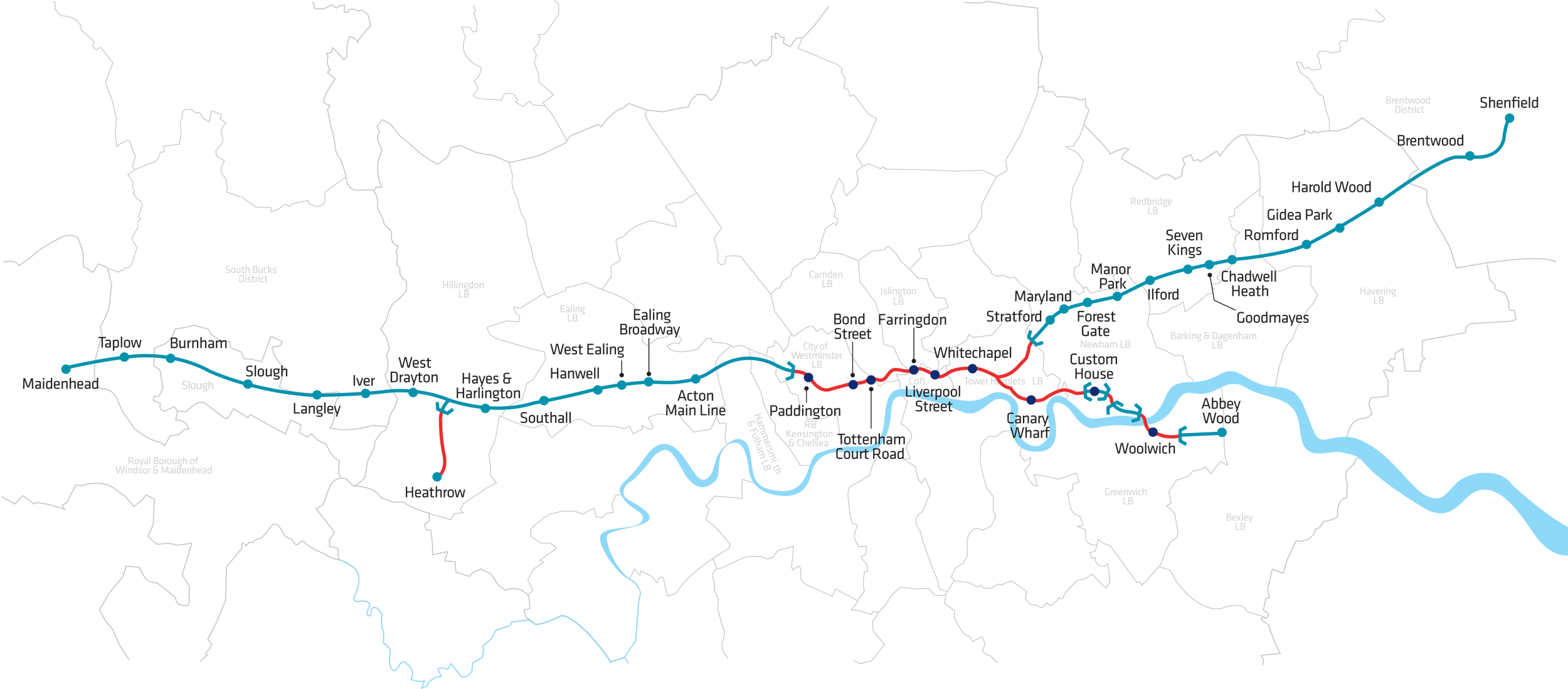
Crossrail is a huge project tunnelling out a new railway line under central London. We featured the Crossrail “live” maps showing the location of the
More...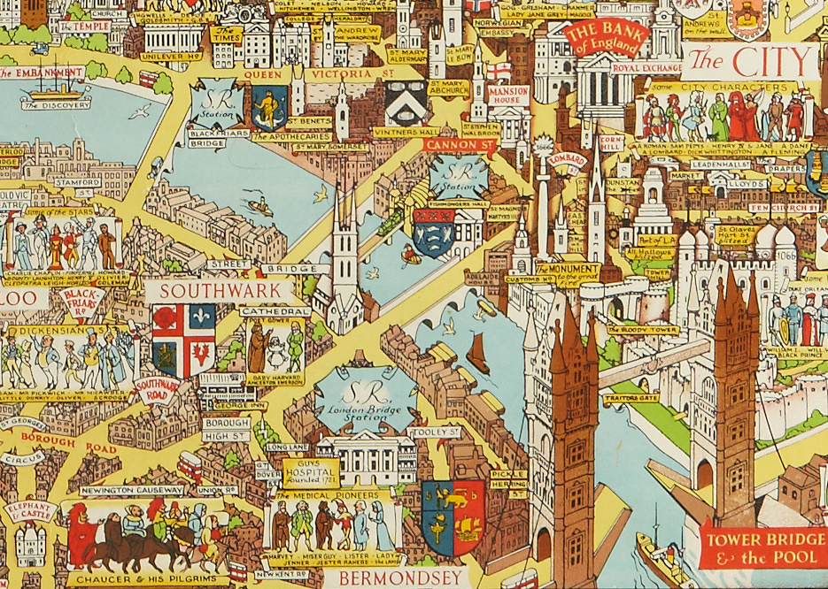
This decorative map was published in or around 1946, as a commemorative keepsake for a weary city and a population that had just been through
More...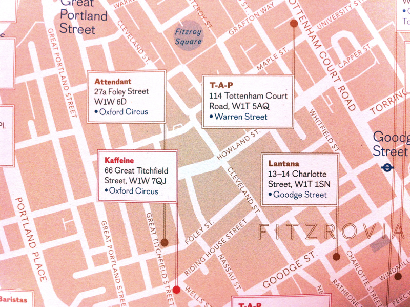
London’s craft beer and microbrewery scene is burgeoning, and trendy independent coffee shops are also popping up everywhere, so what better way to encapsulate this
More...
Dr Ed Manley (@EdThink), a research associate on the Mechanicity project here at the Centre for Advanced Spatial Analysis, created this dramatic, colourful graphic (excerpt
More...