
The British Library has launched a portal to let people georeference thousands of historic maps in their collection which have been recently digitised, allowing the map to be orientated to a modern map. There are two sets of maps currently – fire insurance maps for British and Irish towns at the end of the 19th century, and World War I and US Civil War maps. As well as allowing anyone to work on lining the maps up, there is also a page showing maps already positioned and it is from this, that the above map comes.
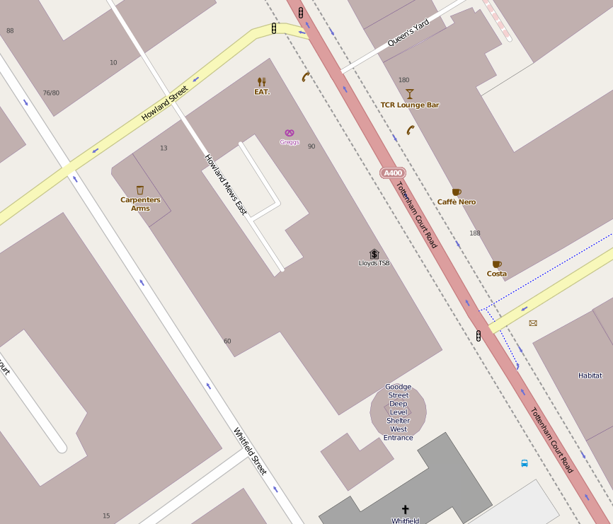
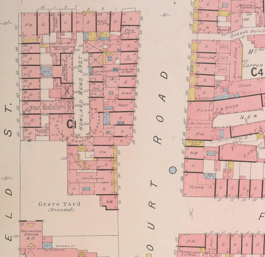
This is one of the fire insurance maps for central London. Each map only covers a small area, but is at a large scale and is full of great detail, and it’s striking both what has remained the same (street patterns and names) and what has changed (the shop types). The one above is of the area that surrounds Mapping London Towers, aka the Centre for Advanced Spatial Analysis (CASA) at UCL. Our building itself is much more modern – 1970s probably – but the basic structure, including the mews that the office has on two sides – Howland Mews East – remains.
What have changed are many of the shops and businesses. Focusing on the block around Howland Mews East: P.H. indicates a public house, which still remains as The Carpenter’s Arms. But within 100m of the office here, there used to be a vaccination station, waxworks, granary (“Stone & Swansong”), rag store, Great Western Railway Parcels receiving office, two dyers, “oil & color” [sic], cabinet showroom, gold beaters, gilder, blind factory, carpenter, horticultural builder and finally a heraldchaser. I don’t think any of those exist any more. I had to look the last one up, it’s apparently someone who engraves patterns into metal. (We think that S stands for a generic shop, and D for dwelling.)
These days, the block instead has: A commercial medical sample testing lab, printer showroom (the actual printing happens in Germany), EAT sandwich shop, LOAF (independent sandwich shop), Greggs sandwich shop, four sofa showrooms, an entrance to a World War II air-raid shelter, a regular office, and a Lloyds Bank branch, as well as the aforementioned pub which has survived.
We particularly like the good use of colour in this map. Pre-1900 maps often tend to be monochrome, so it’s great to see strong, distinct colours being used here to highlight different feature types. The typography is nice too.
Explore the list of georeferenced maps to find the equivalent near you, or georeference one of the remaining unpositioned ones.
See also the National Library of Scotland’s scans of Victorian London maps, which we reviewed before and have similarly impressive detail.
Season’s greetings from Mapping London and we look forward to sharing many more imaginative maps of London with you in 2014.
Above: Thanks to the British Library. Below: Copyright OpenStreetMap and contributors.