We were pleased to recently receive a number of hi-resolution scans of some very old and beautiful London maps, courtesy of the British Library, which
More...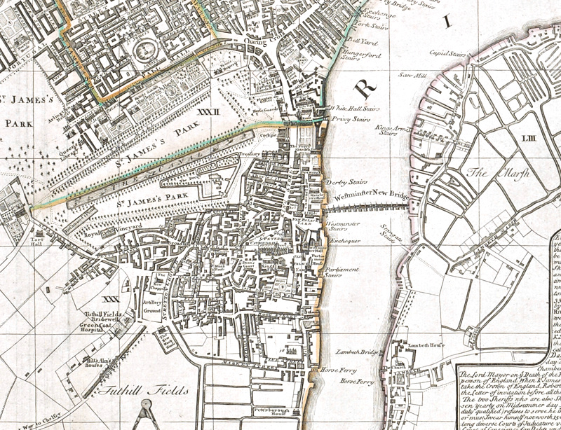
Highlighting the best London maps
We were pleased to recently receive a number of hi-resolution scans of some very old and beautiful London maps, courtesy of the British Library, which
More...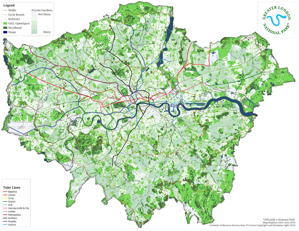
A website calling for a Greater London National Park launched today (1 April) although it’s keen to point out that it’s not actually an April
More...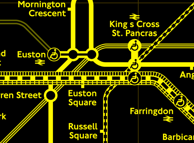
The iconic tube map has featured on many Mapping London posts but not everyone sees the familiar colours in the same way. The official map
More...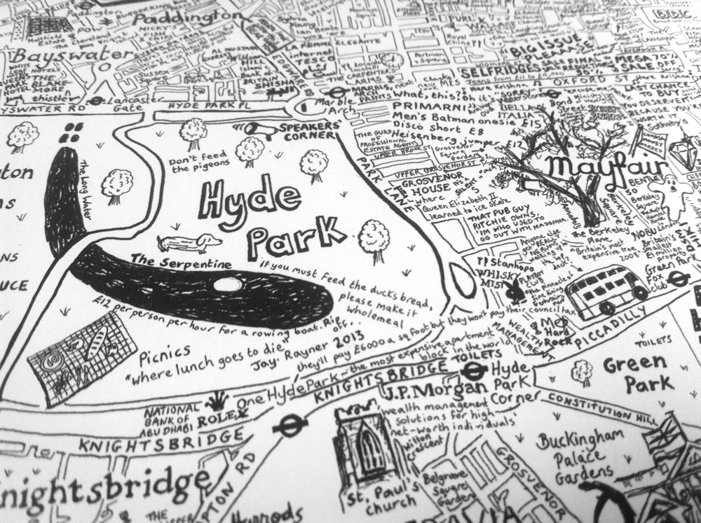
City of Westminster is the first in a series of hand-made maps of London Boroughs that Lovely Jojo has drawn. The black-and-white, text-heavy style, full
More...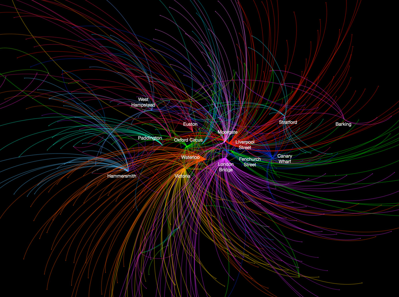
This data map, from UCL CASA‘s own Ed Manley, shows the top destination station, for each starting station, in and around London. The graphic is
More...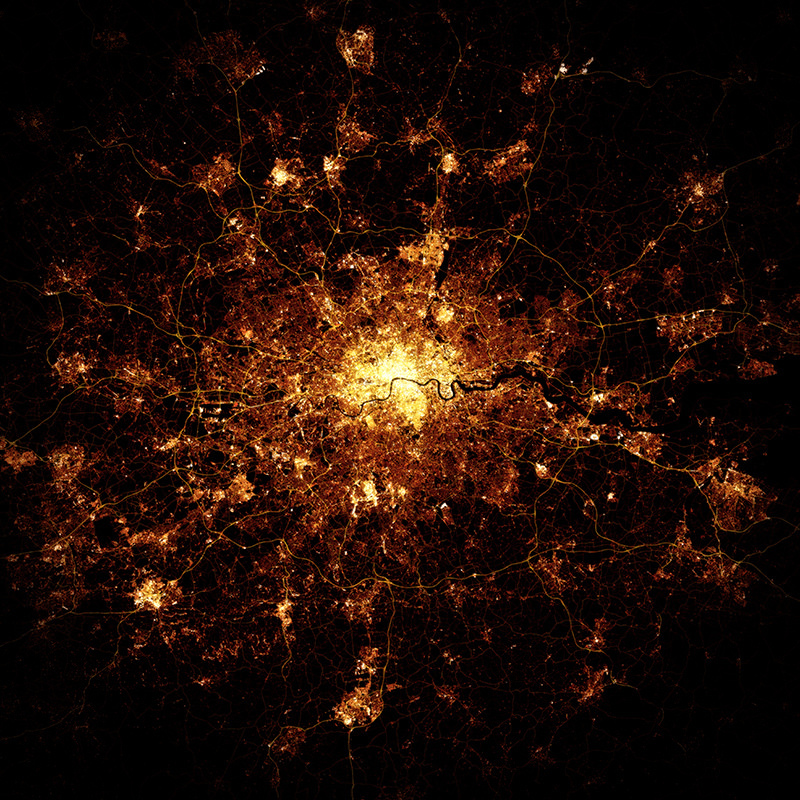
At first glance, this looks like a photo of London at night, maybe from the International Space Station (ISS) or another satellite. Creator Marc Khachfe
More...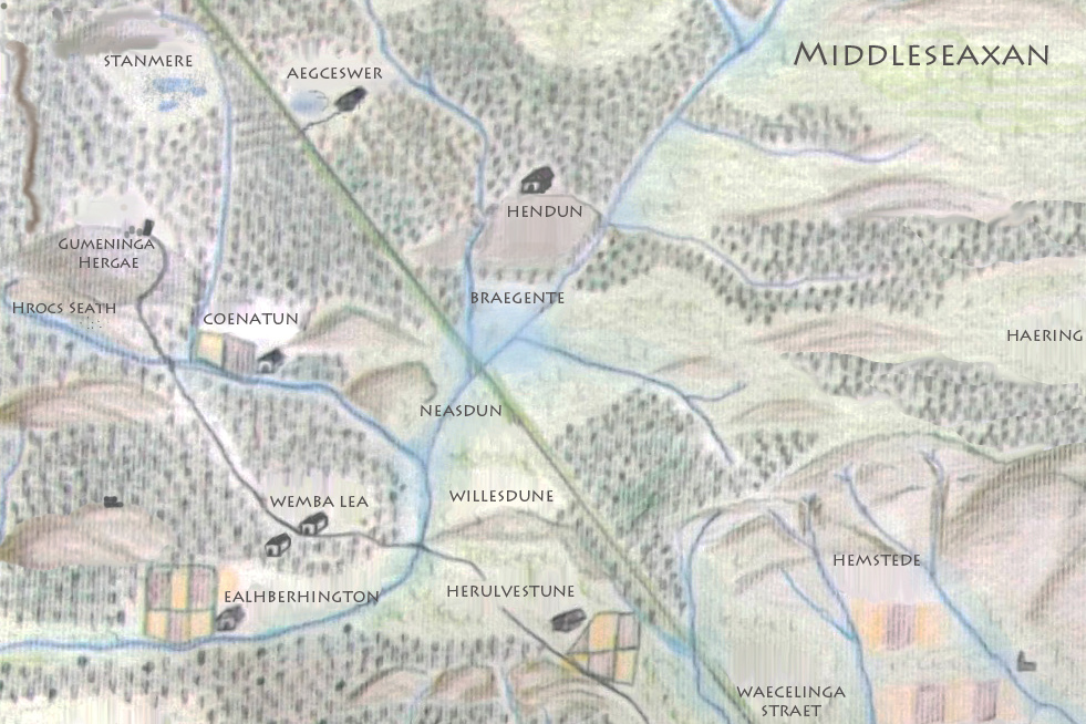
Earlier this week I did a “map swap” with Matt Brown, editor of Londonist, the popular London website. This lovely hand-drawn map, created by Matt
More...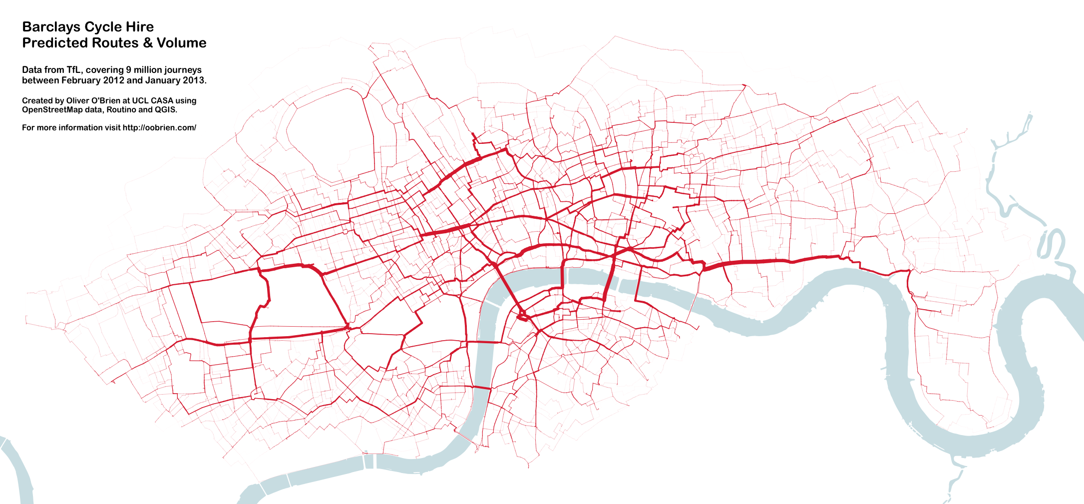
You may remember this map produced by Mapping London co-editor James in 2012. A version of this map appears in a journal article published by
More...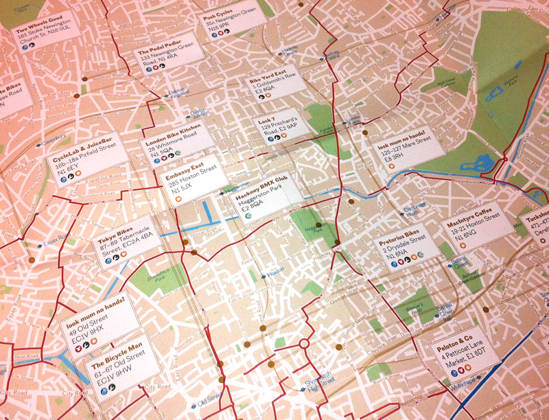
Over half a million cycle journeys now take place in London every day, and a whole service industry has grown in the capital, to cater
More...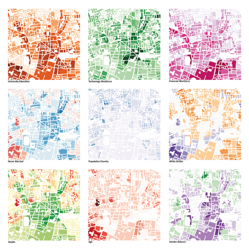
This was the submission by the Mapping London editors into the 10×10 Drawing the City London 2013 art event, which was a charity auction run
More...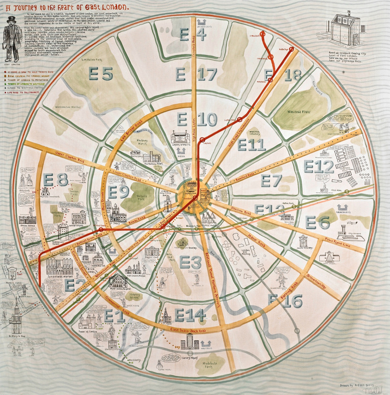
We are big fans of maps based on a circle and of Adam Dant’s work so this map, which combines the two, is a real
More...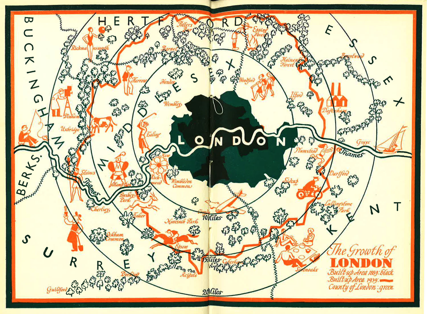
I was intrigued by this blog post of a lovely looking map of London’s Green Belt, dated 1939. The map can be compared a modern
More...