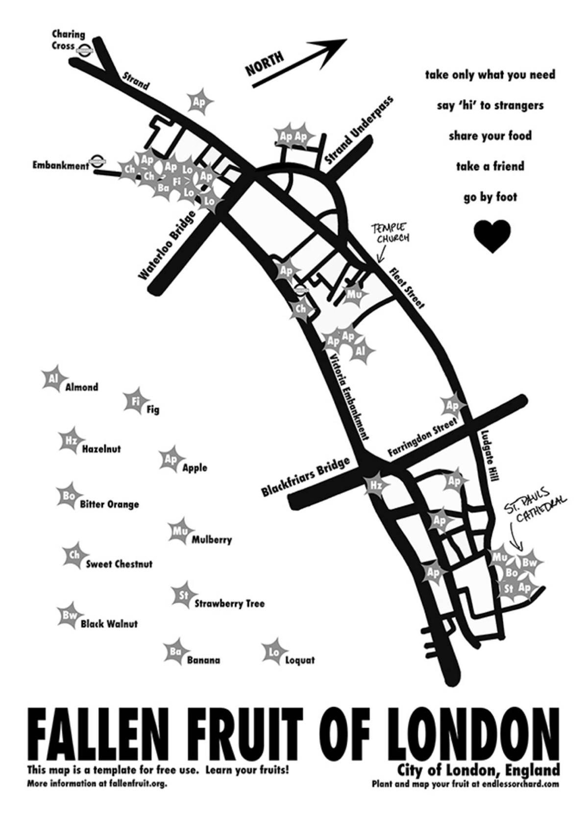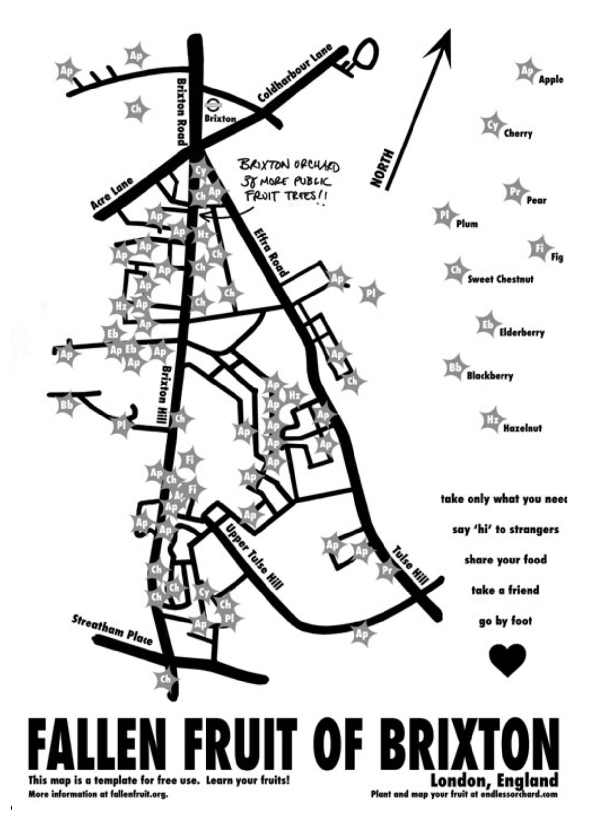
The Fallen Fruit project, by David Allen Burns and Austin Young in the US, allows communities to map publically owned/accessible trees in their neighbourhood which are likely groaning with fruit to eat, at this kind of year. There is an online Google-powered map, Endless Orchard, but Mapping London was particularly taken with their printed maps, some of which are on display as part of an exhibition on depictions of fruit, at the V&A Museum in South Kensington. The maps are quite spartan to look at but show a local street network, with stars indicating fruit trees, and codes inside the starts indicating the fruit type. “Ap” is the code if you like apples. The maps appear at the end of this online magazine.
London has as many trees as people. The ones on Fallen Fruit are either in, or overhanging, public spaces in London – so presumably fair game and not scrumping. Get them before the squirrels and pigeons do!

Fallen Fruit — https://t.co/0Xmq8HiYKP
Fallen Fruit https://t.co/Se3Mrs1RJz
Fallen Fruit – mapping publicly owned/overhanging fruit trees: https://t.co/mdb2enYiGv https://t.co/zIOGkZxDHE
I’m looking for the best place to photograph the plum blossoms.
Can anyone suggest a good place in Kensington.