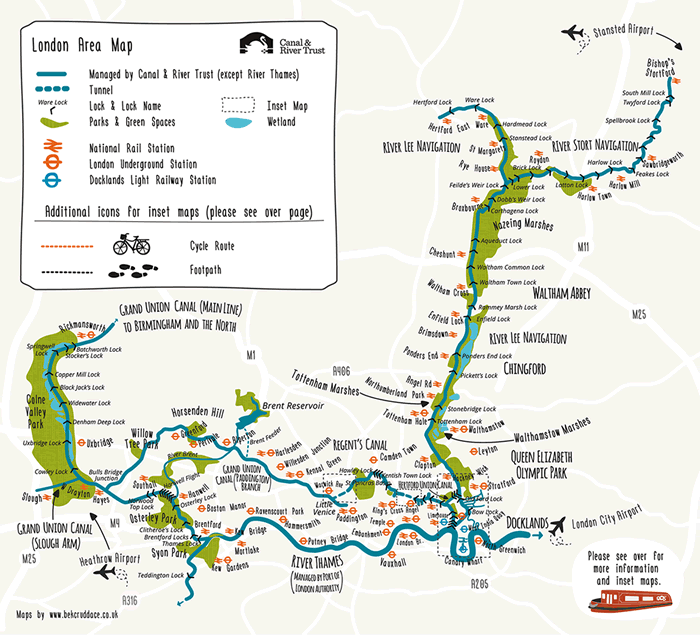
These attractive hand-drawn maps have been produced for a pocket guide “London’s Canals & Rivers” published by the Canal & River Trust by illustrator and cartographer Bek Cruddace. They show the navigable waterways around London, including the Thames and Lea Rivers and the Regent’s and Grand Union canals.
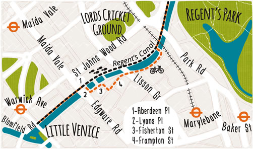
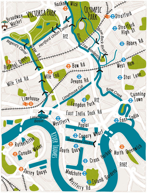
The maps are designed for walkers and cyclists using the towpaths beside the canals. The locations of the locks are marked, as are tube and railway stations, allowing a one-way walk to be planned. Insets show key sections where a specific route is needed:

I really like the strong but not garish colours, the subtle textures applied to the parks and urban areas, the hand-drawn tube roundels, and the attractive fonts. The rounded corners of the water features and parks also act to smooth and soften the graphic. It all comes together to create a both attractive and useful map.
Visit more of Bek’s creations, or her Etsy shop – with some more London cartographical artwork coming soon.
RT @MapLondon: London’s Canals & Rivers – lovely maps of London’s waterway network, drawn by @bekcruddace: https://t.co/MxGYFNzg3X https://…
Knowing the physical map of the place is very important, specially if you are planning to settle there. So if you are planning to live in London, make sure to be familiar with it’s map.