It’s very hot in London today, and tomorrow. It’s best not to be out and about at all, but if you need to be in
More...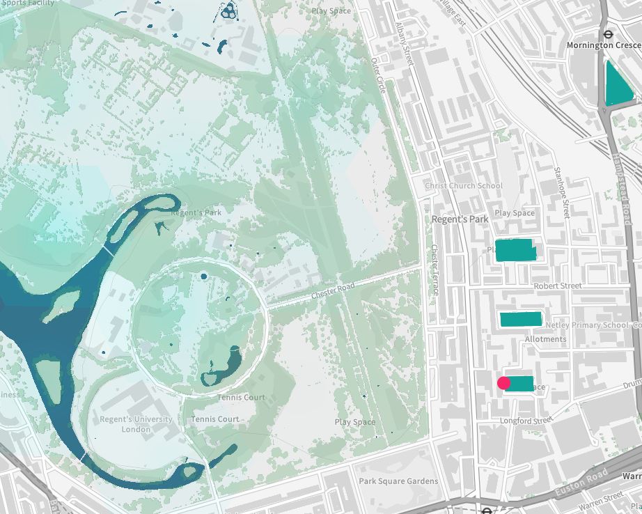
Highlighting the best London maps
It’s very hot in London today, and tomorrow. It’s best not to be out and about at all, but if you need to be in
More...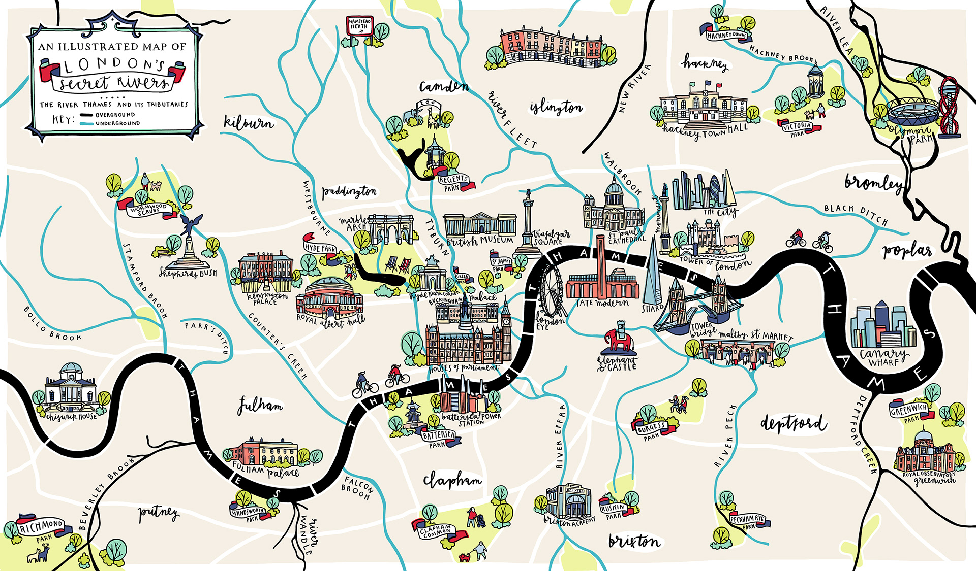
London has a lot more rivers than just the River Thames and River Lea – but many of the rest are either very small and
More...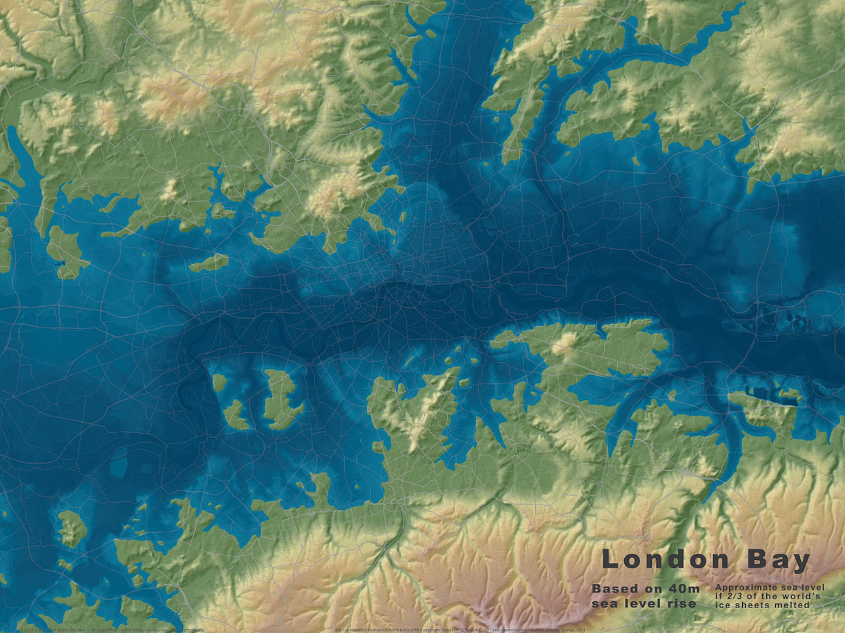
It’s a typical August day in London today, with the rain falling pretty heavily and at least one tube station closed due to flooding. London’s
More...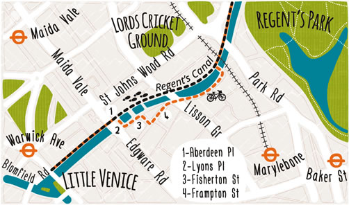
These attractive hand-drawn maps have been produced for a pocket guide “London’s Canals & Rivers” published by the Canal & River Trust by illustrator and
More...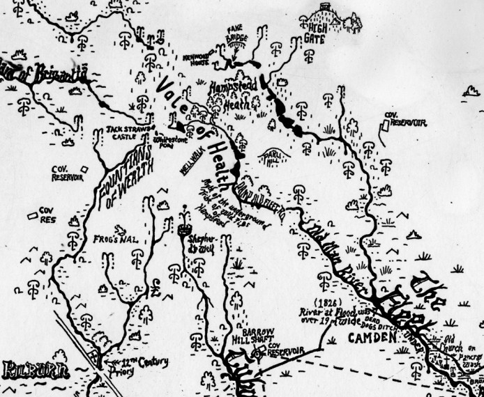
This is a new work by Stephen Walter, in his characteristic hand-annotated, monochromatic style. It features London’s watery features, in particular the many waterways. The
More...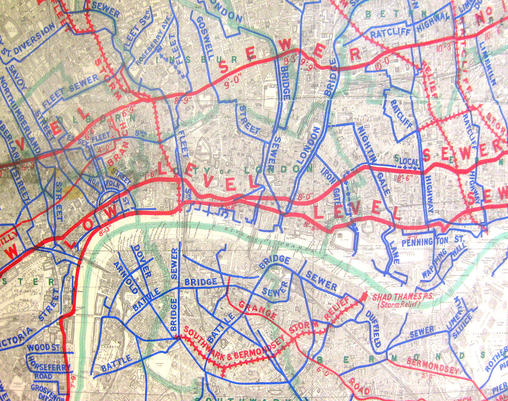
London has many networks – roads, tube trains, electricity, water – but there is another key one, one which was very important in allowing London
More...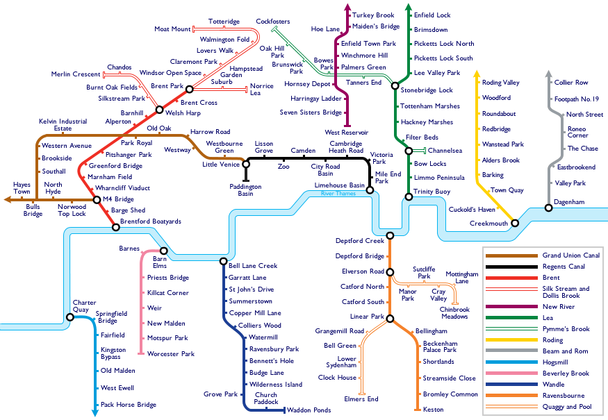
Travelling around London is a little harder today. With a tube strike on, the roads are clogged with traffic jams, and the pavements are full
More...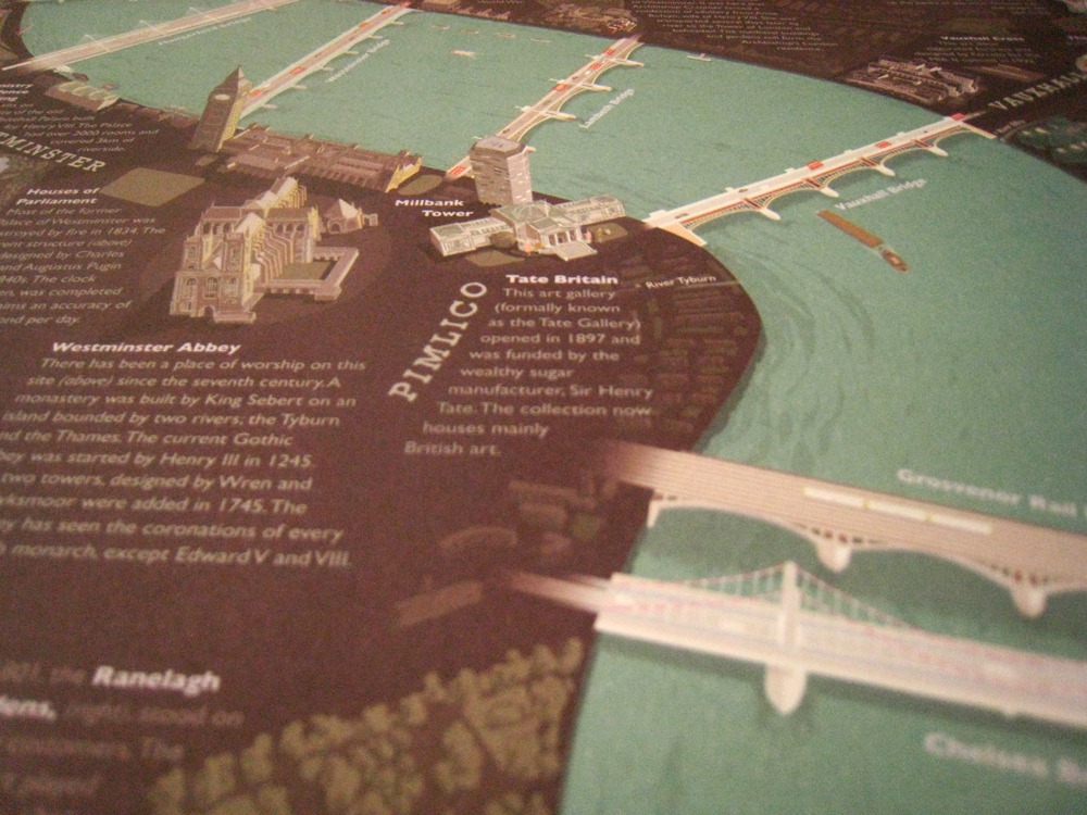
The London Thames is a new poster – a small extract is shown here – created by David Fathers, which features illustrations of the 16
More...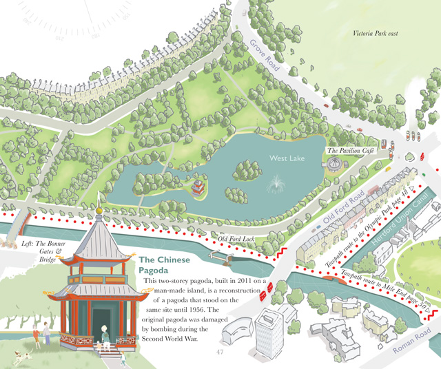
A book, by author and illustrator David Fathers, has recently been published, on the Regent’s Canal. It’s an engaging little book, part route finder, part
More...