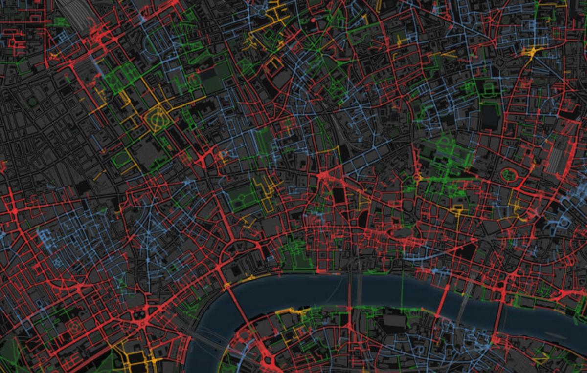

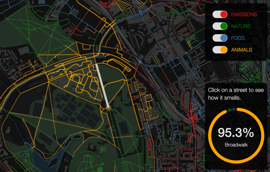
SmellyMaps reveals the “olfactory footprint of London” – the streets which are dominated by traffic fumes, the animal smells emanating out from London Zoo, and the influence of parks and greenspaces on London’s scent experience. Streets are measured for four smell groupings based on tags from Flickr photos calibrated from a smell taxonomy: emissions (coloured red on the map), nature (green), food (blue) and animals (yellow), the map colouring each road by the most dominant of the four. Clicking on the segment reveals the measurements. The results are attractively presented on a background map. SmellyMaps is an output from Bell Labs’ Daniele Quercia, based partly on many urban walks and surveys by RCA student Kate McLean, which created the smell taxonomy from which the Flickr and other social media data was categorised, creating the final map.
I wonder how big the smell footprint from the Lush cosmetic shops extends?
From a presentation by Daniele.
Is “animals” a fancy way to define “dog poop and urines”?
Having walked down Torrington Place recently, shortly after some mounted policeman had gone the same route, I can indeed confirm it smells of “animals”.
The link is broken!
Hi, thanks, the author has let me know that the new link is http://goodcitylife.org/smellymaps/index.html – I’ve updated the article to point to this now.
RT @MapLondon: SmellyMaps by @danielequercia et al – mapping street smells of London on an explorable map: https://t.co/ul6iOB4zpA https://…