To celebrate one year since the release of London: The Information Capital by Mapping London co-editor James Cheshire and graphic designer Oliver Uberti, and the book recently winning the BCS Award, the authors have released a number of new excepts from the book.
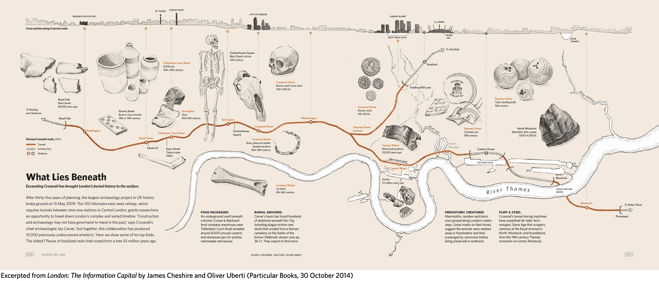
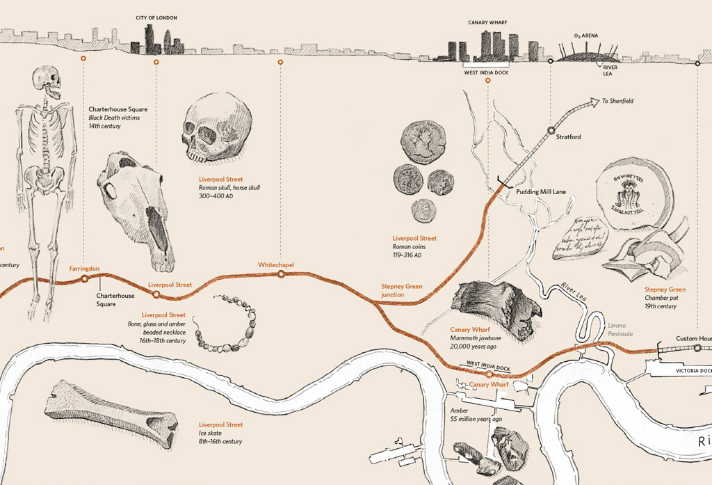
Here we feature “What Lies Beneath”, a map of the tunnelled sections of the forthcoming (2018+) Crossrail line that snakes right through central London. During the archaeological surveys that took place prior to excavating the tunnels, a wide variety of historic artefacts were found, some of which are celebrated in this graphic in the book, along with a map of the route itself and a cross-section of key buildings the line will pass by. From plague skeletons to woolly mammoths,
The cartography of the map is very pleasing to the eye, it combines the characteristic “sketch style”, with both the artefacts and the rail and river lines appearing as “pencil strokes”, but forming proper geographic map accurately showing the route. You can, by the way, see how Crossrail will mesh with the existing TfL routes in London on this interactive map (the line line is in purple on this latter map).
You can buy the book on Amazon. See also our previous feature on the official Crossrail tunnel map.
Sketches by Oliver Uberti with data from Crossrail.

One comment