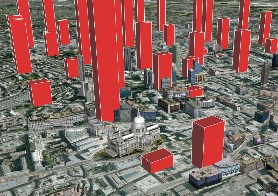

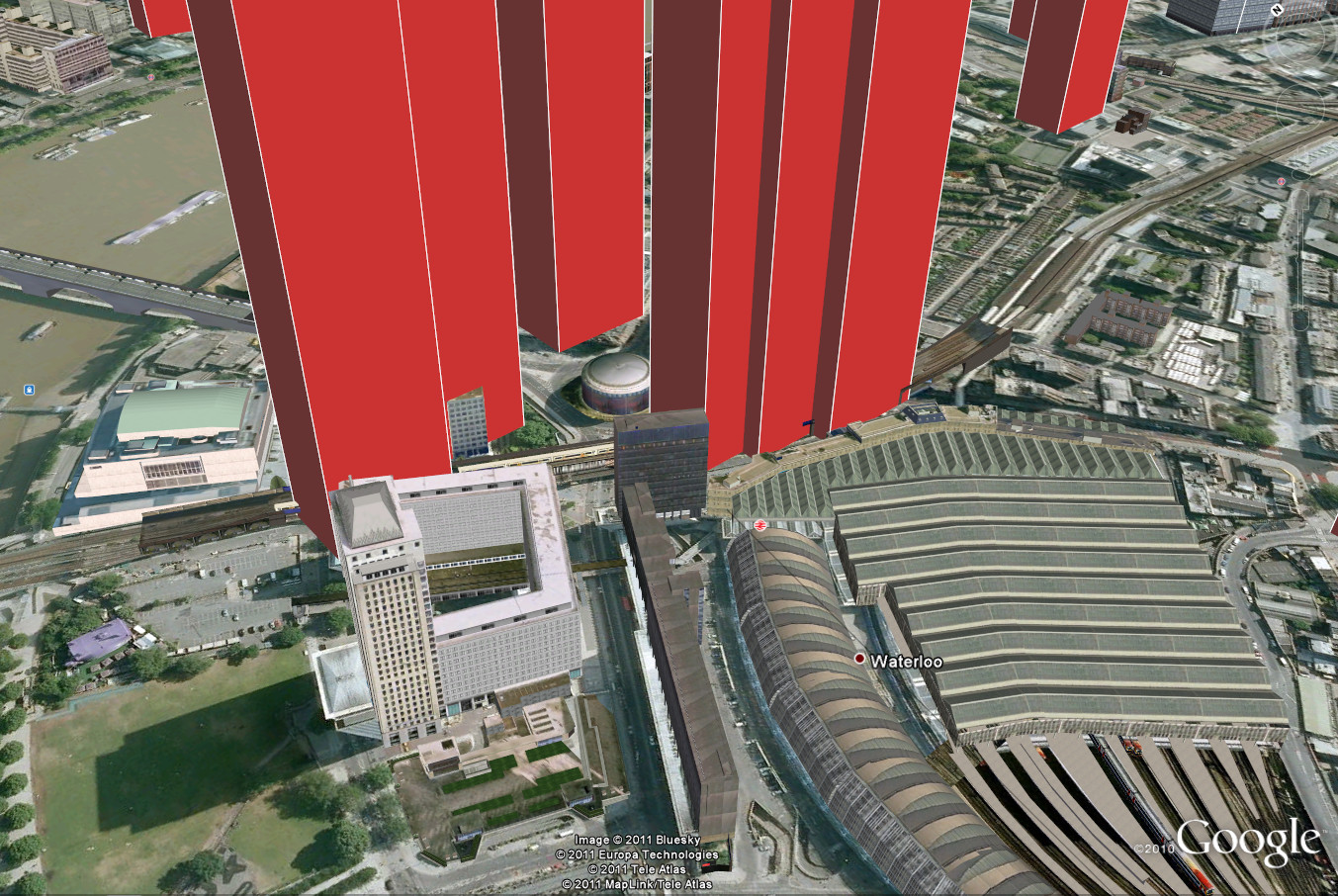
Adrian Short, provider of one of the main 3rd-party APIs for the Barclays Cycle Hire scheme in London – the Boris Bikes API – has taken his data and produced a live-updating KML file of the numbers of bike at each docking station, viewable in Google Earth.
Flying around central London in Google Earth, with Adrian’s KML file loaded in, reveals canyons of empty docking stations, mountains of bikes. In the pictures here, taken on a typical weekday evening, someone at St Paul’s Cathedral needing to hire a bike, would need to head northwards, as the bikes look a little lean on the ground to the south. However, Waterloo is surrounded by “towers” of available bikes, so anyone arriving at the station there would have no problem finding one to hire.
Background imagery is supplied by Google Earth and is copyright 2011 Bluesky, Europa Technologies, Tele Atlas and/or MapLink. The bike data is supplied by Adrian Short and scraped from the TfL website.
Has anyone produced a simple KML of the new, wider Barclays Cycle Hire docking station network? I’m in Sw6 and can’t find the new local stations in a KML (or a GPX) format. Thanks – sure it’s been done, just need to find it (then convince TfL they should do it for us!).
It’s available in XML format on the TfL developer area – a suitable XSLT will get it into KML or GPX.
I converted the XML locations to KML. You can access them here:
https://www.google.com/maps/d/u/0/viewer?hl=es-419&authuser=0&mid=1t0S7Tp7mq3L0YvRqpPK2hPAHauQ
updated today 16/10/16
JTC! You’ve saved me a lot of time! Many thanks
Deat Ollie,
I am a student, and I am doing a research about public bikes in London.
I am using gephi I don’t know if you know the program.
I have some problems with the location of stations in the map of the program. Do you know someone can help me with this problem?
Many Thanks
I am sorry If I disturb you
Best
Hi Eduardo. The locations of stations are available from the TfL Open Data portal: https://www.tfl.gov.uk/info-for/open-data-users/