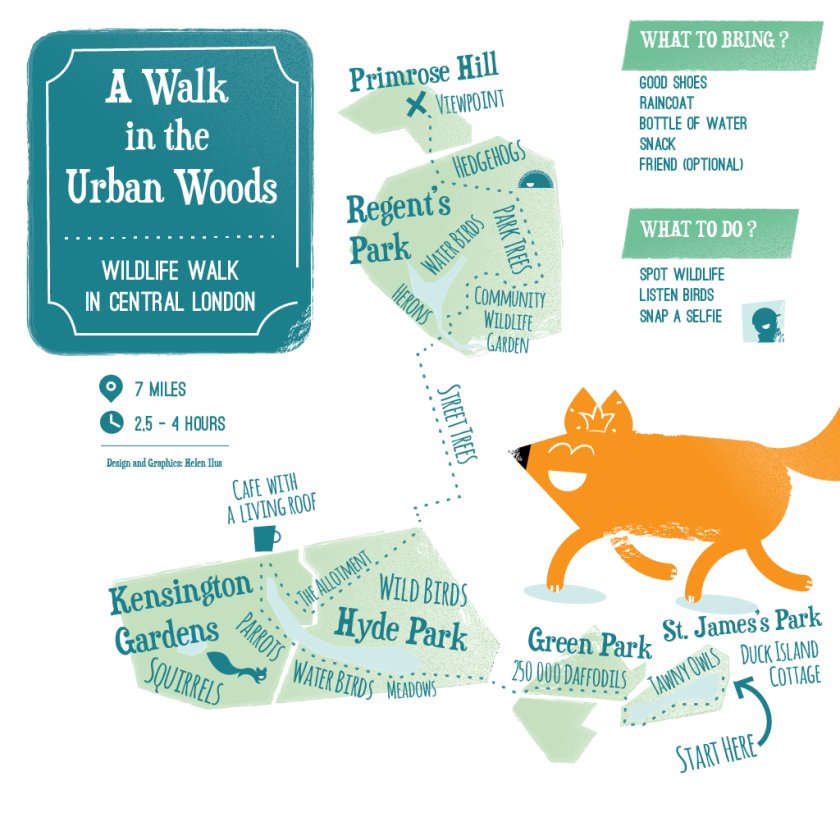
This artistic map of a green walking route in central London has been created by graphic designer Helen Ilus. By showing just the parks that are the focus of the walk, and not the rest of London’s hustle and bustle, it is an effective and attractive way of highlighting the walk. The walk goes from St James’ Park and its Duck Island Cottage, to the viewpoint back across the centre of the capital, on Primrose Hill. By combining this kind of thematic map with Google Maps or a regular street map, the walker has all they need for a pleasant, urban day out.

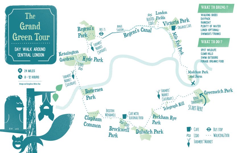
For those for whom seven miles is a little short, this 24 mile extravaganza – The Grand Green Tour, is a big loop around many inner London parks, both north and south of the River Thames.
You will, for sure, be tired after 12 hours of pounding the pavements, so it’s a good one for a cycle, or for splitting into a several legs. A third graphic from Helen, “Wild Weekend”, looks further out from central London, framing two walks in outer London – the North walk being focused around Hampstead, Finsbury Park and the Lea Valley, the South walk going from Barnes to Richmond and Bushy Park, with a suggestion that each walk will comfortably fill a day:
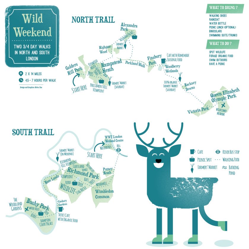
Mapping London really likes the strong design elements of these maps – greens and blues, and plenty of white space to present a decluttered look. You might know some or all of these parks already, if you live in London – but did you know you can link them together efficiently in this way?
Created By Helen Ilus. Images from the illustrator’s Twitter account.
A Walk in the Urban Woods — https://t.co/kiH5IQsdik
A Walk in the Urban Woods by @HelenIlus – four walking routes that each link a number of London’s many parks togeth… https://t.co/vjPkfwfryv
Excellent, 👌