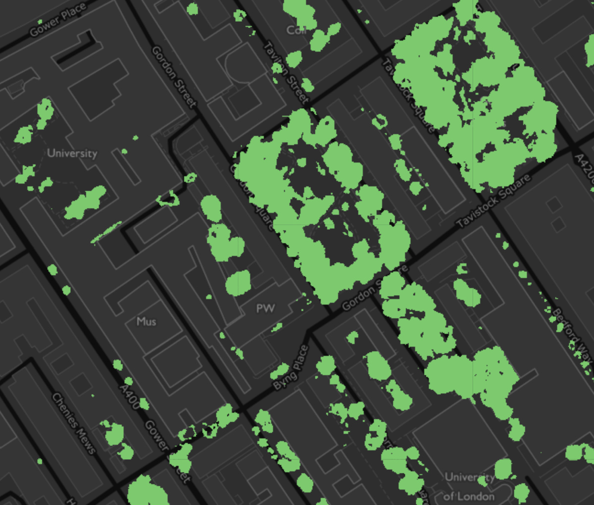
The Greater London Authority has published a data map, showing the locations within London where tree canopies can be seen from overhead. There are about as many trees as people in London, and 21% of the capital’s land area is covered by them. This is an impressive number – this must make London one of the greenest large areas in England. Some of the home countries have perhaps 25%+ tree coverage, but most other “rural” areas are dominated by farmland or moorland, rather than forest.
You can see the map at https://maps.london.gov.uk/canopy-cover/. The data and methodology has also been published.
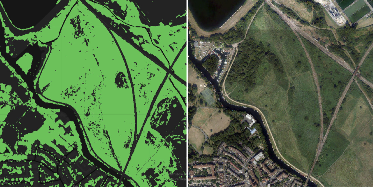
The data was automatically detected from aerial imagery by machine learning. I do have my concerns about it – for example, this area to the left of the curved of the railway line is shown as forest on the map, but actually it is a grassy field:

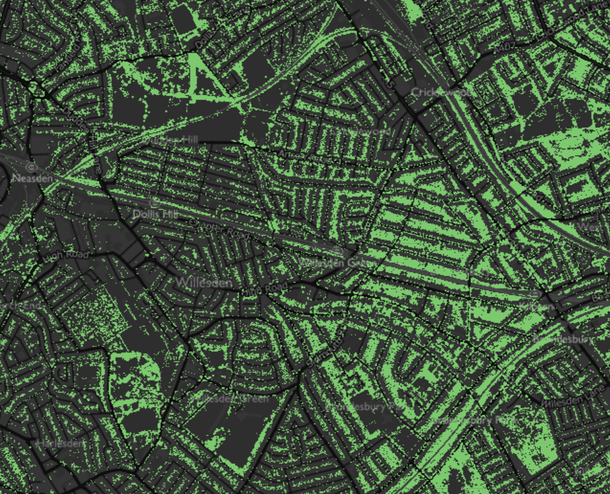
In some residential terraced areas, the back gardens also tend to be entirely full of tree canopies, which seems a little surprising – even if a single tree’s canopy will cover much of a typical small inner London garden, I can’t believe it would cover all of it. So it’s a good first analysis of London’s tree cover, but does need some refining. The main data source is imagery in various wavelengths from the SENTINEL satellite. An obvious additional datasource for refinement would be LIDAR (which is released as open data by the Environment Agency, often at sub-metre horizontal resolution), which can accurately detect height changes. Trees tend to have a characteristic canopy shape and variation (i.e. they are not completely flat) and also comparing LIDAR DTM and DEM heights should show, for example, a green field where the grass is 1 metre tall, is not a field of trees. The map’s methodology report acknowledges that LIDAR would be a good additional source.
This is a good first-pass map of London’s tree coverage though, and it’s open data too, which is great.
The data was produced by Breadboard Labs for the GLA.


Tree Canopy Cover — https://t.co/tDupINmTuR
A map of the tree canopy in London shows how green it is. https://t.co/9KgsemotDd via @MapLondon
Mapping London’s trees: A new data map from @LDN_data of London’s tree canopy cover – up to 21% of the capital coul… https://t.co/mVeQn7EdZS