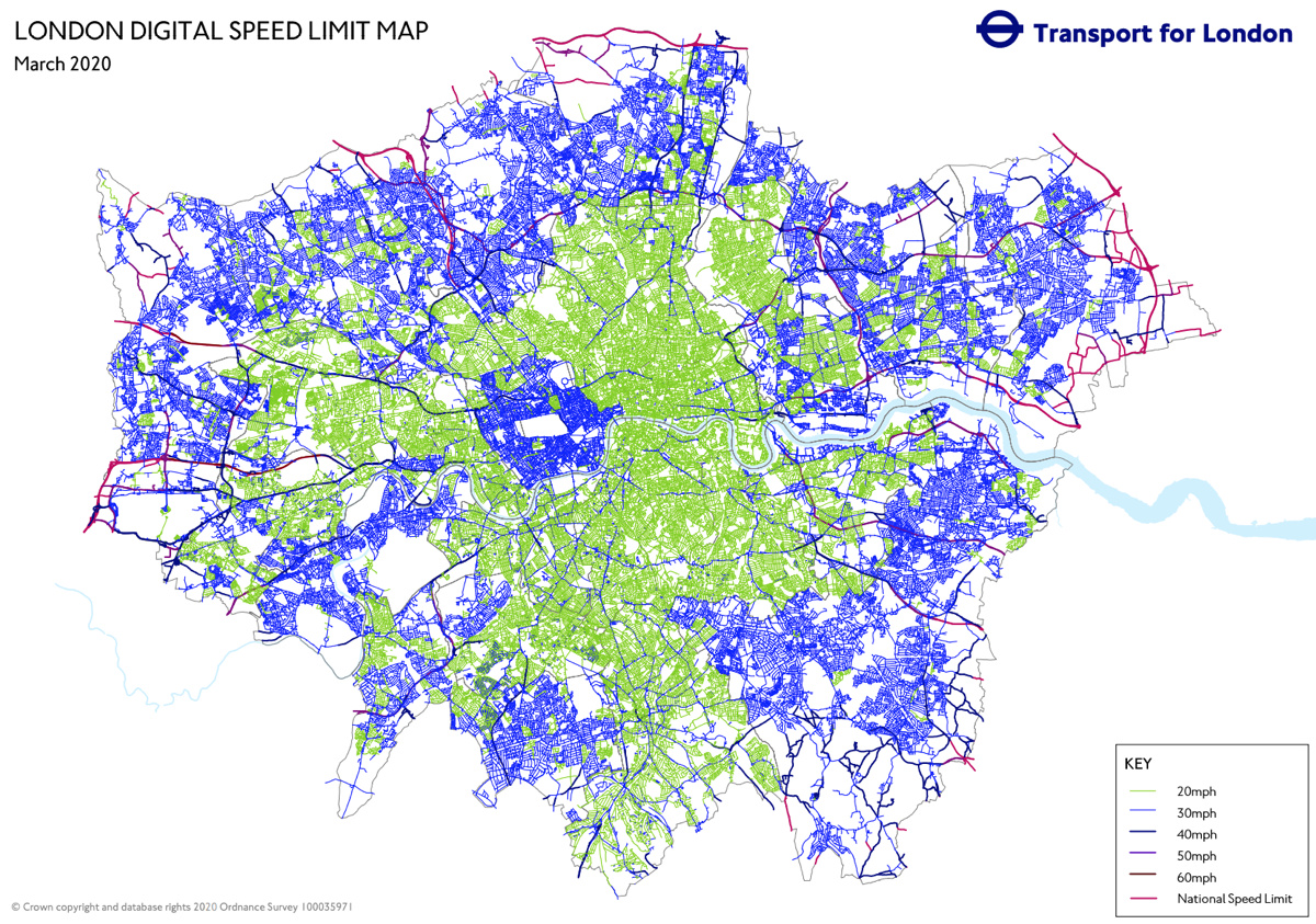
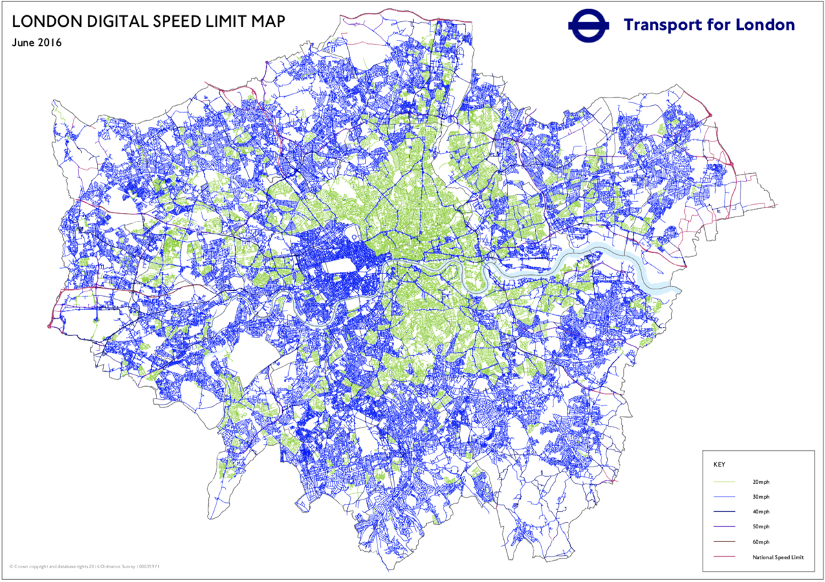
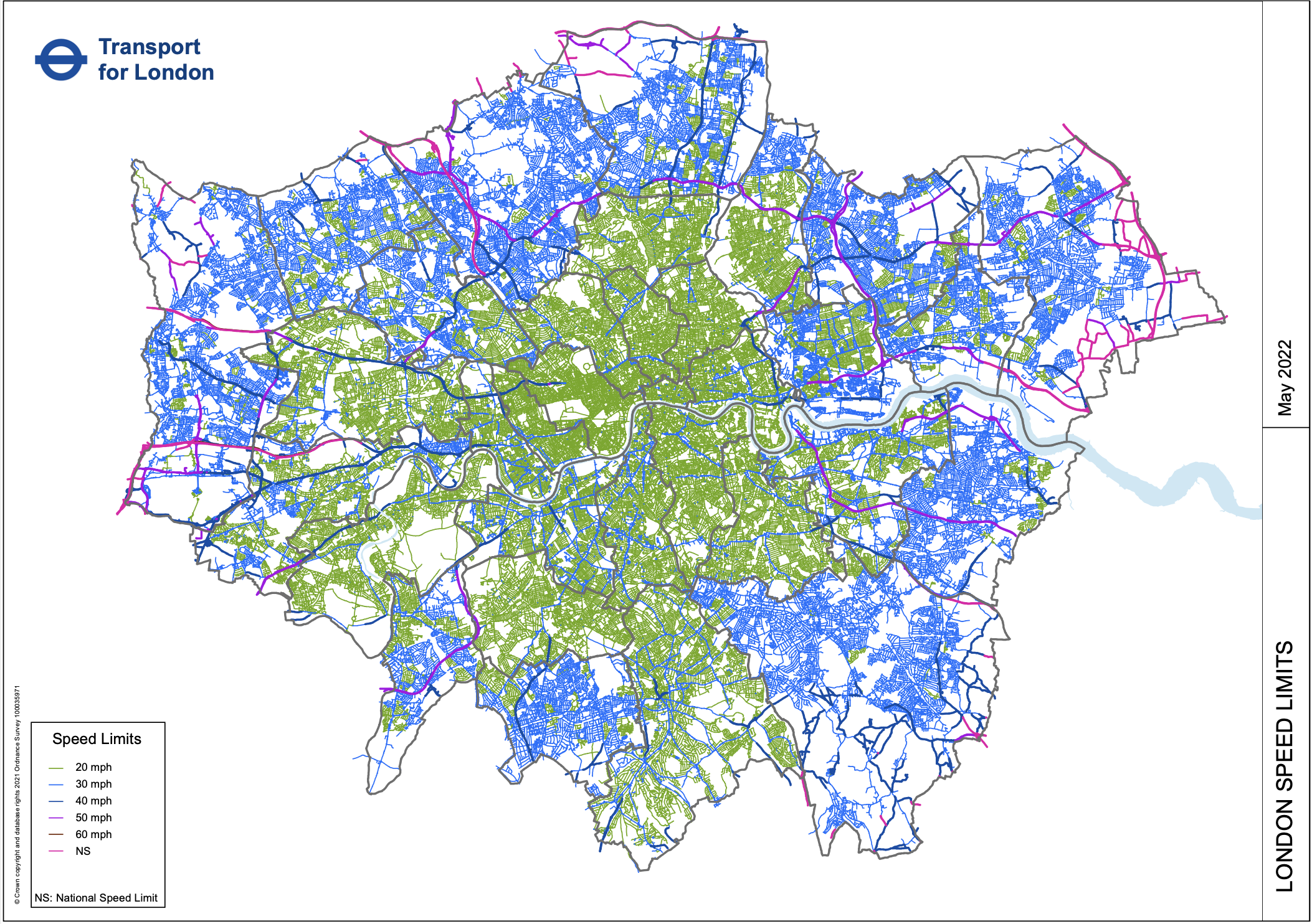
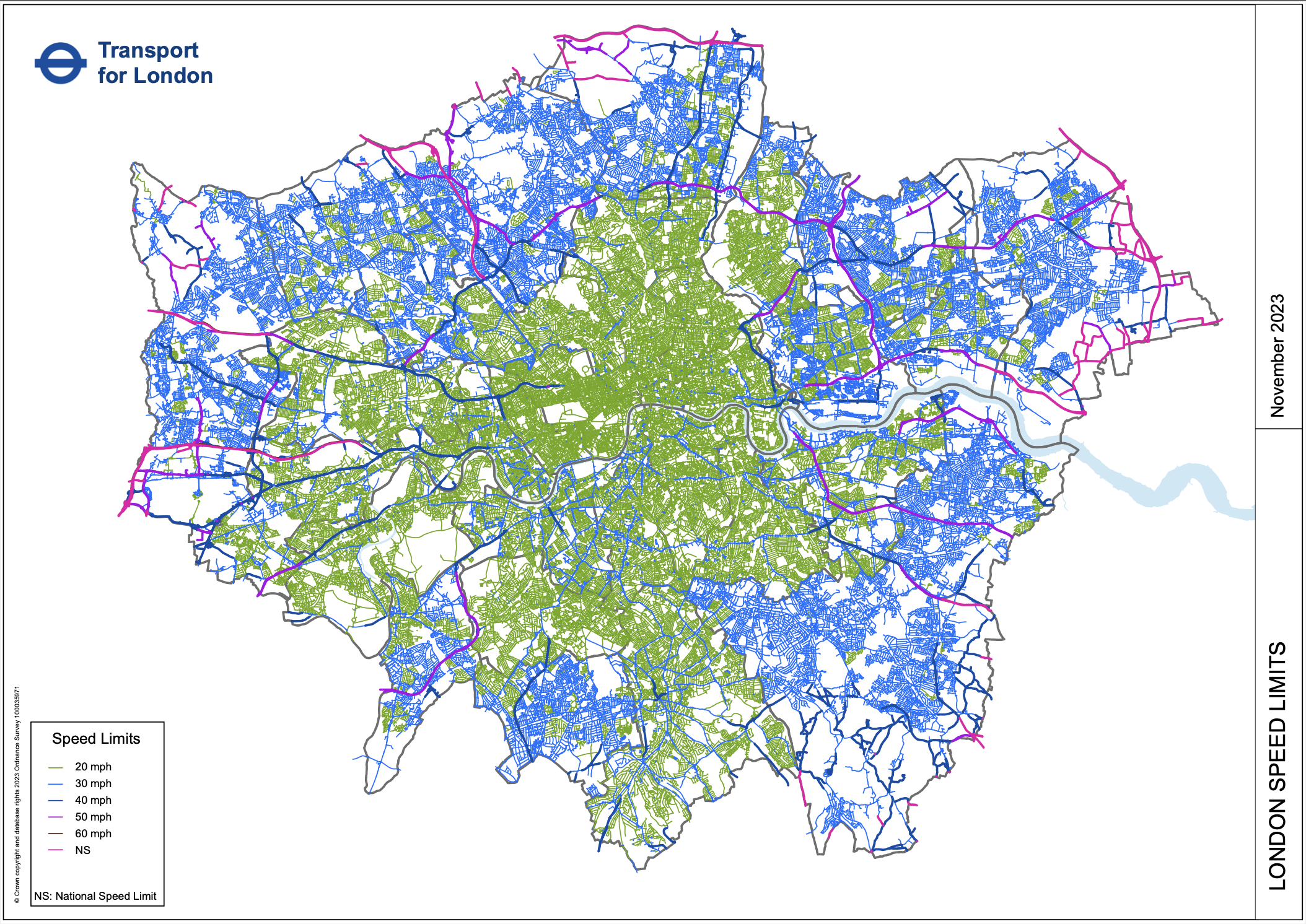
Transport for London have published a London Digital Speed Limit Map (no longer online), showing speed limits for cars on a map of London’s public roads, for the last few years. It is updated regularly. The map is a graphical representation of data supplied to digital mapping data providers, so that they can program in the correct speeds for satnavs in cars.
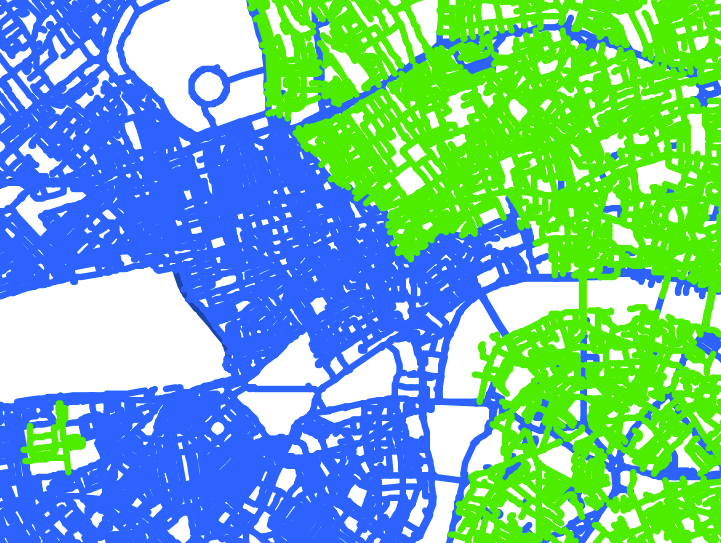
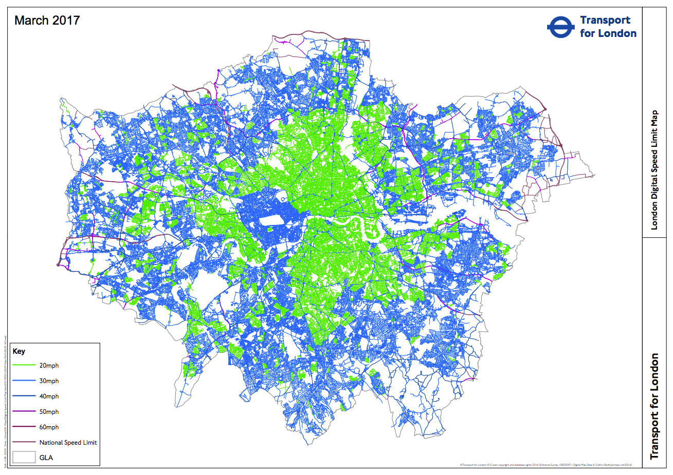
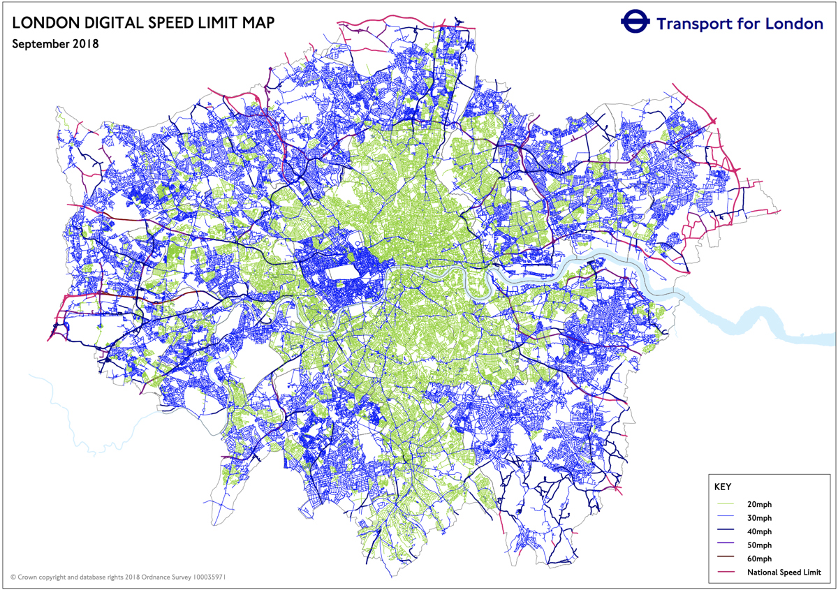
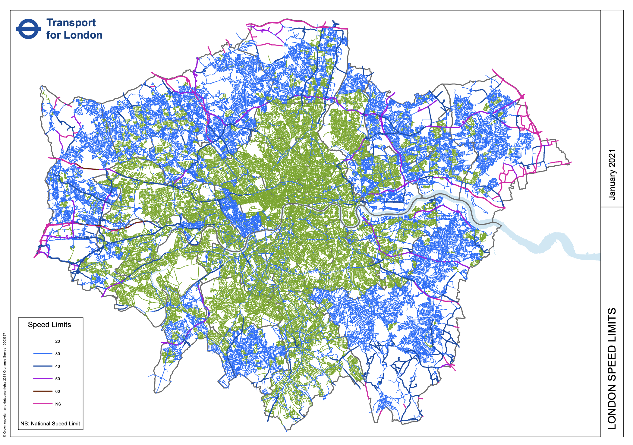
The updates over the last few years reveal the gradual switch, in inner-city London boroughs, from 30mph (blue) to 20mph (green) limits for residential roads. In 2017 and 2018, this has resulted in a glaring hole in west-central London, where Westminster, Kensington & Chelsea and Wandsworth boroughs have resolutely stuck to allowing motorised traffic to travel at up to 30mph in residential areas, with a few small area exceptions (e.g. Queen’s Park in Westminster borough).
This is not a particularly pretty map to look at, being essentially the output from a GIS (geographic information system) rather than a cartographically produced work designed for regular viewing. The 20/30 split is clear but the colours used to distinguish 30/40, and 50/60/National are hard to see – not that many roads in London have speed limits about 30mph anyway. The trends described above, however, are clear. Zooming in a long way helps, revealing your local familiar street network. Nonetheless, it deserves inclusion on Mapping London as it is an important snapshot of how different parts of London are evolving from car-centric design to a more inclusive street scene.
Spot the Westminster borough boundary:
Historic Versions
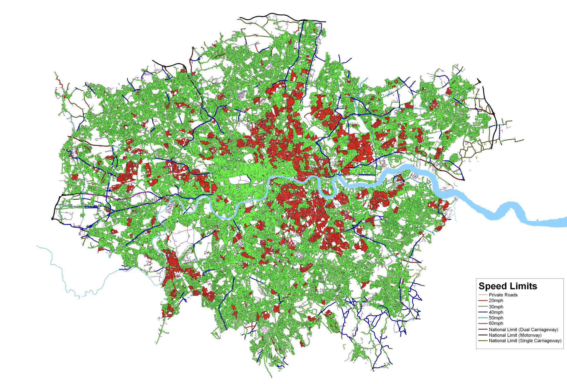
Here’s various versions of the map, from 2009 and then yearly from 2016 until the last on which was publish in November 2023:
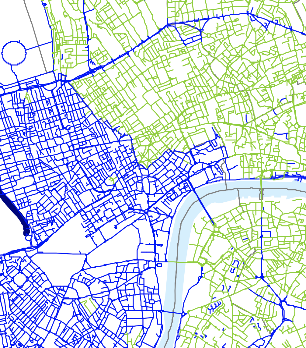
As well as these official maps, OpenStreetMap contributors have been diligently adding speed tags to the roads of London (and indeed the rest of the world) and a special ITO World render (no longer online) shows them on a similar, but prettier, map:
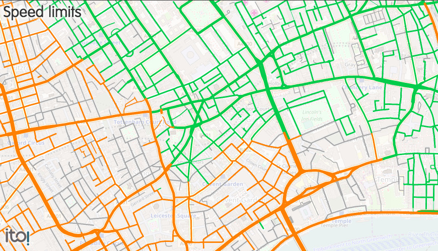
The top maps are © Crown copyright and database right Ordnance Survey and © Collins Bartholomew. The last map is © OpenStreetMap contributors with the map tiles © ITO World and CC-By OpenStreetMap contributors.
Speed Limit Map https://t.co/J1wdmt9N09 | #GIS #mapping
Speed Limit Map | Mapping London at https://t.co/pvUWT3HwaV
RT @MapLondon: TfL’s newly updated map of the speed limits across London (green =20, blue=30) & an OpenStreetMap-based alternative: https:/…
The link to the PDF version of the map is broken. It’s
http://mappinglondon.co.uk/2017/speed-limit-map/content.tfl.gov.uk/digital-speed-limit-map.pdf
But should be
http://content.tfl.gov.uk/digital-speed-limit-map.pdf
RT @MapLondon: TfL’s newly updated map of the speed limits across London (green =20, blue=30) & an OpenStreetMap-based alternative: https:/…
Link to pdf of digital speed map doesn’t work
Thanks Thomas – fixed now.
RT @MapLondon: TfL’s newly updated map of the speed limits across London (green =20, blue=30) & an OpenStreetMap-based alternative: https:/…
Speed Limit Map of London https://t.co/ZbHgU305c5
RT @GeoNe_ws: Speed Limit Map of London https://t.co/ZbHgU305c5
Updated @TfL map of London’s speed limits: a 20mph halo (green) surrounding Wmstr’/Kens&C 30mph (blue):… https://t.co/oE8XHkhrc5
Updated @TfL map of London’s speed limits: a 20mph halo (green) surrounding Wmstr’/Kens&C 30mph (blue):… https://t.co/Uh6LwmO2J1
RT @oobr: Updated @TfL map of London’s speed limits: a 20mph halo (green) surrounding Wmstr’/Kens&C 30mph (blue): https://t.co/wBahNbmCp6 (…
RT @oobr: Updated @TfL map of London’s speed limits: a 20mph halo (green) surrounding Wmstr’/Kens&C 30mph (blue): https://t.co/wBahNbmCp6 (…
RT @oobr: Updated @TfL map of London’s speed limits: a 20mph halo (green) surrounding Wmstr’/Kens&C 30mph (blue): https://t.co/wBahNbmCp6 (…
RT @oobr: Updated @TfL map of London’s speed limits: a 20mph halo (green) surrounding Wmstr’/Kens&C 30mph (blue): https://t.co/wBahNbmCp6 (…
RT @oobr: Updated @TfL map of London’s speed limits: a 20mph halo (green) surrounding Wmstr’/Kens&C 30mph (blue): https://t.co/wBahNbmCp6 (…
RT @MapLondon: Updated @TfL map of London’s speed limits: a 20mph halo (green) surrounding Wmstr’/Kens&C 30mph (blue): https://t.co/0it8XDU…
Thanks for sharing and fixing the link to the PDF version.
Thanks for posting
Can anyone overlay with borough boundaries
Highlights the potential and opportunity for “20 is plenty” on London wide basis
RT @oobr: Updated @TfL map of London’s speed limits: a 20mph halo (green) surrounding Wmstr’/Kens&C 30mph (blue): https://t.co/wBahNbmCp6 (…
RT @oobr: Updated @TfL map of London’s speed limits: a 20mph halo (green) surrounding Wmstr’/Kens&C 30mph (blue): https://t.co/wBahNbmCp6 (…
RT @MapLondon: TfL’s newly updated map of the speed limits across London (green =20, blue=30) & an OpenStreetMap-based alternative: https:/…
RT @MapLondon: Updated @TfL map of London’s speed limits: a 20mph halo (green) surrounding Wmstr’/Kens&C 30mph (blue): https://t.co/0it8XDU…
The link to TfL’s PDF is broken.
Thank you for letting me know, I have updated the link now.