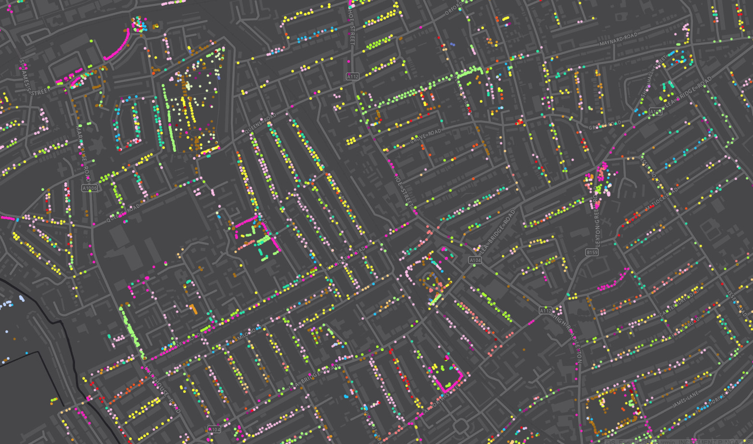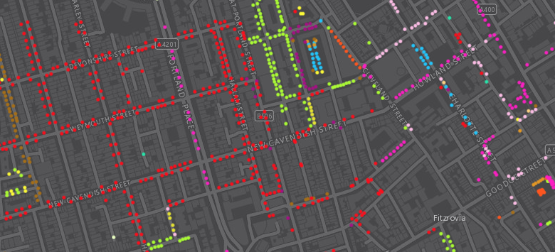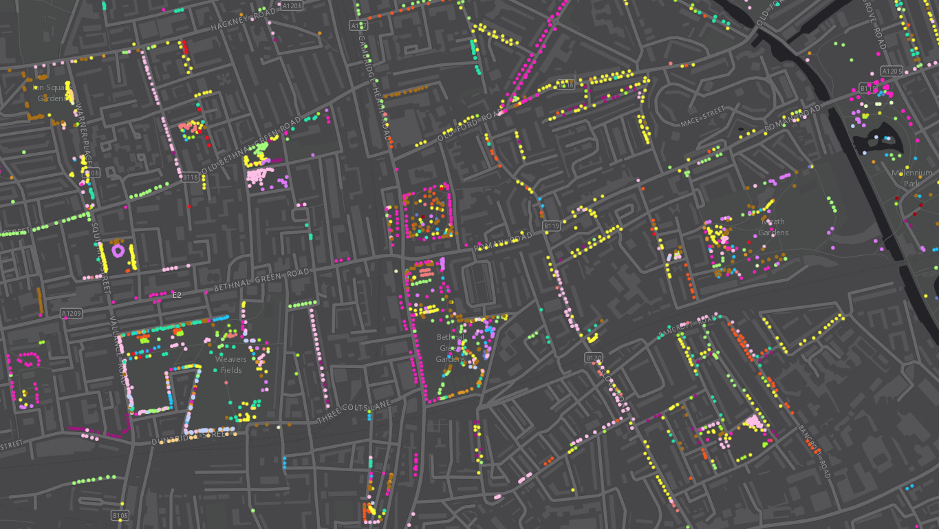
Following a data release of Southwark’s publically maintained trees a couple of years back, the Greater London Authority recently published a map which shows street trees (trees along roads and public paths, and trees in public open spaces, such as small parks and other minor green areas). Each borough has its own tree database and not all boroughs have, at the time of creation of the map, supplied their data, so the map is a little incomplete (for example, it includes Islington and Tower Hamlets, but not Hackney which lies between the two, except alongside TfL-managed “red route” roads). Still, it has good coverage in many parts of London and reveals interesting patterns, not only in planting patterns differing coverage across different streets, but also the variation of species – for example, the red dots in the extract below show lines of pear trees in Marylebone. In total, there are currently 700,000 trees shown, out of a total of around 8 million across London (including those on private land, in forests, and in major parks not managed by the councils.)

The GLA has published the underlying data on the London Data Store as a huge CSV file, along with notes about the collection process. 25 of London’s 32 boroughs released the data in a form which was easy to map, so for 7 borough the map remains largely blank. Within each borough, the level of detail, and the scope of the trees recorded varied.
Boroughs can be reluctant to release such data, as tree damage and ownership disputes can arise from such datasets, but it’s great to see this information, showing the greening of what can be a gritty urban streetscape, being made available to all.
See the map here.
Download the data here.
The map is data driven and so, in order to prevent thousands of tree datapoints from clogging up your browser, it doesn’t allow you to zoom out and see the whole of London at once.

Copyright the Greater London Authority and the respective borough councils. Background: ESRI/HERE/OS.

London’s Street Trees — https://t.co/yPuaJXKlOU
Excellent map… London’s Street Trees https://t.co/V7o1CUYkDj
New post on CASA blog: London’s Street Trees https://t.co/PJAZSKas7F
London’s Street Trees https://t.co/LLucymZ1bM | #GIS #mapping
RT @TheMapAddict: London’s Street Trees https://t.co/LLucymZ1bM | #GIS #mapping
London’s Street Trees: https://t.co/HZebxVuuOU https://t.co/hw29PIjfJv
London’s Street Trees. #analytics #rstats https://t.co/aOCOzTVHOn
https://t.co/6qBAE1Lu77
London’s Street Trees | Mapping London https://t.co/4xVac9e9Xw
RT @MapLondon: London’s Street Trees: https://t.co/HZebxVuuOU https://t.co/hw29PIjfJv
A #Coolmaps of London’s Street Trees https://t.co/D6XSLtDFBr via @MapLondon
London’s Street Trees https://t.co/D7blquC54T via @MapLondon
RT @MapLondon: London’s Street Trees: https://t.co/HZebxVuuOU https://t.co/hw29PIjfJv
RT @MapLondon: London’s Street Trees: https://t.co/HZebxVuuOU https://t.co/hw29PIjfJv
RT @MapLondon: London’s Street Trees: https://t.co/HZebxVuuOU https://t.co/hw29PIjfJv
RT @MapLondon: London’s Street Trees: https://t.co/HZebxVuuOU https://t.co/hw29PIjfJv
RT @MapLondon: London’s Street Trees: https://t.co/HZebxVuuOU https://t.co/hw29PIjfJv