
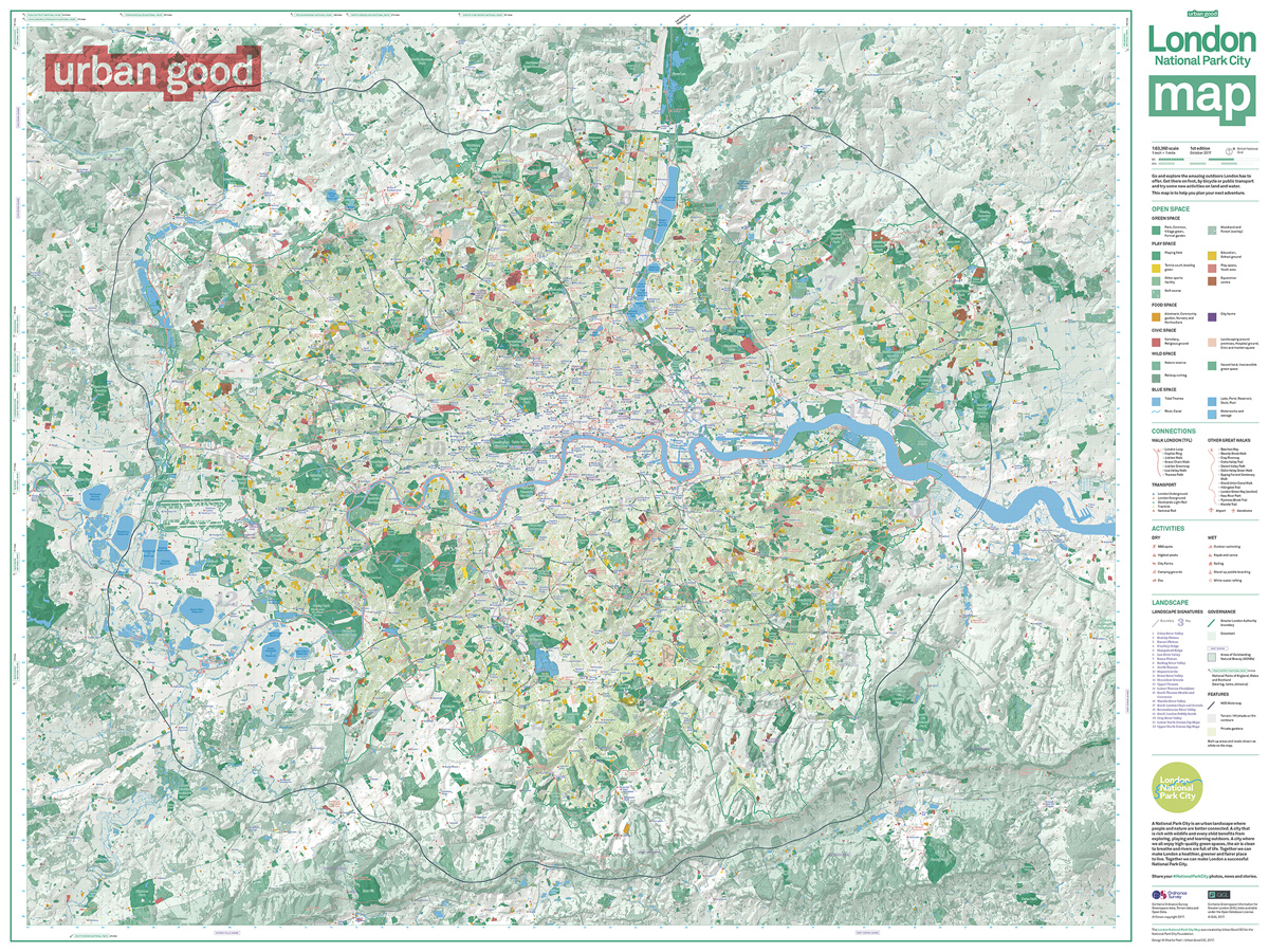
Urban Good, a new community interest company created by Charlie Peel, have this month published the first edition of their London National Park City Map. This huge (over 1 metre wide when unfolded) paper map covering the whole of London, was created through a crowdfunding campaign, and is available from Urban Good’s web store for just a payment of a postage and handling fee. (N.B. temporarily out of stock, but you can pre-order for delivery expected soon). It’s part of a campaign, led by Dan Raven-Ellison, to designate London as the UK’s first National Park city – along the way, increasing the awareness and use of the capital’s many and varied green spaces, to further the fitness and health of Londoners and visitors. The campaign has caught the eye of the London Mayor, and this map has the support of the Greater London Agency.
The map was produced using Ordnance Survey and GiGL (Greenspace Information for Greater London) data and aims to map all of London’s green space and water. When you include private gardens, it’s is estimated that almost 50% of London is green or blue.
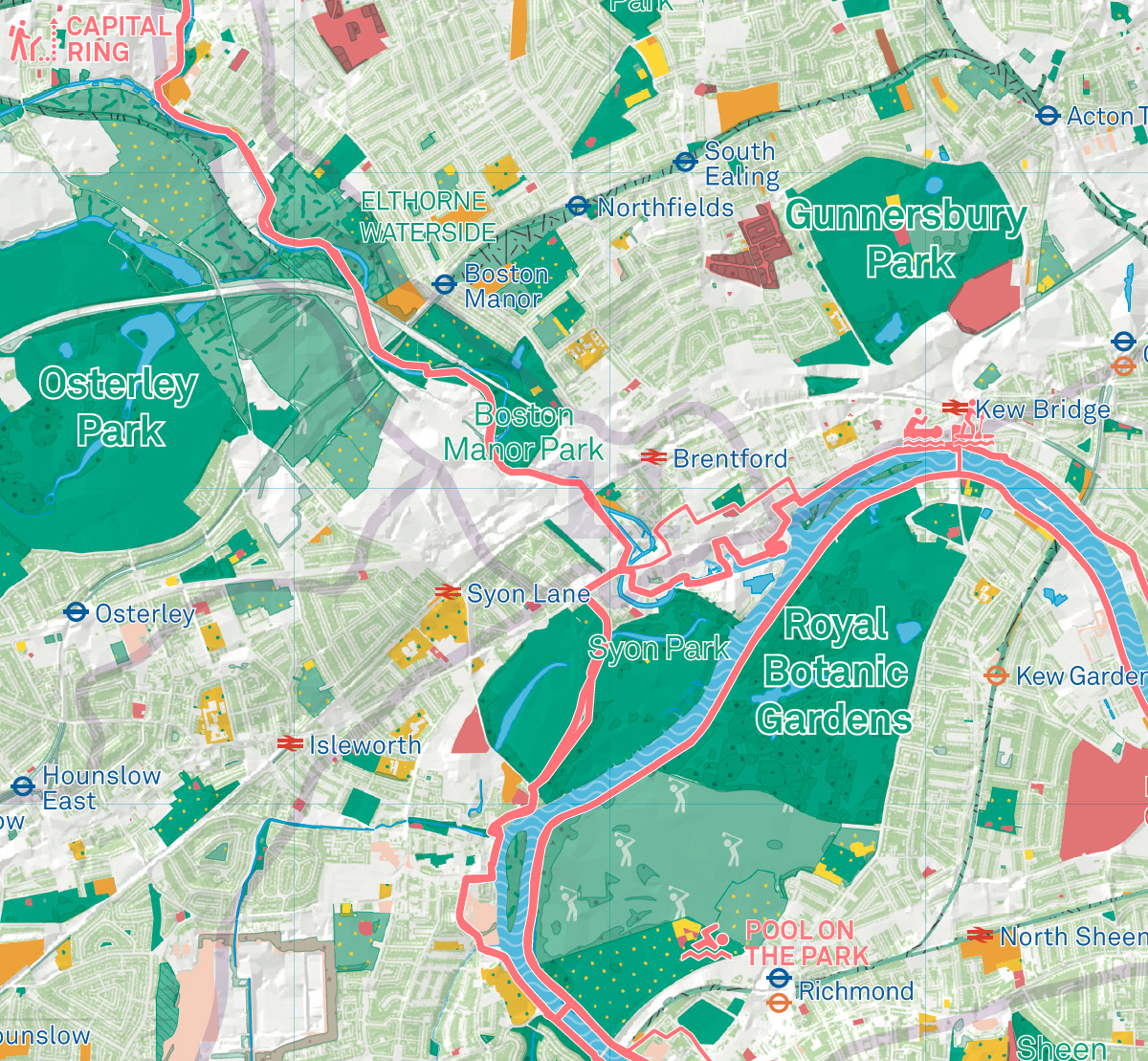
Urban Good have created a detailed map which has many functions – as well as mapping the green and blue space, it highlights public parks, allotments, marked walking trails, city farms, allotments, cemeteries and nature reserves. It also shows the city’s highest peaks and is indeed overlaid with a hillshade texture to show the slopes and hills. This has the effect of blurring and pixelating the garden/water detail below it – a printing quirk when combining raster field data like this with the vectors of the park outlines and captions means that the whole image is typically rasterised when sending to a lithographer or digital printer – but this is perhaps as the creator intended. After all, private gardens are good for the green “stats” of London, and the wildlife, but ultimately it’s the public parks which are layered above the hillshade which are the key useful local landmark this map will guide you, the user, to:
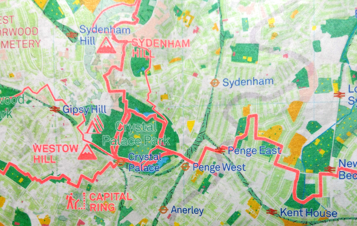
The neon pink colour for point landmarks and trails is certainly distinctive – it contrasts with the green, and although red/green colours together don’t traditionally work well on a map, the use of white buffering and careful cartography means it retains readability here.
Roads, railway lines and buildings, i.e. “non-natural” features, are consciously left out of this map, making finding yourself on the map initially a challenge. However, icons and labels for tube and rail stations are included, and their density in London is such that you can generally locate from these, along with the “inverse” road network – the arrangement of private gardens generally indicating the roads nearby, although the hillshading dots and “noise”, mentioned above, makes this a little frustrating as a navigational aid.
Clarity is also impacted by the bright colours on the graphics on the inverse of the map, which do appear through the relatively thin sheet of paper. Incidentally, outside of the Greater London boundary, private gardens aren’t shown. This has the somewhat converse effect of improving the clarity of the map outside of London, although it is harder to locate yourself here.
On the rear of the main map, once you unfold it (and realise how big it is – it’s just like a classic Ordnance Survey Landranger map!) are a series of smaller maps, infographics and lists, highlighting London’s gardens, waterways, scenic areas and so on. It’s a little hard to first access and then read this additional information. Ultimately, the extra graphics here would look great in book form – hopefully a green London guide might follow from the Urban Good project. An online version would also be lovely to have, a more easily accessible if less tangible product. The map itself is a wonderful, clean and comprehensive work, and the issues described above simply arise during the transfer to the physical product.
Producing a full-size, printed map, one which would require almost the width of a tube carriage to unfold in full, is a brave thing do to today, in a world of Google Maps on everyone’s smartphone, mapping a constantly evolving and developing city into a paper product and then giving it away for almost nothing. But if it helps Londoners discover and explore a new public green space (out of the several thousand that appear) then that must be a good thing.
Photos from the Urban Good website and a hard-copy map sent courtesy of Charlie Good.
London National Park City Map — https://t.co/iczL1LcUxC
London National Park City Map https://t.co/vpkZWmG2PH | #GIS #mapping
RT @MapLondon: Mapping London reviews the London National Park City Map – a huge fold-out paper map produced by @urbangoodcic https://t.co/…
London National Park City Map https://t.co/sPUw2avdWz
RT @MapLondon: Mapping London reviews the London National Park City Map – a huge fold-out paper map produced by @urbangoodcic https://t.co/…
RT @MapLondon: Mapping London reviews the London National Park City Map – a huge fold-out paper map produced by @urbangoodcic https://t.co/…
RT @MapLondon: Mapping London reviews the London National Park City Map – a huge fold-out paper map produced by @urbangoodcic https://t.co/…
RT @MapLondon: Mapping London reviews the London National Park City Map – a huge fold-out paper map produced by @urbangoodcic https://t.co/…
RT @MapLondon: Mapping London reviews the London National Park City Map – a huge fold-out paper map produced by @urbangoodcic https://t.co/…
RT @MapLondon: Mapping London reviews the London National Park City Map – a huge fold-out paper map produced by @urbangoodcic https://t.co/…
RT @MapLondon: Mapping London reviews the London National Park City Map – a huge fold-out paper map produced by @urbangoodcic https://t.co/…
RT @MapLondon: Mapping London reviews the London National Park City Map – a huge fold-out paper map produced by @urbangoodcic https://t.co/…
RT @MapLondon: Mapping London reviews the London National Park City Map – a huge fold-out paper map produced by @urbangoodcic https://t.co/…
RT @MapLondon: Mapping London reviews the London National Park City Map – a huge fold-out paper map produced by @urbangoodcic https://t.co/…
RT @MapLondon: Mapping London reviews the London National Park City Map – a huge fold-out paper map produced by @urbangoodcic https://t.co/…
RT @MapLondon: Mapping London reviews the London National Park City Map – a huge fold-out paper map produced by @urbangoodcic https://t.co/…
RT @MapLondon: Mapping London reviews the London National Park City Map – a huge fold-out paper map produced by @urbangoodcic https://t.co/…
RT @MapLondon: Mapping London reviews the London National Park City Map – a huge fold-out paper map produced by @urbangoodcic https://t.co/…
RT @MapLondon: Mapping London reviews the London National Park City Map – a huge fold-out paper map produced by @urbangoodcic https://t.co/…
RT @MapLondon: Mapping London reviews the London National Park City Map – a huge fold-out paper map produced by @urbangoodcic https://t.co/…
RT @MapLondon: Mapping London reviews the London National Park City Map – a huge fold-out paper map produced by @urbangoodcic https://t.co/…
RT @MapLondon: Mapping London reviews the London National Park City Map – a huge fold-out paper map produced by @urbangoodcic https://t.co/…
RT @MapLondon: Mapping London reviews the London National Park City Map – a huge fold-out paper map produced by @urbangoodcic https://t.co/…
RT @MapLondon: Mapping London reviews the London National Park City Map – a huge fold-out paper map produced by @urbangoodcic https://t.co/…
RT @MapLondon: Mapping London reviews the London National Park City Map – a huge fold-out paper map produced by @urbangoodcic https://t.co/…
RT @MapLondon: Mapping London reviews the London National Park City Map – a huge fold-out paper map produced by @urbangoodcic https://t.co/…
Great that it highlights the many green spaces that London has, when I first visited New York (Manhattan) I was surprised at how many green spaces (in addition to Central Park) that it has. Thanks for sharing. Kind regards Alastair Majury from Dunblane