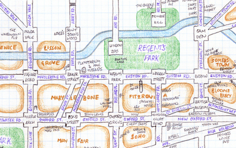

Mappa Lundi is a hand-drawn map of central London which simplifies the street network, districts, parks and tourist attractions into a simple, pseudo-grid like structure. Matt Lancashire created the map back in May 2010. You can see it on Flickr.
We like the careful use of colour to distinguish streets, areas and parks, the inclusions of the Regent’s Canal and the Thames which bookend the mapped area, and the near adherence to the principles of a grid for the street network (resulting in some distance distortion), but with a few diagonals and other directions where needed. London’s main street network has never looked so ordered. A cross between a geographical map and a street-level version of the Beck-style tube map.
Available under a Creative Common’s CC-By-NC licence by Matt Lancashire.
Need a map that helps decide where to stay and what is close-by in terms of attractions like parks, museums etc. for family so that I can could book a stay place accordingly. Thanks.