This is a cross-post from oobrien.com. Above is an excerpt of a large, coloured-dot based graphic showing the locations of street trees in Southwark Borough
More...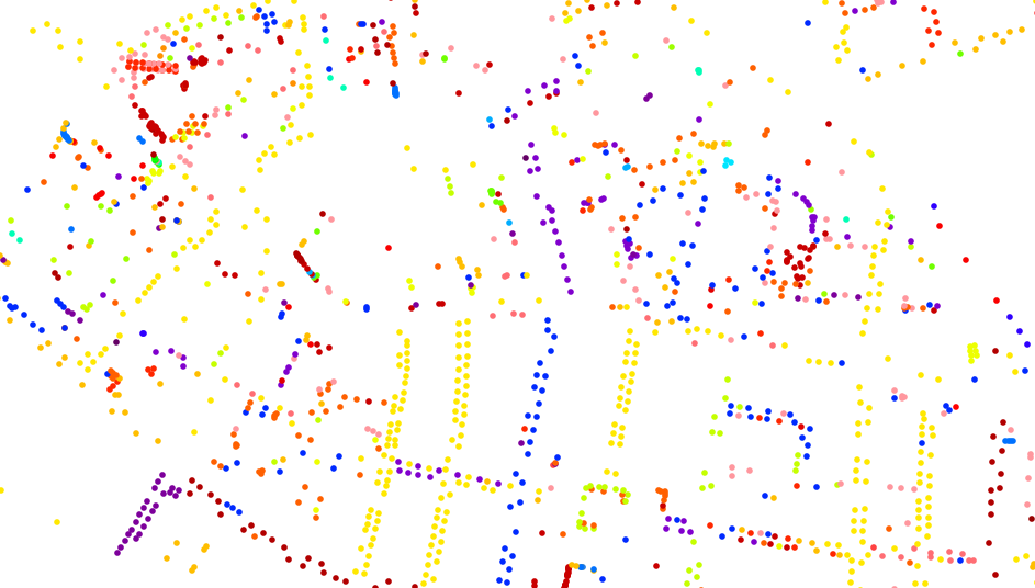
Highlighting the best London maps
This is a cross-post from oobrien.com. Above is an excerpt of a large, coloured-dot based graphic showing the locations of street trees in Southwark Borough
More...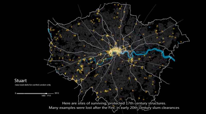
This animation shows how the roads in the London area formed, from Roman times through the industrial revolution and to the modern day. London’s boundary
More...
Here’s a real treat. The National Library of Scotland’s Map Department, supported by David Rumsey, have taken some very high-resolution scans of the Ordnance Survey
More...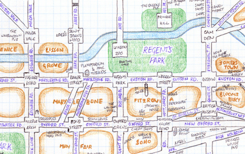
Mappa Lundi is a hand-drawn map of central London which simplifies the street network, districts, parks and tourist attractions into a simple, pseudo-grid like structure.
More...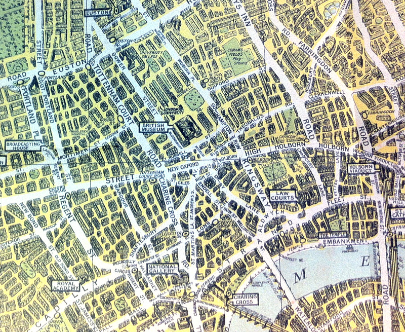
The above map is an extract from a reproduction of the “Pictorial Map of London” published in 1938 by what was then known as the
More...
The Nike Grid was an Alternative Reality Game (ARG) for runners, held over two weeks on the streets of London late last year. After each
More...