Crossrail is a huge project tunnelling out a new railway line under central London. We featured the Crossrail “live” maps showing the location of the
More...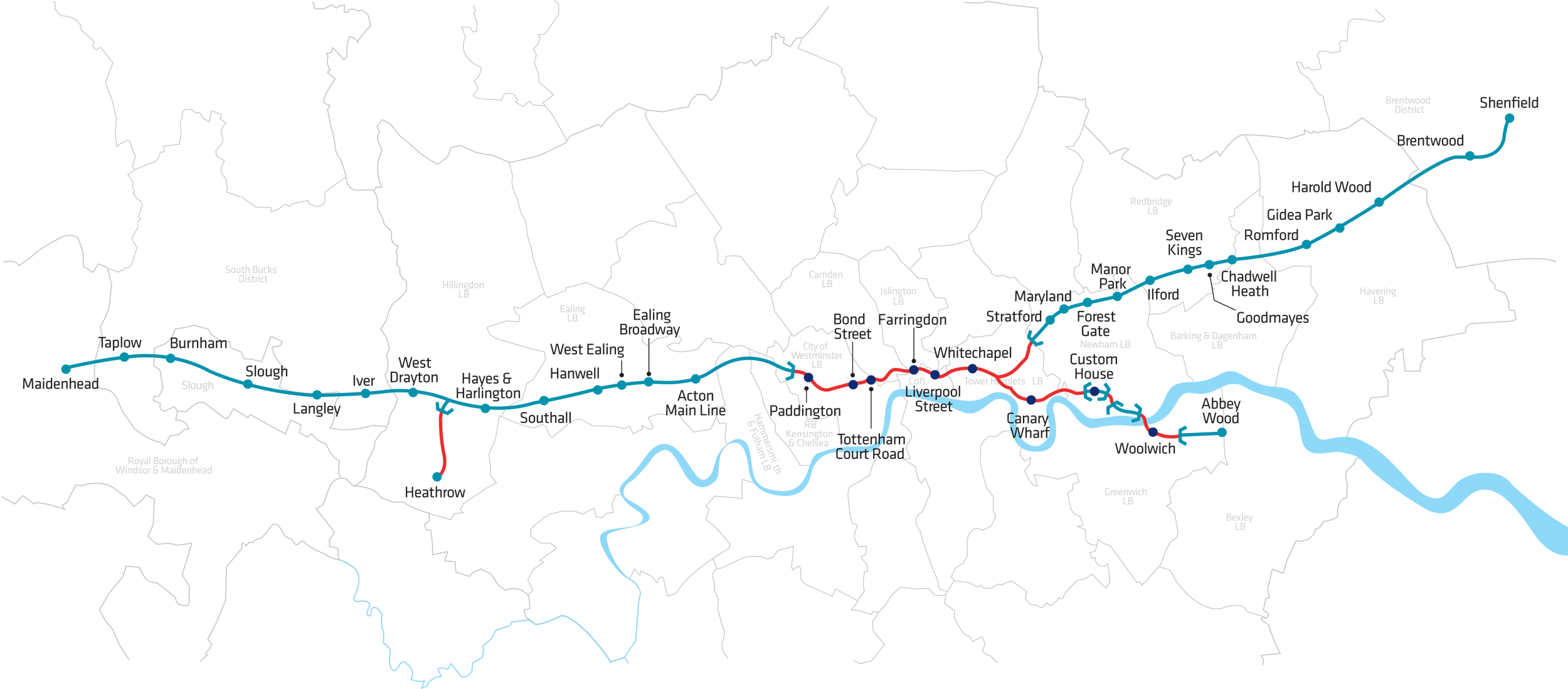
Highlighting the best London maps
Crossrail is a huge project tunnelling out a new railway line under central London. We featured the Crossrail “live” maps showing the location of the
More...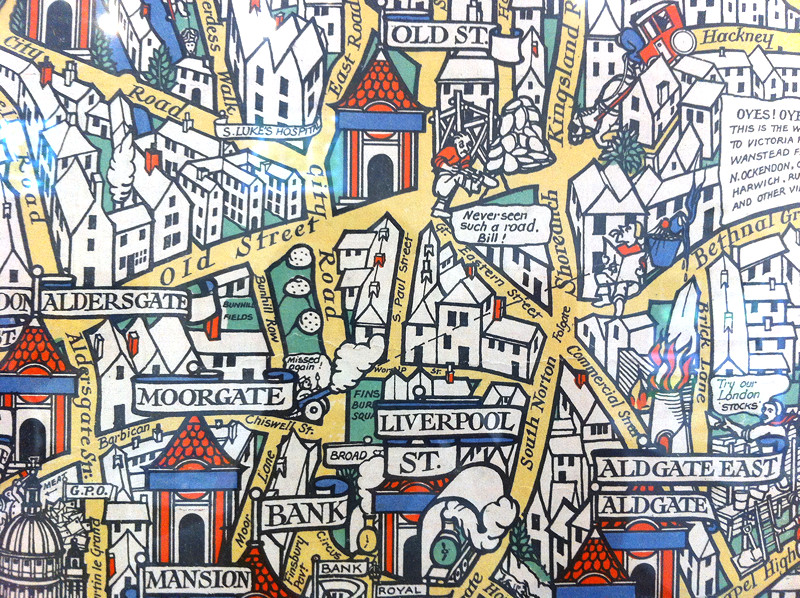
Above is a small part of the “Wonderground Map of London Town” – MacDonald Gill created this fantastic decorative map, which was commissioned to provide
More...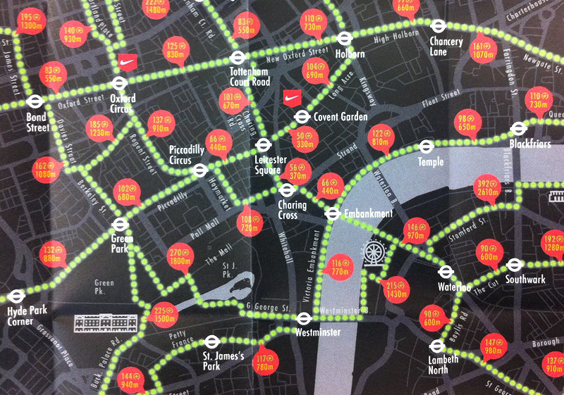
After reviewing many fine maps produced by others, it’s always nice to feature our own work once in a while. Above is an extract of
More...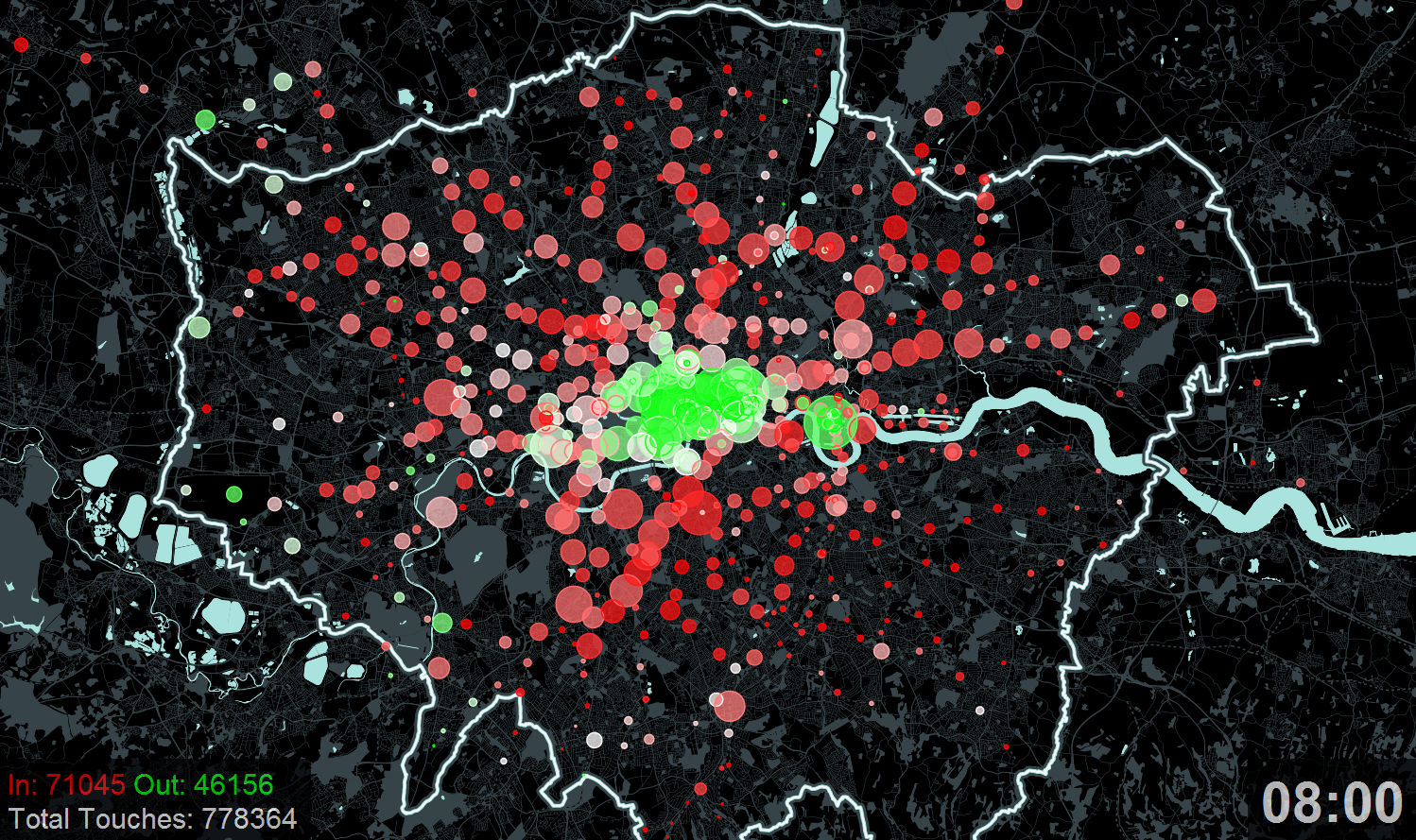
Here is an animation that Ollie created a couple of years ago for the “Sense and the City” exhibition at the London Transport Museum.
More...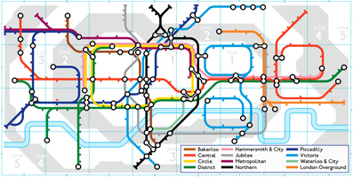
When we started the Mapping London one of our “ground rules” was not to turn it into a blog about Tube maps. On the 150th birthday of
More...
Perhaps inspired by Joy Division’s Unknown Pleasures album cover (maybe a favourite for the commute?), Jon Reades (from UCL CASA– of course!) has created this beautiful
More...
Transport for London would really rather you didn’t travel into Zone 1 – the central part of London. It’s a lot cheaper to travel on
More...
A new exhibition – Sense and the City – opens today at the Transport Museum in Covent Garden. It includes a number of transport data
More...
The world is not short of London underground network maps, there is something very appealing about the mix of lines, curves, dashes and circles, all
More...Another brilliant visualisation from UCL’s CASA, this time from Anil Bawa-Cavia. It visualises trips made on the London Underground using data gathered from Oyster Cards. Each trail is
More...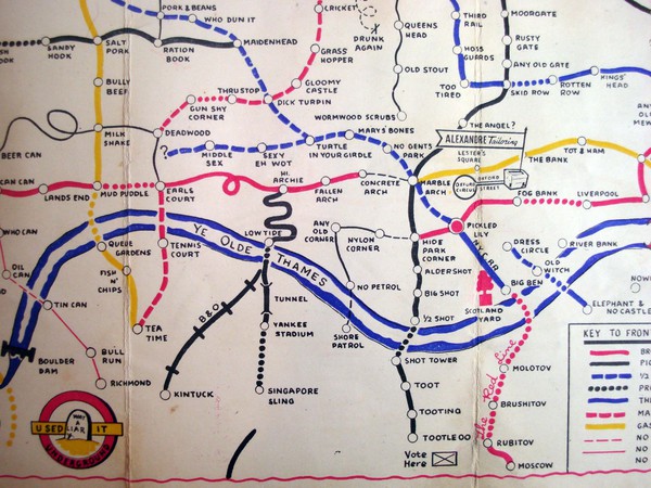
I wanted to steer clear of the iconic London Underground map because it is always featured on map blogs. I have already failed miserably thanks
More...